Download
1 / 62
620 likes | 834 Vues
Modelling and Simulation of Tsunami Waves for Improved Defence Provision in Phuket. สวัสดีครับ Hello from Phuket, Thailand Richard N. Zobel Department of Computer Engineering Faculty of Engineering Prince of Songkla University, Phuket Campus 80 Vichit Songkram Road, Kathu

E N D
Modelling and Simulation of Tsunami Waves for Improved Defence Provision in Phuket สวัสดีครับ Hello from Phuket, Thailand Richard N. Zobel Department of Computer Engineering Faculty of Engineering Prince of SongklaUniversity, Phuket Campus 80 Vichit Songkram Road, Kathu Phuket, Thailand 83210
Introduction The author was working in Phuket from three days after the tsunami for the following two and a half months. He was able to observe the local effects at the beaches around Phuket, the largest island in the Andaman Sea, off the South West coast of Thailand, and took pictures and video. The situation at each beach is unique and relates to both local factors and the magnitude, phase and direction of the sea wave in relation to the local geography of both the sea bed and the beach area. Some beaches were badly damaged and others less so, some were badly damaged at the ends of the beaches. Others suffered because the land behind the beach was very flat, and some areas were buffered by the mangrove forest.
Introduction Photographic and video evidence acquired at the time and later. Used in relation to research for key factors responsible for the damage, loss of life and injury for this specific tsunami. Considers possible future tsunami with different characteristics. Uses simulation to predict the consequences for affected areas. Possible defences which minimise the effects of future tsunami are discussed. Conclusions for those who may need to consider these defences. Emphasis is on how modelling and simulation can be used to study the possible effects of future tsunami with respect to affordable provision of defences at the sites likely to be affected.
The Tsunami in Phuket, Thailand The events in Phuket on Sunday, 26 December: (Thailand is 7 hours ahead of England) 07.59 An earthquake shook Phuket Island. It was also felt in the Capital, Bangkok; in the North West, at Chiang Mai; and in the South East, at Hat Yai. 09.45 The Tsunami arrived on the West side ( Andaman Sea) 09.55 The second wave arrived. Major damage occurred in only ten minutes in some places 10.00 The waves reduced and gradually subsided Thailand: 5,303 Dead; 3,396 Missing; 8,457 Injured
Map of South East Asia Hat Yai Earthquake started here *
The Areas Affected Phuket is an island off the South West coast of Thailand. It is about 50km North to South, and about 25 km wide. (about the size of the Isle of Wight or Singapore) The main tourist beaches are on the Andaman Sea (West) side of the Island. The mainland to the North of Phuket is called Phang Nga Phang Nga is very flat and damage here went as far as 2km inland. The mainland to the East of Phuket is called Krabi. This area was less affected as it was partly shielded by Phuket.
The Provinces of South Thailand Gulf of Thailand Andaman Sea Malaysia
Phuket Island Airport Nai Yang Beach Surin Beach Prince of Songkla University (PSU) Kamala Beach Phuket Town Patong Beach
The Sea Has Gone Away! • The CD of the Tsunami arriving at Patong Beach shows • some very interesting and illuminating features: • The sea has gone away • The Tsunami is coming • The Tsunami approaches the beach • The angry sea • Chaotic flows • The whirlpool
What is Being Done The Smashed Buildings, Restaurants, Shops and Beach Facilities are now cleared up and the rubbish sorted for re-cycling, removed and stored. Re-building is underway, and many businesses and facilities are already open. However, there are not many tourists yet at Patong Beach, the main tourist beach. The pictures of the beaches were all taken by the author on Sunday 23 January, four weeks after the Tsunami
Patong Beach – Damaged Part of Hotel Resort – Under Re-construction
A Restaurant at Kamala Beach – Already under Re-construction
PLATE TECTONICS In the situation concerning the recent major event, the Australian-Indian plate is moving towards the Eurasian plate and has been in collision with it for millions of years. More specifically, the Indian plate has been pressing against the Burma (Myanmar) micro plate. The pressure has built up over a long period of time, how long is not known (100-300 years). It was eventually partially released on 26 December 2004 in a large movement, Richter scale 9.3, which saw the Indian Ocean floor move some 15m or more towards Indonesia.
The 90 East Ridge There is an ocean ridge, running in a North/South direction, roughly along the 90o East line of longitude, all the way from Australia to India, a distance of some 5000km. Associated with the zone where the Indian ocean sub-plate meets with the Burma continental micro-plate, there are several deep trenches, notably the Java Trench, depth around 7km, and the Sumatra Trench, depth around 6km. This is a very ancient structure and is the site where the Indian Ocean floor slides under the Burma Micro Plate. This type of plate collision is called a Subduction Zone
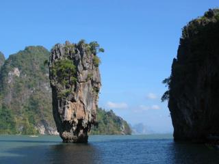
Phuket, Phang Nga and Ranong Most of PhuketIsland is hilly, so perhaps only a few percent of the area of this beautiful island was damaged. Sadly, Phang Nga, the mainland to the north of Phuket is much flatter, resulting in extensive damage and loss of life. A marine police launch was found beached, some 2 km inland. Many tourists were living in tents. They had little chance and nowhere safe to go. In some of the Sea Gypsy villages, the elders had a tribal memory which suggested that if the sea goes out a long way suddenly, it will quickly come back inland as far as it went out, so go up hill fast before it does. Those that did survived, although their villages did not. In Phuket, Phang Nga and Ranong, many villages lay behind mangrove forest and consequently suffered only minor damage. Others have had their mangrove forest replaced by fish and prawn farms, and were not protected.
MODELLING AND SIMULATION It is very clear that the system for which modelling and simulation is to be attempted is extremely complex and highly non-linear. Further, verification and validation is almost impossible, since any data is likely to be sparse and incomplete. Predicting the occurrence and/or magnitude of such events is also extremely difficult.
Static Features Such is the advance in technology it is now possible to measure the precise position of the land and of the depth of the sea from satellites. This enables sea depth and boundaries to be established. So, at least in principle, the problem is computable using the appropriate three dimensional, time-varying, non- linear Navier-Stokes partial differential equations to predict the ensuing tsunami sea waves, if the origin or epicentre of the earthquake is known.
Dynamic features For the recent tsunami, it subsequently became clear that the total inverted rupture duration was 200s and the peak slip was about 20m. The rupture propagated as a series of earthquakes from the original epicentre towards the northwest for about 400km with a speed of 2.0km/s, along the subduction line near to the 90 East Ridge. This substantially changed the nature of the tsunami, especially in its effect on Phuket and the adjacent mainland areas of Phang Nga and Krabi. Following this development, part of the tsunami wave front became a North/South line travelling East towards Sri Lanka and West towards Phuket. This is distinctly different from that emanating from a single point epicentre.
Modelling of Sea Waves This subject is complex and concerns the general Navier-Stokes three dimensional (3-D) partial differential equations for viscous, compressible flow in relation to: Eulerian Conservation of Mass Eulerian Conservation of Momentum Eulerian Conservation of Energy
Modelling of Sea Waves Eulerian Conservation of Mass: t + U. = - .U where:Uis the particle velocity, andis the water density = xi + yj + zk;wherei, j, kare unit vectors and U . = Uxi + Uyj + Uzk Conservation of mass is of fundamental importance to most systems. In this context the mass balance must include all mass arriving in a given 3-D volume and all mass leaving that volume during a computational time period, in addition to the mass already present in that volume prior to that time period.
Modelling of Sea Waves Eulerian Conservation of Momentum: t + U .U = -. + g = ijP – Sij where:Pis the water pressure,gis thegravitational constant, andSijare the total viscosity deviators (e.g.Sx = qx – q), whereqis the viscosity). Conservation of momentum is a second fundamental consideration in that the systems sum of the products of individual mass elements and their velocity must remain constant.
Modelling of Sea Waves Eulerian Conservation of Energy: t + U .I = -: U+ 2T where:: U =jiUi/Xj Iis the internal energy is a real viscosity coefficient. Conservation of energy is a little more tricky. However, it must be remembered that energy is only transferred from one form to another and is consequently not lost.
Modelling of Sea Waves • This set of equations may be simplified by assuming the flow is incompressible ( = 0) • The equations may be further simplified by excluding viscosity. • Viscosity terms may be included if the fluid is incompressible, with or without shearing forces. • Further details and a full discussion of these equations may found in Numerical Modelling of Water Waves, 2nd Edition, 2004, by Mader [6]. • This is the definitive work
Modelling of Sea Waves • In computational terms, each of these equation sets must be converted into finite difference equations before solutions may be computed digitally. • In order to do this, assumptions must be made in relation to the most appropriate form for the representation of differential terms to achieve an acceptable accuracy of result. • To represent such a large volume of water, it is necessary to carefully consider the spatial resolution, which needs to be adequate to represent the spatial frequencies, or wavelengths of the expected sea waves, but also needs to minimise the computational cost. This is always a difficult compromise. • The temporal aspects must also be considered in terms of minimum acceptable sample rate in this respect.
Modelling of Sea Waves • It is important to appreciate that for these systems, such as water wave systems, the consequences of having relatively low damping needs to be considered in relation to the convergence of the solutions, and of their divergence with time from an initial state. • In relation to the shallow water simulations, these aspects also need to be carefully looked at, since in shallow water the wavelength becomes considerably shorter and the wave height considerably larger. In addition the volume under consideration becomes much smaller.
Tsunami Wave Dynamic Features It is clear that a “simple” solution of the Navier- Stokes equation with an input of a point source earthquake and tsunami will not suffice. Further than this, the wave comes and goes with declining amplitude and is modified by obstructions, plus reflection and refraction from islands and the shoreline. If this is not enough, each surge results in progressive pile up and/or removal of tens of metres of silts and sediments where tsunami move in shallow waters. This also causes concern for large ships bringing relief supplies in respect of harbour access and movement through narrow busy waterways such as the MalaccaStrait. Much surveying will be necessary to enable vessels to proceed safely.
Dynamic features But there is more, it turns out that the sequence of earthquakes, mainly to the North of the original earthquake involved a shift of the ocean floor by perhaps 15m in a matter of minutes. The IndonesianIsland of Sumatra and the Indian Nicobar and Andaman Islands may have moved as much as 20m. The scale is staggering; the total force involved was estimated at around 600 Megatons of TNT.
Possible Defences against Tsunami Tsunami arise from: Earthquakes (Indian Ocean, Pacific Ocean, etc), Landslides (Lytuya Bay), Cavity collapses, Asteroids (Cretaceous-Tertiary Chicxulub) and other related sudden major movements of land above or below sea or water surface level. Few can be foreseen Prediction is difficult Need to employ effective warning systems Need to employ affordable defences to minimise death, injury and destruction
Defence Possibilities In Krabi, villages which lay behind mangrove forests were far less affected than those where the forest had been removed to make way for fish farms or other commercial activities Minimisation of the scale of mangrove forest removal could minimise the damage caused by future tsunami. Alternatively, man-made structures might be created which in some way mimic nature in this respect.
Defence Possibilities Mangrove forest Phang Nga Bay
Defence Possibilities Other possibilities: • Refugesto be constructedto provide escape to an upper story when stranded in a flat area • Changes to the shallow seasnear the beaches by dredging, or of dumping sand or rocks. • Modification of the built environmentat the planning stages. • Changestovehicle parking policyand provision.
Modelling and Simulation of Possible Tsunami in the Indian Ocean • Source of future tsunami which would affect western coasts of South Thailand, is most likely to be the subduction zone earthquakes associated with the fault line which includes the Sunda Trench, to the west coast of Sumatra, to the Andaman and Nicobar islands in the north. Other possibilities include cataclysmic explosion of volcanoes such as Krakatoa (between Sumatra and Java) and Tambora on the island of Sumbaya. • Both single and multiple earthquakes (as for the recent events) need to be considered. • Simulation of the effects of such earthquakes on possible tsunami generation is needed, but not easy to model.
Modelling and Simulation of Possible Tsunami in the Indian Ocean • Hydrological data is required to model the seafloor boundaries. • However, the recent tsunami has caused changes to the sea floor • The possible effects of reflections from islands and undersea rock formations also need to be considered. • Such studies will provide samples of input data for shallow water studies in the coastal areas. • Full Navier-Stokes compressible water wave simulations needed for validation of simpler models used to reduce simulation costs for both deep and shallow water studies.