GCSE Geography Economic Development Topic Case Studies
70 likes | 269 Vues
GCSE Geography Economic Development Topic Case Studies . Solar Cookers: Aid project . Coca Cola in Cali, Columbia. HQ Atlanta, Georgia, USA Bottling plants in over 200 countries Focus of this case study: Cali, Columbia, South America Background Coca Cola is a multinational company because

GCSE Geography Economic Development Topic Case Studies
E N D
Presentation Transcript
Coca Cola in Cali, Columbia • HQ Atlanta, Georgia, USA • Bottling plants in over 200 countries • Focus of this case study: Cali, Columbia, South America • Background • Coca Cola is a multinational company because • It operates across the globe in over 200 countries • It makes large profits- $24 billion • Employs many people across the world 146,000 • It has a global location because this brings advantages such as: • Labour costs- many labour costs in LEDC are lower = higher profits • Transport coasts will be lower if the product is made in that country= higher profits • Legalization on worker rights and health and safety may be less strict in some countries, which means less overheads and higher profits • It widens your market. More consumers= higher profits • Positive impacts • Local people are employed in jobs. • In Cali, for every 1 job created in Coca Cola, another 10 are generated elsewhere, positive multiplier effect. • Coca Cola pays thousands of dollars in taxes to the Columbian government. The government uses the money to invest in public services e.g. schools • Local farmers provide the factories with sugar cane, providing them with an income. • Negative impacts • Coca Cola have been accused of being anti-union, which would mean they could pay workers less, meaning more profits for them. • Coca Colas bottling company FEMSA have been accused of suing paramilitary groups to attack trade union members. • 6 union workers were killed by paramilitary groups. • Higher management jobs have gone to foreign workers, not those from Cali. • Coca Cola have been accused of pumping waste into rivers killing wildlife. • Works have been killed in the Cali bottling plant. • Coca Cola have been caught not paying local taxes. • The investment of Coca Cola in Columbia is blamed for the decline in the traditional fruit juice vendors.
Location of industry in an MEDC- Meadowhall Sheffield, UK • What: Shopping centre- built on a former steelworks site • 280 Shops • Facilities including a leisure centre, cinema, crèche and other attractions for children; • Reasons for locating here: large area of flat land= easier to build on than hills • Nearto suburban housing (provides a labour force) • Near a number of motorway intersections (nearby M1/A roads) = great accessibility and access to large sphere of influence • 9 million people living within an hour’s drive of the centre= customers! • Large, free car parks (12,000 spaces!)= easy for customers • Railway line runs past the site- Two new railways stations built= easy for customers • Provides plenty of space for expansion and for providing large free car parks • Super tram link with the city centre • Rates and rents are lower than in the city centre (shops can be bigger) - i.e. cheaper land on edge of Sheffield old brownfield site (was a steelworks) with plenty of room for expansion if required • Impacts on the environment: • Changed it from a dirty polluting steelworks= old contaminated land reused • Lots of trees and shrubs planted= give out oxygen • Lots of people travel there by car= atmospheric pollution • Thousands of plastic bags given out each year that end up in landfill
Location of industry in LEDC: Tourism Goa Situated on the west coast of India, approximately 400 kilometres south of Bombay. Goa's coastal strip is approximately 100km long boasting idyllic sandy beaches and blue crystal seas. Traditional industries included fishing, rice growing and toddy tapping - where an alcoholic drink is fermented from the sap of the coconut palm. Literacy rate 77% - high for India. Number of tourist visitors now exceeds 1 million annually - about 20% are arrivals from overseas. Tourist season is from October through to May when average temperatures range from 31-34 degrees Celsius. Heavy rain prevents tourism from June to September. Tourism creates 15% of the states income and 10% employment • Strong physical factors make it ideal for the location and development of tourism: • 105km of sandy, palm-fringed beaches • The hot dry weather in the tourist season • Exotic animals • Human factors include • Direct flights to Goa- and more cheaper flights • Cost of tourist services and general goods is cheaper • The ruins of Old Goa attract tourists- World heritage status • There are many hotels for all price ranges • Problems: • Water usage by hotels/ swimming pools • Deforestation- many trees lost due to building of new tourist facilities/ hotels etc • Habitat loss- valuable mangroves have been destroyed to build hotels. • Species are becoming endangered- The Indian bullfrog is now critically endangered • Future? • Possible solutions to the problems • 1. Diversifying the areas of tourism: the tourism industry in Goa has mainly concentrated on beach tourism. Other types of tourism should be encouraged e.g. yoga tourism to disperse the numbers of tourists. • 2. Using Goa’s rivers to decongest the roads of traffic. Use the rivers as a transport method! • 3 Provide information pamphlets aboard planes prior to tourist arrival. Tourists can read on how best to act to ensure they do not damage the environment they are visiting. • 5. Include water posters in bathrooms in all accommodation to encourage visitors to reduce water consumption.
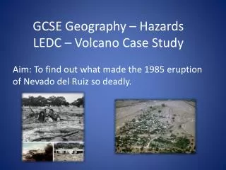
Aral Sea • The Aral Sea Case study Sheet • Why is the Aral sea shrinking? • 2 major rivers, the Syr Darya and the Amu Darya flow into the Aral Sea. • Water from these 2 rivers has been used to irrigate fields in Uzbekistan and Kazakstan so that cotton and rice can be grown. • Very little water from these 2 rivers now reaches the Aral Sea. • High temperatures in this region mean that evaporation rates are high which adds to the problem. • Why is this an environmental disaster? What are the impacts on the environment? • The water in the Aral Sea is becoming more and more polluted with the chemicals from the fertilisers and pesticides used on the irrigated farmland. • The soil is so salty that plants cannot easily be grown or crops! • The local climate is becoming hotter and drier as the effect of the Aral Sea is reduced. • The air is salty and dusty. Both the air and water is polluted causing a huge health hazard • What methods have been used to reduce the impacts of this disaster? • In areas where the sea has dried up trenches have been dug up and clean sand put in, then a tree called The Saxaul tree is planted. This traps sand and stops it blowing around creating the lung disorders . • Using a new $126m World Bank loan, the Kazakhstan government is building a second dam. The new dam traps water from the Syr Darya in the North Aral sea. • The Kazak government has rebuilt nearly 60 miles of canals and waterways- to improve water distribution (stops wasting water!!) • Holes were covered in irrigation channels with steel plates. Also stops wasting water) The flow of the Syr Darya has doubled!! • However, nothing is being done in the South Aral in Uzbekistan, this is predicted to totally disappear n the next 50 years. • How can GIS such as satellites be used to analyze economic activity and environmental conflict? • Satellite images can track changes in the size and shape of the Aral sea • Satellite images can be studied to see where the greatest loss is occurring