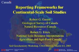
Reporting Frameworks for Continental-Scale Soil Studies
Reporting Frameworks for Continental-Scale Soil Studies. Robert G. Garrett Geological Survey of Canada Natural Resources Canada and Robert G. Eilers National Soils Resource Interpretations Agriculture and Agri-Food Canada Soil Geochemistry Workshop, USGS Denver, March 4-6, 2003. Outline.

Reporting Frameworks for Continental-Scale Soil Studies
E N D
Presentation Transcript
Reporting Frameworks forContinental-Scale Soil Studies Robert G. Garrett Geological Survey of Canada Natural Resources Canada and Robert G. Eilers National Soils Resource Interpretations Agriculture and Agri-Food Canada Soil Geochemistry Workshop, USGS Denver, March 4-6, 2003
Outline • Spatial Variation, at what scale is information required? • Sampling Frameworks and Strategy • Considerations for Pedon Sampling • Questions and Identification of Topics for Discussion
Spatial Resolution • What do clients/users require? • Has to meet multi-stakeholder requirements • Political or natural units (frameworks)? • NAFTA-CEC has developed a Tri-National ecological classification for North America • This classification reflects the underlying geology, climate, botany, soil microbiology and pedology
The Ecoregion Classification • The Level II Ecoregion classification will be used by Environment Canada in future Ecological Risk Assessments and for framing Risk Management decisions • Level II ecoclassification has been completed for both Canada and the US. It is a commonly accepted spatial framework • This framework respects and reflects the subject-matter interests of a broad population
An Example - Arsenic • Reframing a 2 site per 800 km2 1992 soil geochemical study of the Canadian Prairies • The 1992 objective was to acquire an unbiassed estimate of mean geochemical levels and identify any systematic spatial variation • Total As (mg/kg - ppm) was determined by Instrumental Neutron Activation Analysis (INAA) in the <2 mm fraction of 0-25 cm surface soils
Considerations for Pedon Sampling • Statistical selection of sample sites • Number and location • Site type and definition • Simple or Deluxe site, or • Mutiple purpose, multi-stakeholder, site • Purpose • Characterization • Monitoring Short term or long term
Considerations for pedon sampling.Basic Landform elements Surface and subsurface soil hydrology Recharge Dissipation Zones Transit Zones Accumulation Zones
Considerations for Pedon Sampling • Spatial Variability at a Site • Representivity of landform elements • Extrapolatability • Temporal Variability at a Site • Replicability • Biological (dynamics) • Sampling Coordination • Temporal independence – pedological and geological • Temporal dependence – biological (seasonal sensitivities)
Considerations for pedon sampling.Basic Landform elements(spatial variability of sample site) Pedon site - Pedology/geology Satellite- sample subsites ? - monitoring sites ?
Considerations for Pedon Sampling(Malegus 1997, U of M.) • Grassland Soils (Profile variability)
Considerations for Pedon Sampling(Malegus 1997, U of M.) • Recently cultivated Forest Soil (Profile variability)
Some Outstanding Questions • What Spatial Framework is both practical and meets client/user needs? • The answer defines the target populations • How do we obtain representative samples from the target populations to meet user/client needs? • How do we physically collect soils on a pedon and local/site scale? • How do we report the results and meet user/client expectations?
Acknowledgements • We thank Glenn Lelyk and Susan Davies for their assistance in preparing the maps and graphics used in this presentation, and to Russ Malegus for the use of his thesis data.