Global Earthquake Data Report June 7, 2011
Explore earthquake details worldwide on June 7, 2011: Hawaii, California, Mexico, Indonesia, Fiji, Japan, and more. 8 Relevant

Global Earthquake Data Report June 7, 2011
E N D
Presentation Transcript
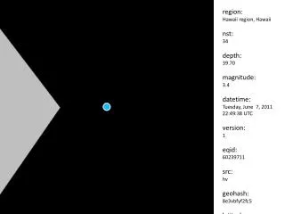
region: Hawaii region, Hawaii nst: 34 depth: 39.70 magnitude: 3.4 datetime: Tuesday, June 7, 2011 22:49:38 UTC version: 1 eqid: 60239711 src: hv geohash: 8e3vbfyf2fc5 latitude: 19.307500 longitude: -154.996800 created: 2011-06-17 23:51:12 id: 166987
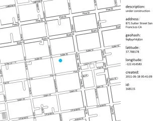
region: Southern California nst: 111 depth: 3.00 magnitude: 2.6 datetime: Tuesday, June 7, 2011 20:51:52 UTC eqid: 14997652 src: ci geohash: 9qhf8qfeukxb latitude: 34.227200 longitude: -117.055700 created: 2011-06-17 23:51:12 id: 166989
region: Greater Los Angeles area, California nst: 155 depth: 11.10 magnitude: 3.0 datetime: Tuesday, June 7, 2011 16:30:10 UTC version: 1 eqid: 14997468 src: ci geohash: 9qh9grv0skdu latitude: 34.100300 longitude: -117.272000 created: 2011-06-17 23:51:12 id: 166991
region: Chiapas, Mexico nst: 366 depth: 75.80 magnitude: 5.4 datetime: Tuesday, June 7, 2011 14:55:20 UTC version: 7 eqid: c00041ny src: us geohash: 9ftz656bhw1t latitude: 15.354800 longitude: -93.072200 created: 2011-06-17 23:51:12 id: 166993
region: Nias region, Indonesia nst: 16 depth: 33.80 magnitude: 4.6 datetime: Tuesday, June 7, 2011 10:53:49 UTC version: 7 eqid: c00041l7 src: us geohash: w0jp2q6rcsr4 latitude: 1.310100 longitude: 97.045400 created: 2011-06-17 23:51:12 id: 166995
region: Kuril Islands nst: 395 depth: 58.10 magnitude: 5.3 datetime: Tuesday, June 7, 2011 10:38:30 UTC version: 7 eqid: c00041kr src: us geohash: z2tdvu6mtf4h latitude: 48.320200 longitude: 154.240400 created: 2011-06-17 23:51:12 id: 166997
region: Virgin Islands region nst: 12 depth: 64.10 magnitude: 3.6 datetime: Tuesday, June 7, 2011 10:08:24 UTC eqid: 11158002 src: pr geohash: de6k314ym48c latitude: 19.034900 longitude: -64.288000 created: 2011-06-17 23:51:12 id: 166999
region: Easter Island region nst: 127 depth: 10.10 magnitude: 4.9 datetime: Tuesday, June 7, 2011 09:32:24 UTC version: 7 eqid: c00041jq src: us geohash: 36zxwrbrj5nt latitude: -28.169100 longitude: -112.927900 created: 2011-06-17 23:51:12 id: 167001
region: Pakistan nst: 24 depth: 39.80 magnitude: 4.7 datetime: Tuesday, June 7, 2011 09:08:34 UTC version: 5 eqid: c00041jg src: us geohash: ttg465czjzwv latitude: 32.761100 longitude: 71.809300 created: 2011-06-17 23:51:12 id: 167003
region: Virgin Islands region nst: 6 depth: 29.70 magnitude: 3.0 datetime: Tuesday, June 7, 2011 08:54:39 UTC eqid: 11158001 src: pr geohash: de65vf5db4jz latitude: 18.951900 longitude: -64.430000 created: 2011-06-17 23:51:12 id: 167005
region: Fiji region nst: 57 depth: 516.20 magnitude: 4.8 datetime: Tuesday, June 7, 2011 08:52:10 UTC version: 5 eqid: c00041jd src: us geohash: 2hc47phjpmzm latitude: -17.846400 longitude: -178.456100 created: 2011-06-17 23:51:12 id: 167007
region: Philippine Islands region nst: 43 depth: 75.90 magnitude: 4.5 datetime: Tuesday, June 7, 2011 08:34:00 UTC version: 5 eqid: c00041iv src: us geohash: wccg210xcybx latitude: 10.421900 longitude: 126.211700 created: 2011-06-17 23:51:12 id: 167009
region: Missouri nst: 160 depth: 5.10 magnitude: 3.9 datetime: Tuesday, June 7, 2011 08:10:34 UTC version: A eqid: c00041ic src: us geohash: 9yz2fg8wgt2y latitude: 38.121000 longitude: -90.933000 created: 2011-06-17 23:51:12 id: 167011
region: Mona Passage, Puerto Rico nst: 5 depth: 71.30 magnitude: 3.0 datetime: Tuesday, June 7, 2011 06:46:25 UTC eqid: 11158000 src: pr geohash: d7pzd3pb72f7 latitude: 18.198900 longitude: -67.741900 created: 2011-06-17 23:51:12 id: 167013
region: southern Mid-Atlantic Ridge nst: 124 depth: 10.30 magnitude: 5.3 datetime: Tuesday, June 7, 2011 05:18:32 UTC version: 8 eqid: c00041g1 src: us geohash: 78hs9jjc70er latitude: -44.181300 longitude: -16.119900 created: 2011-06-17 23:51:12 id: 167015
region: off the east coast of Honshu, Japan nst: 28 depth: 25.60 magnitude: 4.7 datetime: Tuesday, June 7, 2011 03:52:31 UTC version: 6 eqid: c00041f1 src: us geohash: xpjvmd0wu0es latitude: 40.310000 longitude: 143.328500 created: 2011-06-17 23:51:12 id: 167017
region: Nias region, Indonesia nst: 45 depth: 60.40 magnitude: 4.6 datetime: Tuesday, June 7, 2011 03:27:41 UTC version: 4 eqid: c00041es src: us geohash: w0hyvg7k1qzt latitude: 1.205100 longitude: 96.936900 created: 2011-06-17 23:51:12 id: 167019
region: Nias region, Indonesia nst: 82 depth: 42.60 magnitude: 5.0 datetime: Tuesday, June 7, 2011 02:54:24 UTC version: 7 eqid: c00041e4 src: us geohash: w0hyccymxed7 latitude: 1.197100 longitude: 96.765500 created: 2011-06-17 23:51:12 id: 167021
region: Kenai Peninsula, Alaska nst: 33 depth: 89.80 magnitude: 2.5 datetime: Tuesday, June 7, 2011 02:00:39 UTC version: 1 eqid: 10247298 src: ak geohash: bdu4j5p3jncb latitude: 60.837000 longitude: -151.645100 created: 2011-06-17 23:51:12 id: 167023
region: offshore Libertador O'Higgins, Chile nst: 46 depth: 25.70 magnitude: 4.5 datetime: Tuesday, June 7, 2011 01:07:08 UTC version: 4 eqid: c000418t src: us geohash: 63uey22vf1be latitude: -34.494700 longitude: -72.146100 created: 2011-06-17 23:51:12 id: 167025
region: off the east coast of Honshu, Japan nst: 98 depth: 44.00 magnitude: 4.8 datetime: Tuesday, June 7, 2011 01:06:42 UTC version: 6 eqid: c000418u src: us geohash: xnt4261m72ve latitude: 36.969900 longitude: 142.044100 created: 2011-06-17 23:51:12 id: 167027
region: near the north coast of New Guinea, Papua New Guinea nst: 33 depth: 35.60 magnitude: 5.0 datetime: Tuesday, June 7, 2011 00:39:29 UTC version: 6 eqid: c000417t src: us geohash: rprdtm8nkfnj latitude: -3.748000 longitude: 145.777800 created: 2011-06-17 23:51:12 id: 167029