Download

1 / 7
70 likes | 227 Vues
GIS at Statistics Norway March 2012. Mr Tekie T.Ghebre Seninor Executive Officer Statistics Norway Oterveien 23 NO-2225, Kongsvinger, Norway Tel : +47 62885203 E-mail : ttg@ssb.no. Ms Ida Skivenes Higher Executive Officer Statistics Norway Kongens gate 6 0033 Oslo, Norway

E N D
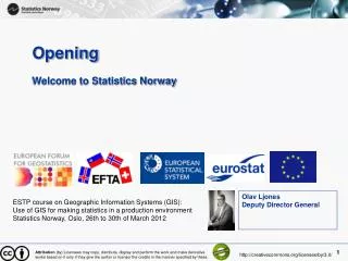
GIS at Statistics NorwayMarch 2012 Mr Tekie T.Ghebre Seninor Executive Officer Statistics Norway Oterveien 23 NO-2225, Kongsvinger, Norway Tel : +47 62885203 E-mail : ttg@ssb.no Ms Ida Skivenes Higher Executive Officer Statistics Norway Kongens gate 6 0033 Oslo, Norway Tel : +47 21 09 44 48 E-mail : ida.skivenes@ssb.no ESTP course on Geographic Information Systems (GIS): Use of GIS for making statistics in a production environment Statistics Norway, Oslo, 26th to 30th of March 2012 Attribution (by) Licensees may copy, distribute, display and perform the work and make derivative works based on it only if they give the author or licensor the credits in the manner specified by these. http://creativecommons.org/licenses/by/3.0/
Rules for handling confidensiality • The Statistical Act § 2-6 imply that Statistics Norway as a • main rule do not publish tables with less than 3 units within a group (table cell) where the sample can lead to identification of individuals. • At the moment this applies to population statistics, where average age is only shown for grid cells with more than 4 inhabitants. • When combining different geographical information for the unique grid cell, problems with confidentiality may increase further. The grid might for example be combined with for instance digital municipal borders or a digital road network which will give information on where the cells are located. • Main source: Geir-Harald Strand and Vilni Verner Holst Bloch. 2009. Statistical grids for Norway. Documentation of national grids for analysis and visualisation of spatial data in Norway. Attribution (by) Licensees may copy, distribute, display and perform the work and make derivative works based on it only if they give the author or licensor the credits in the manner specified by these. http://creativecommons.org/licenses/by/3.0/
Organisation of GIS • No dedicated GIS department, a more spread out structure. • A steering commitee and GIS group has recently been appointed. • In addition, there are 8 GIS contacts person within Statistics Norway, from the following sections: • Population statistics • Environmental statistics • Construction and services • Agricultural statistics • Publication services Attribution (by) Licensees may copy, distribute, display and perform the work and make derivative works based on it only if they give the author or licensor the credits in the manner specified by these. http://creativecommons.org/licenses/by/3.0/
Policy regarding licencing and pricing • No centralized distribution or package system for handing out statistics derived from GIS. • Statistics Norway publishes different statistics which may be displayed as maps. In addition to ready made maps (for copy and paste), geodata is published which may be plugged into a user’s own geographical information system for free. • No charge for the data itself (the statistics) but in cases that require custom made deliveries the user has to pay for the work hours spent preparing the finished product. Attribution (by) Licensees may copy, distribute, display and perform the work and make derivative works based on it only if they give the author or licensor the credits in the manner specified by these. http://creativecommons.org/licenses/by/3.0/
GIS is used in the following areas • Delimitation of urban settlements with dynamic boundaries • Noise Annoyance Calculations • Building in the shore zone • Land use in central business districts • Indicator for population dispersion- a part of the government grants to the municipalities • Land cover statistics • Land use in urban agglomerations Main source: Arne Knut Ottestad. Status report on GIS for Statistics Norway Attribution (by) Licensees may copy, distribute, display and perform the work and make derivative works based on it only if they give the author or licensor the credits in the manner specified by these. http://creativecommons.org/licenses/by/3.0/
Basic Geostatistical units • Population • Buildings • Ground Properties • Sport facilities • Farms • Businesses • Land Cover Maps (1 : 5 000 – 50 000) • ++ thematic maps via Norway Digital Main source: Vilni Verner Holst Bloch. Statistics Norway Attribution (by) Licensees may copy, distribute, display and perform the work and make derivative works based on it only if they give the author or licensor the credits in the manner specified by these. http://creativecommons.org/licenses/by/3.0/
Software in use • ArcGIS 10 • ArcView 9.1 • Spatial Analyst • Geostatistical Analyst • Network Analyst • ArcSDE • SAS • PX-Map( For producing simple thematic maps we use ) Main source: Arne Knut Ottestad. Status report on GIS for Statistics Norway Attribution (by) Licensees may copy, distribute, display and perform the work and make derivative works based on it only if they give the author or licensor the credits in the manner specified by these. http://creativecommons.org/licenses/by/3.0/