GPS Best Practices -- Field
280 likes | 454 Vues
GPS Best Practices -- Field. Chris Wayne (CRLA) channeled through Tim Smith April 1, 2008. Session Overview. Discuss best practices for field techniques when conducting GPS-based missions Field recon, antenna positioning, pre-field preparation and other important stuff

GPS Best Practices -- Field
E N D
Presentation Transcript
GPS Best Practices -- Field Chris Wayne (CRLA) channeled through Tim Smith April 1, 2008
Session Overview • Discuss best practices for field techniques when conducting GPS-based missions • Field recon, antenna positioning, pre-field preparation and other important stuff • techniques for maximizing accuracy and completeness of field-collected data • “software generic” but examples use Garmin and Trimble workflows.
Review of pre-planning session: • “Now you’re ready… right?” • Verify everything: GPS settings, batteries, personal gear, gas in the rig • Test it all before you leave the lab, especially the GPS
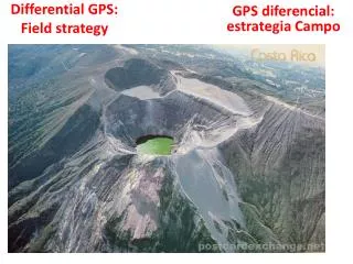
Field Recon – Know before you go • Be realistic about what you can accomplish in 1 day • Round trip? Go to your most distant point then map your way back • If you don’t finish, you have less distance to cover when you return • Pay attention to features that will become attributes
Safety First! • Water, food, communication • Plan left with responsible party: departure time & place, return time & place • Map and compass and competency with them. • DO NOT TRUST YOUR LIFE OR YOUR MISSION TO A GPS UNIT! • (Would you trust life or mission to a double-A battery?????)
Getting geared up • “10 essentials” for hiking • Camera • Rite-in-rain Notebook • Other field forms on R-in-R paper • GPS Quick Guide • FOOD!!!!!!
Define and Review Mission Goals • Positional Requirements: • Mapping into GIS: Points, lines, polygons • Relocation by GPS and/or map and compass • Attribute requirements • Just a name and/or ID? • GIS-quality attributes? • Project requirements • What must be done by when? • Fast, accurate, cheap: pick 2
Attribute Collection • Minimum: Unique ID (name or number) of a position or feature • Ideal: Detailed, multi-field descriptions of positions or features that meet pre-defined standards • Reality: A bit of both • Geodatabases and data dictionaries help us reach the ideal • ALWAYS include an “Other as Encountered” option in menus, AND a “Notes” field
Ways to collect attributes • Rec Grade (Garmins, Magellans): Waypoint metadata forms, available on NPS GIS Site • Requires careful manual notekeeping • Data Dictionary: Built in Trimble Pathfinder Office, deployed with Terrasync • Will require conversion to use in ArcGIS • Geodatabase: Built in ESRI ArcCatalog, deployed in field with ArcPad
Workflow Examples • Trimble: Mapping-grade units • More accurate, correctable, steep learning curve • Garmin: recreational-grade units • Less accurate, not correctable, learn on the fly • Table to compare and contrast
Trimble - ArcPad Workflow Example • Check out data (or data schema) from Geodatabase using ArcMap • Upload data to Trimble unit • Collect field data with ArcPad • GPSCorrect optional but required for post-processing • Download field data from Trimble unit • Post-process field data (either in Pathfinder Office or ArcMap w/GPS Analyst extension) • Only possible if you used GPSCorrect while collecting • Check corrected field data back into Geodatabase using ArcMap
Trimble - Terrasync Workflow Example • Build data dictionary in Pathfinder Office • Upload data to Trimble unit • Collect field data with Terrasync (.ssf files) • Download field data from Trimble unit • Post-process field data in Pathfinder Office • Convert corrected field data back into Geodatabase using ArcMap
Garmin – ArcMap Workflow Example • Configure GPS unit: coordinate system, datum, etc. * • Upload background maps to Garmin unit using MapSource * • Upload tracks and waypoints (if needed) using DNRGarmin or ArcMap • Collect field data : tracks and/or waypoints • Turn off tracklog before turning off GPS! Why..? See upcoming slide! • Download tracks and/or waypoints from Garmin using DNRGarmin • Export field data (tracks and/or waypoints) to ArcMap using DNRGarmin • * These tasks normally have to be done only once, unless the Garmin runs out of power or the settings get changed. Always verify before you go into the field!
Managing Garmin Tracklogs • Turn off tracklog before turning off GPS! • Otherwise, your track will connect the last point collected on your previous mission to the first point collected on your new mission • Contrast to ArcPad or Terrasync, where you must explicitly save each feature before making a new one • Mapping is a secondary design consideration for Garmins, navigation and re-location are primary
Differential (“real time”) correction • 3 options: • WAAS: Wide-Area Augmentation System satellites • NDGPS: National Differential GPS Beacons • Onstar Satellite Subscription • Each must be separately enabled on each unit • Not all GPS units support all options
WAAS and Real-time Correction • Always turn on WAAS • Works with rec-grade and mapping grade units • Remember it is only line-of-sight • NDGPS is active (for now…? Thanks Tim!) • Most units (e.g..: Trimble) will require additional hardware to receive: Trimble BoB, Thales Mobile Mapper • Won’t work with rec-grade units • A supplement to, not a replacement for, Post-processing
Quantity Over Quality? • Better to get a bad position than no position? • Trimble doesn’t think so: many units won’t allow a 2d position • You may disagree– dumb down the minimum quality of positions to increase quantity (1 is better than 0)
Quantity Over Quality? • Settings are dynamic—adjust them according to conditions • Few options on recreational grade e.g.: Garmins • Many options on mapping grade e.g.: Trimbles • Personal experience: Garmins are less accurate but get much better reception under canopy, in cars, even indoors
How to get better reception in poor conditions • You will sacrifice accuracy for productivity! • Bump up maximum allowable PDOP (lower = better quality position) • Allow 2d (no elevation, x-y only) • Trimble units won’t let you do take 2d • Change minimum angle: lower angle above horizon higher PDOP but more satellites • Use the pre-plan utility in GPS Analyst or PFO • Tells you estimated PDOP, available SVs for your location at any given time
Reading your constellation: where are the SVs? • SV = “Space Vehicle” = Satellites • Arrangement of SVs in sky = constellation • Best constellation: many scattered across the sky • Farther from “bullseye” = lower on horizon
Canopy and canyon conditions • Wood (trunks) is worse than leaves/needles • Rock and buildings worse than wood • Canopy + Canyons = Patience + flexibility • Any antenna helps, especially on a range pole. Higher the better. • Even after adjusting PDOP, minimum angle, raising the antenna… • Be prepared for walk, stop, wait, wait, walk, stop, wait, walk… etc.
Listen to your unit! • Make sure that all warnings are audible, not just visual • 2D only! max PDOP exceeded! no SVs! etc. • You can hear when you lose signal • Allows you to look up so you don’t walk off a cliff • Annoying? Of course.
AntennaUse • Use an external antenna whenever possible • Different grades of antenna: multi-path rejection, receptivity • Antenna is the GPS position, not the unit • Keep it still if collecting a point • Multiple antennae will interfere with each other—maintain at least a foot of spacing • Tip: Duct tape is OK—tape it down
Antennas with Trimbles • Important to get antenna settings correct • Antenna type: Zephyr, Hurricane, etc. • Antenna Height (above ground) • Set in TerraSync SetupAntenna • Or if using ArcPad • GPSCorrect if available • PFController if not • ArcPad takes what you give it w/o question
Serious mapping? Take two units! • CRLA example on backcountry trails: • Mapping-grade unit: Trimble GeoXH w/Hurricane Antenna running ArcPad, GPSCorrect • Backup unit: Garmin GPSMap 76CSx w/Gilsson MCX Antenna and waypoint metadata forms • Don’t waste a day in the woods w/nothing to show for it!
Navigation Considerations • To paraphrase Joel: “GPS just messed everything up.” • Even a rec-grade unit will have better accuracy than any map, paper or digital • Background maps on GPS vary widely in source and quality • Even 2005 Orthos are generally based on 1:24k National Map Accuracy Stds = 40’ = 10m
Wrap-Up • Field work with GPS units is a dynamic undertaking… • Not just a walk in the woods with the GPS • Never trust your life to a GPS unit • Look up– pay attention to conditions that affect your GPS reception and your safety (cliff edges, snags, traffic!) • Look down– don’t ignore your unit, it may be telling you something important • Never trust your life to a GPS unit!