Regional Hydro-Ecologic Simulation System (RHESSys)
190 likes | 442 Vues
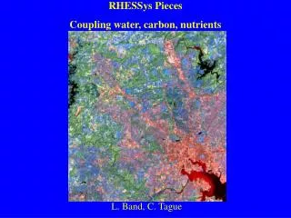
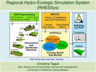
Regional Hydro-Ecologic Simulation System (RHESSys). http://fiesta.bren.ucsb.edu/~rhessys. Christina Tague Bren School of environmental science and management University of California, Santa Barbara. Vertical drainage. Lateral drainage. Carbon and Nitrogen cycling.

Regional Hydro-Ecologic Simulation System (RHESSys)
E N D
Presentation Transcript
Regional Hydro-Ecologic Simulation System (RHESSys) http://fiesta.bren.ucsb.edu/~rhessys Christina Tague Bren School of environmental science and management University of California, Santa Barbara
Carbon and Nitrogen cycling Energy (radiation), carbon, nitrogen and water balance Stand competition for water, light, nutrients Feedback betweenNPP, growth,phenology, and soil biogeochemical cycling
Spatial Hierarchy Basin Hillslope(within basin) Drainage Organization Zone(within hillslope) Meteorology & Energy Patch(within zone) Soil & Litter Strata(vertical within patch) Vegetation overstory understory
Parameter FilesLibrary of parameters: • Vegetation • Soils • Zone processes • Land use • Time Series Files • Required: • Temperature & Precipitation • Single station interpolation • Gridded climate data • Optional – many additional ID’s link each object to the input information Template Initialize state variables WORLDFILE Populated spatial hierarchy G2W GIS (GRASS) INPUTS CF9 FLOWTABLE Connectivity between patches RHESSys Process based sub-models MODEL TEC FILE Temporal event control Output (~100 store/flux variables)Daily, Monthly, YearlyBGC, HydroBasin, Hillslope, Zone, Patch, Stratum
Time Series Data • Zone level: Required • Minimum daily temperature • Maximum daily temperature • Precipitation • Zone level: Optional • Day length • Duration of rainfall • Incoming longwave radiation • Incoming direct shortwave radiation • Incoming diffuse shortwave radiation • Nitrogen deposition as N03 • Nitrogen deposition as N0H4 • Incoming direct PAR radiation • Incoming diffuse PAR radiation • Relative humidity • Mean daytime temperature • Night time temperature at sundown • Soil temperature • Vapor pressure deficit • Wind speed • Carbon dioxide • Minimum temperature lapse rate • Maximum temperature lapse rate • Patch level: Optional • Irrigation • Fertilizer N03 • Fertilizer NH4