Moderate Resolution Sensor Interoperability
Explore how to maximize the interoperability of moderate-resolution Earth observation sensors and data, focusing on user feedback, good practices, and future directions. The initiative aims to encourage synergy among observing systems and improve data uptake. Enhance user guidance and implement multi-sensor data streams effectively. Collaborate with CARD4L and FDA to streamline data access and processing. Present 2017 achievements and outline future strategies for promoting interoperable products.
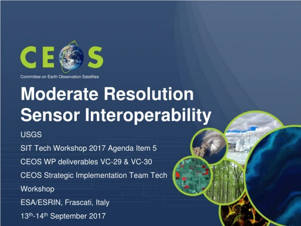

Moderate Resolution Sensor Interoperability
E N D
Presentation Transcript
Moderate Resolution Sensor Interoperability Committee on Earth Observation Satellites USGS SIT Tech Workshop 2017 Agenda Item 5 CEOS WP deliverables VC-29 & VC-30 CEOS Strategic Implementation Team Tech Workshop ESA/ESRIN, Frascati, Italy 13th-14th September 2017
Synergy among CARD4L, MRI, and FDA • CEOS Analysis Ready Data for Land • Product family specifications facilitate uptake of EO data by the user community • Future Data Architectures • CARD4L-compliant data feed FDAs • MRI identifies good practices forimplementation of multi-sensor data sets • Moderate Resolution Interoperability • - Addresses how to combine data / scientific methods to maximize interoperability • CARD4L is the first step • - MRI provides feedback to CARD4L Full exploitation of EO data requires critical user feedback informing current implementations and future directions
Moderate Resolution Sensor Interoperability (MRI) Initiative • This initiative addresses the CEOS strategic objective to encourage complementarity and comparability among the increasing number of Earth observing systemsin the moderate resolution class for both optical and SAR sensors and the data received from them. • 2017 Accomplishments • A framework paper for moderate (10-100m) resolution interoperability describes data characteristics important for densifying and extending time series using multi-sensor data streams. • The Harmonized Landsat Sentinel-2 (HLS) case study identifies and summarizes lessons learned through the production of an interoperable data product. • The Vegetation dynamics monitoring with HLS data will explore the relationship between spatial resolution, temporal resolution and vegetation type. • The MRI Survey gathers lessons learned and good practices of multi-sensor interoperability from the user community
MRI - Where Next • Framework • Feedback for CARD4L threshold and target specifications to maximize interoperability • Move beyond focus on Surface Reflectance ARD products • User Experience • Provide user community guidance for implementing and using multi-sensor data streams • Survey to discover and document good practices • Community feedback to understand user requirements
MRI Case Studies and Synergy with FDA and CARD4L • Data Access Case Studies - FDA • The HLS data product will migrate to Amazon Web Services to provide an accessible platform for investigating interoperable applications • FDA technological solutions (pilots) provide services to user communities and explore new methodologies • User Case Studies – GFOI & GEOGLAM • Coordinate the identification of GEO thematic user case studies through coordination with GFOI, GEOGLAM and other user communities.
MRI Way Forward - 2018 • Continue as LSI-VC activity • Focus on user needs case studies
Time lines • Kickoff telecon on the 2-3 March 2017 • Presentation of framework for endorsement at LSI-VC-3 on 20 March 2017 • Presentation of work plan with emphasis on metadata at WGISS in April 2017 • Presentation of work plan at SIT-32 in April 2017 • Presentation of work plan with emphasis on data at WGCV in May 2017 • Presentation of 2017 results at LSI-VC-4 in September 2017 • Presentation at SIT TW in September 2017 • Incorporate feedback with recommendations for CEOS Plenary • Presentation at CEOS Plenary in October 2017 • Seek endorsement of MRI Framework document
The MRI Team • Co-leads • Team members
MRI Framework Current and Future Outcomes • Promote changes to operational products or post processing methodologies to create interoperable ARD products For example, radiometric cross calibration to standard references, and acceptance of compatible geographic reference grid, DEMs and atmospheric models – typically reduces uncertainty • Identify good practices to accommodate differences among products For example, spatial resampling to the same pixel-size and to remove residual misregistration and spectral band adjustment for different spectral response curves – typically increases uncertainty • Understand uncertainties Producer uncertainties associated with geometry, radiometry, illumination and view angle, atmosphere, etc. User uncertainty requirements for monitoring application specific change • Provide user guidance Lessons learned and good practices
MRI Framework Components • MRI components complement CARD4L and describe issues and solutions with for multi-sensor data sets. • General Metadata provided at the scene or product level describe data characteristics Reference grid accuracy; geometric accuracy; spectral bands; spectral response curves, radiometric accuracy, revisit time and lifetime; field of view; and mean local time • Per-Pixel Metadata support data filters and corrections Clouds; cloud shadow; land/water mask; snow and ice masks; DEM; terrain shadow mask; illumination and viewing geometry; data quality • Measurements and corrections applied using metadata and data models Measurements; measurement normalization; aerosol, water vapor and ozone corrections; SBAF corrections • Geolocation and corrections for image to image registration Geometric corrections; resampling
Multi-sensor implementations • Cooperation among agencies is needed to support interoperability through the continued evolution of Analysis Ready Data. • Adopt Standards • OGC/ISO metadata standards • Shared reference grids and DEMs • Reflectance and atmospheric models • Common general and per pixel metadata • Understand impact of inherent differences • Pixels sizes • Spectral band differences • Spectral band availability • Revisit time • The MRI initiative supports CARD4L and Future Data Architecture studies and studies at agencies evolving implementation strategies. These strategies may be physical higher level products or models designed to use well defined lower level products as inputs. When standards cannot be adopted, compensation for differences is needed.
MRI Framework: General Metadata • Adopt common OGC or ISO metadata standard
The MRI Survey provides the user community an opportunity to contribute lessons learned and good practices. MRI Survey Q1 Q2 Q3 Q4 Q5: 4 responses
The MRI Survey was distributed initially to the LSI-VC, MRI, SDCG and GEOGLAM teams. MRI Survey Q6: 4 responses Q7: 4 responses Q8 Q9 Q10: 1 response