Download
1 / 48
510 likes | 778 Vues
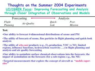
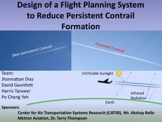
Design of a Flight Planning System to Reduce Persistent Contrail Formation. Persistent Contrail. (Non-persistent) Contrail. Team: Jhonnattan Diaz David Gauntlett Harris Tanveer Po Cheng Yeh. UV/Visible Sunlight. Infrared Radiation. Earth. Sponsors:

E N D
Design of a Flight Planning System to Reduce Persistent Contrail Formation Persistent Contrail (Non-persistent) Contrail Team: Jhonnattan Diaz David Gauntlett Harris Tanveer Po Cheng Yeh UV/Visible Sunlight Infrared Radiation Earth Sponsors: Center for Air Transportation Systems Research (CATSR), Mr. Akshay Belle Metron Aviation, Dr. Terry Thompson
Agenda • Context • Stakeholder Analysis • Problem, Need Statement, Mission Requirements • Design Alternatives • Design of Experiment • Project Management • Questions
Global Climate Change Energy Demand Burning of Fossil Fuels Greenhouse Gas Emissions Global Temperature Increase Population Increase Global Climate Change Melting Ice Caps Droughts Mean Sea Levels Rising Extreme Storms “Global Climate Change.” National Aeronautics and Space Administration. http://climate.nasa.gov/effects Department of Ecology. State of Washington http://www.ecy.wa.gov/climatechange/whatis.htm
U.S. CO2 Emissions • Increasing trend of CO2 emissions • 1.7 billion metric tons CO2 from Transportation sector • Air transportation: • 11 % of CO2 emissions from transportation sources • 1.9 million metric tons CO2 from Air Transportation http://epa.gov/climatechange/ghgemissions/global.html http://www.epa.gov/climatechange/ghgemissions/gases/co2.html
Projected Passenger Increase Greater than 26% increase from 1977 to 2012 *Approximately 21 lbs CO2 released per gallon of fuel burned* http://apps.bts.gov/xml/air_traffic/src/index.xml http://www.transtats.bts.gov/FUEL/Fuel_Hist.aspx *http://www.eia.gov/environment/emissions/co2_vol_mass.cfm
Jet A Fuel Combustion Process aCnH2n+2 + bO2 + 3.76bN2→ cH2O+ dCO2 + 3.76bN2 + heat CO2 Climate Change Radiative Forcing CH4 Chemical Reactions NOx O2 H2O Aircraft Engine Microphysical Processes H2O Aerosols Air SOx Fuel Contrails HC Soot Sridhar, Banavar & Chen, Neil. “Design of Aircraft Trajectories based on Trade-offs between Emission Sources.” 2011.
The Issue • Studies suggest persistent contrails may have a three to four times greater effect on the climate than carbon dioxide emissions. • Contrails inhibit the movement of incoming and outgoing radiation UV/Visible Sunlight Sridhar, B., Hok, N., Chen, N. “Aircraft Trajectory Optimization and Contrails Avoidance in the Presence of Winds.” 2011. Infrared Radiation Earth GAO, “Aviation and the Environment.” 2000. Waitz, I., Townsend, J., Cutcher-Gershenfeld, J., Greitzer, E., and Kerrebrock, J. Report to the United States Congress: Aviation and the Environment, A National Vision, Framework for Goals and Recommended Actions. Partnership for Air Transportation Noise and Emissions Reduction, MIT, Cambridge, MA, 2004.
The Issue -Contrails cause greater radiative forcing than CO2 -Contrails create induced cirrus clouds -The understanding behind contrails and induced cirrus clouds is relatively low Gossling, Stefan, and Upham, Paul. Climate Change and Aviation- Issues, Challenges and Solutions. 2009.
Contrail duration varies with respect to wind conditions (wind shear) as well as temperature changes • Contrail frequency varies with frequency of weather conditions
Persistent Contrail Formation Conditions • Schmidt-Appleman Criterion • Altitude: 29,000ft - 41,000ft • Temperature: below -40℃ • Humidity: RHi > 100% • Ice content/ice capacity (Similar to RHw) • RHi > 100% indicates Ice Super-Saturated Region (ISSR) • Greater likelihood of persistency in colder months. Palikonda, Rabindra. “Contrail climatology over the USA from MODIS and AVHRR data.” 2002.
Contrail Mitigation Studies • Technological Changes • Fuel Additives • Jet Engine Redesign • Jet Airframe Redesign • Operational Changes • Flight Planning Changes: contrail avoidance flight paths Royal Commission on Environmental Pollution, “The Environmental Effects of Civil Aircraft in Flight,” London, UK, 2002. http://www.rcep.org.uk/avreport.htm.
Contrail Avoidance Flight Path • Tactical Maneuvering • En-Route request to maneuver around ISSR • Strategic Maneuvering • Pre-flight plan filed with ATC with built-in ISSR avoidance • For this Project: Strategic Maneuvering • Reduces cognitive workload on ATC • Does not change current flight planning process
Flight Planning Airline Dispatcher Proposed Flight Plan Flight Service Stations Accepted/Rejected Flight Plan http://www.faa.gov/air_traffic/publications/controller_staffing/media/cwp_2012.pdf
Agenda • Context • Stakeholder Analysis • Problem, Need Statement, Mission Requirements • Design Alternatives • Design of Experiment • Project Management • Questions
Stakeholder Analysis Who is affected if contrail avoidance flight planning is attempted? What are their interests and goals?
Ideal Solution/Win-Win • Win-win would occur with an ideal solution that would: • Maintain ATO’s desired level of safety • Reduce airline operational costs • Reduce environmental impact Although out of the scope of this particular project, it should be noted there is also a need for education regarding the effects of contrails
Agenda • Context • Stakeholder Analysis • Problem, Need Statement, Mission Requirements • Design Alternatives • Design of Experiment • Project Management • Questions
Problem Statement • Contrails have a negative impact on the environment. • Lack of system negotiating stakeholders’ needs in order to provide flight paths avoiding ISSR while accounting for tradeoffs between • fuel consumption • travel time • miles of contrails formed Royal Commission on Environmental Pollution, “The Environmental Effects of Civil Aircraft in Flight,” London, UK, 2002. http://www.rcep.org.uk/avreport.htm.
Gap Contrail Neutral IATA: “Reduce net CO2 emissions by 50% by 2050 compared to 2005.” IATA: “Global cap on our [CO2] emissions in 2020.” Contrail favorable weather conditions Miles of contrails % Contrail Coverage Radiative Forcing # of jets Marquart et al., 2003: Future development of contrail cover, optical depth, and radiative forcing: Impacts of increasing air traffic and climate change.
Need Statement • Need to provide FAA and AOC with a Decision Support System to estimate • amount of fuel consumed • CO2 emissions produced • miles of contrails formed • flight duration • Need to analyze relationship between • amount of fuel consumed • CO2 emissions produced • miles of contrails formed • flight duration • percentage of contrail avoidance attempted.
Mission Requirements • MR1: The system shall provide the ability by 2020 to reduce the radiative forcing due to contrails to the 2005 baseline of 7.06mW/m^2. • MR2: The system shall provide the ability to maintain contrail neutrality after 2020 at the radiative forcing value of 7.06mW/m^2. • MR3: The system shall minimize CO2 emissions, miles of contrails formed, flight duration, fuel consumption. • MR4: The system shall maintain an equivalent level of safety standards for aircraft spacing.
Agenda • Context • Stakeholder Analysis • Problem, Need Statement, Mission Requirements • Design Alternatives • Design of Experiment • Project Management • Questions
Contrail Avoidance Methods Altitudes of Concern (29,000-41,000 ft.) Red: Travel Through Contrail Regions Blue: Contrail Avoidance RHi>100% Y B RHi>100% Z Y Z Altitude Adjustment B A B X Horizontal Adjustment X A Combination Adjustment X A
Value Hierarchy Assume safety levels will be maintained *Note: CO2 emissions are a linear factor of amount of fuel consumed
Sample Use Case Anticipated Users: --Airlines --Air Traffic Control User NOAA System Input Origin/Destination Input Aircraft Request Weather Data Send Weather Data Great Circle Distance Flight Path Airway Routes Contrail Avoidance Flight Path Fuel Consumption per path Contrails Formed per path Flight Duration per Path
Agenda • Context • Stakeholder Analysis • Problem, Need Statement, Mission Requirements • Design Alternatives • Design of Experiment • Project Management • Questions
Design of Experiment • Control: • Great Circle Distance (GCD) 0% Avoidance • Independent Variables: • Flight Plans • Airway Flight plan Actually filed plan • Contrail Avoidance Flight plan • Altitude Adjustment • Horizontal Adjustment • Combination Adjustment • Dependent Variables: • Fuel Consumption • Miles flown through contrail regions • Flight Duration • Carbon Dioxide Emissions
Design of Experiment • Procedure • Each aircraft (≈ 22,000) will be flown with each of the alternative flight routes • CO2 emissions and miles of contrails formed will be summed for all flights for each alternative flight route to view total effect on NAS • Tradeoff analysis will be completed between each of the dependent variables • Currently in the process of devising tradeoff analysis
System Requirements • The system shall accept flight path data as an input. • The system shall accept NOAA .grib2 weather data as an input. • The system shall identify the location and the dimension of the ISSR. • The system shall perform vertical avoidance, horizontal avoidance, and combination avoidance. • The system shall output contrail distance formed, amount of fuel used, CO2 emitted, and total flight time. • The system shall be able to model contrail avoidance paths. • The system shall be able to model airway routes. • The system shall be able to model the great circle distance.
RAP Data From NOAA • Matrix obtained from .grib2 files • .grib2 files obtained through publicly available FTP from NOAA • ISSR Data • Graphical representation of RHw weather data • Temperature data is in similar format • Lambert Projections
Contrail Avoidance System • Uses predicted weather data to avoid areas with a high chance to yield persistent contrails. • The system shall be able to determine which weather cells must be avoided to reduce contrail formation. • Inputs • Flight Object • Weather Object • Outputs • Fuel Consumption • Miles Contrail Formed • Flight Time
Physical Processes Modeled • Velocity • Thrust • Drag • Fuel Consumption • CO2 Emissions • RHi for persistent contrail formation
Anticipated Results • More contrail avoidance maneuvers will cause more fuel burn • Each alternative will be weighed on value hierarchy weights
Anticipated Recommendations • Recommend flight plan with optimum tradeoff between • Miles of contrails produced • Amount of fuel burned • Amount of CO2 produced • Flight duration
Work Breakdown Structure • 16 major topics decomposed into subtasks • 131 total tasks
Scheduling • Critical Path • Need Statement • Stakeholder Analysis • System Alternatives • Simulation • Results Analysis
Budgeting • Cost/engineer • Baseline cost: $45/hour/engineer • GMU overhead: $2.13 multiplier • Total cost/engineer: $95.74/hour/engineer • Worst Case Plan: • Hours: 1,457 • Cost: $139,500 • Best Case Plan: • Hours: 730 • Cost: $69,750
Next Phase Plan • Continue developing contrail avoidance algorithm • Begin Programming Simulation: 11/25/2013 • Value Hierarchy Weights • Consider wind optimal routes • Working in Partial Contrail Avoidance • Devise tradeoff analysis • Analyze NOAA Rapid Refresh Data for patterns and trends
Risks • High Risk, High Impact: • Contrail avoidance and flight path algorithms complication may exceed comprehension • Mitigation: Request expert help • Medium Risk, High Impact: • Simulation coding not being done on time • Mitigation: more hours • Medium Risk, Medium Impact: • Deliverables not completed on time • Mitigation: more hours