Rivers and Drainage
Rivers and Drainage. Dr. R. B. Schultz. Streams and Drainage It is important that we make a review of the hydrologic cycle. *97% of all water is oceans (salt water) *2% of all water is in ice caps/polar ice *0.6% is groundwater (fresh) *0.2% is rivers and lakes (fresh)

Rivers and Drainage
E N D
Presentation Transcript
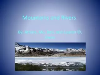
Rivers and Drainage Dr. R. B. Schultz
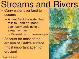
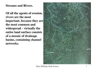
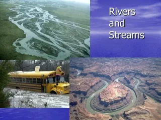
Streams and Drainage It is important that we make a review of the hydrologic cycle. *97% of all water is oceans (salt water) *2% of all water is in ice caps/polar ice *0.6% is groundwater (fresh) *0.2% is rivers and lakes (fresh) *0.16% is atmospheric water (fresh) Streams: Gaining streams are those that take in water with time and tend to widen. Losing streams are those that lose water with time and tend to become narrower. Intermittent streams are those that are wet during the wet season and dry in drier times. There are several drainage patterns that develop based on rock type: • 1.Dendritic -- branching • 2.Radial-- associated with uplifts/hills • 3.Rectangular-- associated with resistant rock • 4.Trellis-- associated with resistant ridges
There are several stages of stream development: a.Early (adolescent) -- waterfalls and rapids present b.Middle (adult) -- widening floodplains c.Mature -- meandering streams present d.Old age -- very broad, wide valley, Yazoo stream tributaries and oxbow lakes present *Materials carried by the stream is referred to as bedload. *The larger the particles, the less they are moved by water. Water tends to round particles with time. Three (3) types of materials in streams: 1.Bedload/Traction Load -- that which is heavy and pushed by the water 2.Saltation – bouncing effect of grains Suspended load -- that which is carried and bounced by the water 3.Dissolved -- actually dissolved in the water Head of stream is starting point; mouth of stream is “end”.
Stages of Stream Development Initial Stage: Fast moving stream, narrow valley Second Stage: Meanders develop, widening floodplain Last Stage: Wide floodplain, yazoo streams, and oxbow lakes develop
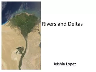
*Channel shape is based on the velocity of the stream and resistance of rock it is cutting into. *Water in streams tends to move quicker in the center of the stream and slower towards the outside. *Wider streams move slower than narrow streams. *Outside of meander is called a Cutbank and is associated with erosion. *Inside of meander is called a Point Bar and is associated with deposition. *Much (~45%) of the eastern portion of the U.S. is drained by the Mississippi River, whereas the western portion of the U.S. is predominantly drained by the Colorado River. *The point between where drainage shifts is called a divide. *As water from a river (stream) empties into a large body of water like an ocean, it forms a structure called a delta. *The Mississippi River emptying into the Gulf of Mexico is the type example of a delta. *Deltaic switching occurs when no more sediment can be added to a given area. Thus, the river takes the path of least resistance and moves or migrates.
Key Terminology Gaining stream Losing stream Intermittent stream Dendritic Radial Rectangular Trellis Bedload Traction load Saltation Suspended load Dissolved load Head Mouth Floodplain Yazoo stream Oxbow lake Meander Cutbank Point bar Divide Delta Deltaic lobe switching Drainage basin
Pertinent Web Sites Dartmouth Flood Observatory This Web site is a research tool for early detection, mapping, measurement, and analysis of extreme flood events worldwide using remote sensing. Disaster Finder (NASA) A complete index to the best disaster Web sites on the Internet. Discharge Data United States Geological Survey (USGS) real-time and historical river discharge data by state. Envirofacts (EPA) Envirofacts is a single point of access to select U.S. EPA environmental data. Environmental Protection Administration (EPA) Water Office United States Environmental Protection Agency (EPA) Office of Water includes links to related federal and state agencies. Flood Links Links to various types of flood information. Floodplain Management Floodplain management from the Floodplain Management Association (FMA). Global Hydrology and Climate Center (NASA) The Global Hydrology and Climate Center (GHCC) is a joint venture between government and academia to study the global water cycle and its affect on climate. Hazards (USGS) Information obout several types of environmental hazards from the United States Geological Survey (USGS). Historical Streamflow Data (USGS) Access to records of almost 19,000 stations that are part of the United States Geological Survey stream gaging network; some records go back more than a century. Hydrologic Calculations Online hydrologic calculators from LMNO Engineering, Research, and Software, Ltd. Hydrologic Remote Sensing Center The National Operational Hydrologic Remote Sensing Center of the National Weather Service. Hydrology Web The Hydrology Web is a site that hosts a comprehensive list of links to Hydrology and related Hydrology resources. International Rivers Network The International River Network (IRN) supports local communities working to protect their rivers and watersheds. It works to halt destructive river development projects, and to encourage equitable and sustainable methods of meeting the needs for water, energy and flood management.
Landform Atlas of the United States The color landform atlas of the United States includes shaded relief maps and satellite image maps of each state. River Data Links This Central Michigan University site maintained by Dr. Mark Francek lists several good links to websites containing information relative to topics discussed in the chapter. River Systems and Flooding Excellent class notes on river systems and flooding from Tulane University. Running Water Links (Houghton Mifflin) Links to several running water sites, including class lecture notes, arranged by topic. Stream and River Landforms Text and images about how water shapes the land from the Geological Survey of Canada. Streams and Mass Wasting Links (NAGT) An extensive listing of streams and mass wasting links arranged by topic from the National Association of Geology Teachers (NAGT). TopoZone The TopoZone bills itself as the Web's center for recreational and professional topographic map users. Here you can interactively view topographic maps from the entire United States. Water Data, Real Time (USGS) Real-time water data from the United States Geological Survey (USGS). Water Pollution Links This Central Michigan University site maintained by Dr. Mark Francek lists several good links to websites containing information relative to topics discussed in the chapter. Water Quality Information Center The Water Quality Information Center collects, organizes, and communicates the scientific findings, educational methodologies, and public policy issues related to water quality and agriculture. Water Resources Links This Central Michigan University site maintained by Dr. Mark Francek lists several good links to Web sites containing information relative to topics discussed in the chapter.
Water Resources of the United States (USGS) Information about water resources in the United States from the United States Geological Survey. Watershed, Locate Your This U.S. Environmental Protection Agency (EPA) site alllows you to locate and obtain information about the watershed you live in, including a small map of the watershed. Watershed Resources Links An extensive listing of watershed links from the Global Rivers Environmental Education Network. Water Resource Terms (Glossary of) A glossary of water resource terms from the Edwards aquifer home page. Water Use (USGS) The National Water-Use Informational Program from the USGS. World's Water, The The World’s Water is a site dedicated to providing up-to-date water information and data, and web connections to organizations, institutions, and individuals working on a wide range of global freshwater problems and solutions.