Download
1 / 34
340 likes | 582 Vues
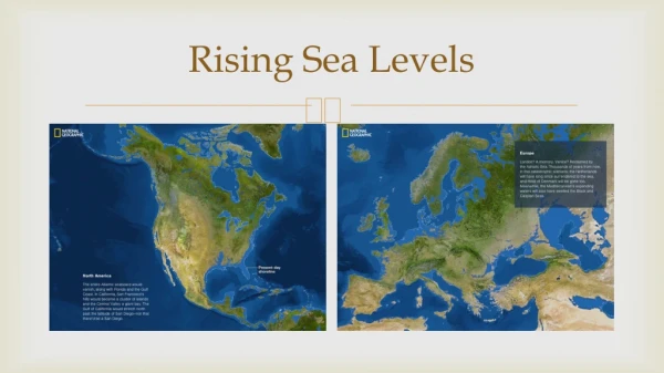
PLANNING FOR RISING SEA LEVELS NBWA November 5, 2010. Preliminary Study Vulnerability Adaptation Strategies Next Steps. HASPA Hayward Area Shoreline Planning Agency. Potential inundation. Light Blue – 16 in Dark Blue – 55 in Source: USGS, BCDC. Functions. Urban Habitat

E N D
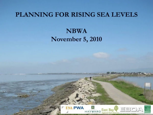
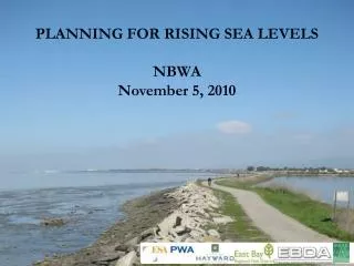
PLANNING FOR RISING SEA LEVELS NBWA November 5, 2010
Preliminary Study • Vulnerability • Adaptation Strategies • Next Steps
HASPA Hayward Area Shoreline Planning Agency
Potentialinundation • Light Blue – 16 in • Dark Blue – 55 in Source: USGS, BCDC
Functions • Urban • Habitat • Storm drainage • Land fill • Sewage treatment • Utility corridors • Trails Oro Loma Marsh Triangle Marsh Cogswell Marsh Alkali Flat Hayward Marsh Oliver BrothersProperty
Storm drainage • Designed for a certain bay elevation • Lack of drainage as MLLW rises • Structures fixed relative to tide frame • Upstream impacts will increase • Exposure increaseswith time • Adaptation mayrequire pumping • Opportunity toconsolidate
Oro Loma wastewatertreatment plant Functions • Urban • Habitat • Storm drainage • Land fill • Wastewater • Utility corridors • Trails Solar drying ponds KOFY Alameda County West Winton Ave City of Haywardwastewatertreatment plant
Functions Railroad • Urban • Habitat • Storm drainage • Land fill • Sewage treatment • Utility corridors • Trails PGE Cable EBDA line HP Gas Bay trail
Inundation Frank’s Dump West - New Year’s Eve 20058.9 ft tides; 40mph westerly winds Photo: Mark Taylor
Groundwater Elevation Levee slope increases as mudflat lowers and levee raised Armored levee
Hold the Line Levee slope increases as mudflat lowers and levee raised Armored levee
Realign Rapid landward movement increases as sea level rises
Opportunities - Sediment • Trapped in channels in watershed • Trapped in marinas further alongshore • In the past, sources were more diffuse
Opportunities - Freshwater • Large amount of freshwater passes through area • Opportunity to reconfigure EBDA line • In the past, sources were more diffuse
Opportunities – Brackish Marsh • Historic element of the Bay • Greater biomass, wave attenuation and sediment trapping • Grow the marshes upwards • Steepen the existing natural shoreline • Adaptively respond to changes in sea level
Gradual Steepening ImpermeableBermor Wall Seepage Berm Bay Rapid landward movement increases as sea level rises FreshwaterSwale Cut offwall Mudflat Tidal Marsh Brackish Marsh
Gradual Steepening Treated Wastewater and Stormwater Overflow Wave Attenuation Seepage Rapid landward movement increases as sea level rises FreshwaterSwale Mudflat Tidal Marsh Brackish Marsh
Gradual Steepening Rapid landward movement increases as sea level rises FreshwaterSwale Mudflat Tidal Marsh Brackish Marsh
Fringing (attached) barrier beach Nearshore (detached) barrier beach
Next Steps Master Plan Vulnerability Assessment Infrastructure Ecology Property Adaptation Strategy Interim Management
Preview of the late 21st century? San Pedro Road, China Camp - January 2010 spring tide Photo: Peter Baye