Download
1 / 17
180 likes | 218 Vues
BALWOIS 2010, 25-29 May, Ohrid , Macedonia. FLOOD RISK ASSESSMENT OF URBAN AREAS Cvetanka Popovska Milorad Jovanovski Dragan Ivanoski Igor Pesevski Ss Cyril and Methodius University Faculty of Civil Engineering Department of Hydraulics, Hydrology and River Engineering

E N D
BALWOIS 2010, 25-29 May, Ohrid, Macedonia FLOOD RISK ASSESSMENT OF URBAN AREAS Cvetanka Popovska Milorad Jovanovski Dragan Ivanoski Igor Pesevski Ss Cyril and Methodius University Faculty of Civil Engineering Department of Hydraulics, Hydrology and River Engineering Skopje, MACEDONIA www.gf.ukim.edu.mk
BALWOIS 2010, 25-29 May, Ohrid, Macedonia URBAN AREA DESCRIPTION Geographical position Climate Morphology Population Social relationship Economic activities
BALWOIS 2010, 25-29 May, Ohrid, Macedonia URBAN SYSTEM ELEMENTS space, biological needs, emotional needs, relationships Human Community Nature water, air, temperature, precipitation, land use, pollution, protection Laws, managements, education, health, economical and industrial development housing, public service, cultural and recreational centers roads, railways, airports, communication, Informatics systems Cores Networks
BALWOIS 2010, 25-29 May, Ohrid, Macedonia URBAN SYSTEM ELEMENTS Human Community Nature Cores Networks
BALWOIS 2010, 25-29 May, Ohrid, Macedonia CAN WE UNDERSTAND THE URBAN SYSTEM BETTER THAN WE DO NOW? YES, by measuring different phenomenon related to natural disasters, war conflicts and other economic and political activities
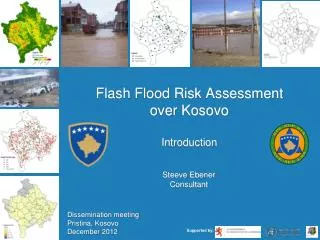
BALWOIS 2010, 25-29 May, Ohrid, Macedonia CASE STUDY Airport Prishtina in Kosovo
BALWOIS 2010, 25-29 May, Ohrid, Macedonia Watershed map and drainage network system
BALWOIS 2010, 25-29 May, Ohrid, Macedonia FCE (2008) Hydrograph Method
BALWOIS 2010, 25-29 May, Ohrid, Macedonia FLOOD ROUTING ANALYSIS RUNWAY N2 P1 P2 PEIMETER ROAD
BALWOIS 2010, 25-29 May, Ohrid, Macedonia LONGITUDINAL SECTION P1+P2 RUNWAY PERIMETER ROAD N2
BALWOIS 2010, 25-29 May, Ohrid, Macedonia RISK ASSESSMENT FACTORS AND INDICATORS
BALWOIS 2010, 25-29 May, Ohrid, Macedonia CONCLUSIONS alfa.i (2006) • The floods are overestimated • The overestimation imposed reconstruction that includes: - construction of additional culvert under the runway - construction of pumping station at N2 - diversion of pumped water to Magura River - diversion of culverts D2 and D3 to Henc River
BALWOIS 2010, 25-29 May, Ohrid, Macedonia FCE (2008) • Hydrological and hydraulic modeling was carried out • The existing storm sewer system enables safety transfer of flood • There is no need of additional culvert under the runway • Maintenance of the existing storm sewer system is out of issue • Management of the existing storm sewer system is out of issue • Risk assessment could not be performed due to lack of data
BALWOIS 2010, 25-29 May, Ohrid, Macedonia THANK YOU…
Evaluation formulas: Vegetation index=vegetation cover/total land area (%) Population density=total population/total land area (persons/km2) Resistance damage index=amount of damages/GDP of normal year (%) Crop damage area=crop damage area caused by heavy rainfall (ha) Flood damage index (FDI)=Ip+Ih+Ie Ip - persons damage number Ih - houses damage number Ie - economic losses