The Coriolis Effect and Ekman Transport
520 likes | 1.46k Vues
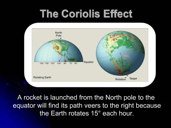
The Coriolis Effect and Ekman Transport. The tendency for the path of a moving object to deflect to the right in the Northern Hemisphere and to deflect to the left in the Southern Hemisphere Caused by the Earth’s rotation relative to an object in motion over its surface.

The Coriolis Effect and Ekman Transport
E N D
Presentation Transcript
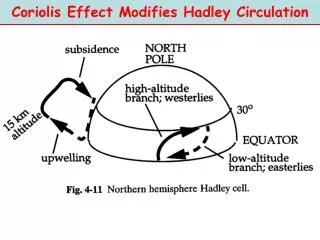
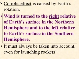
The tendency for the path of a moving object to deflect to the right in the Northern Hemisphere and to deflect to the left in the Southern Hemisphere • Caused by the Earth’s rotation relative to an object in motion over its surface.
Apparent deflection of the path of an object • Object does not actually deviate from its path, but it appears to do so because Earth is moving underneath.
MARINE ENVIRONMENT surface winds + coriolis effect surface currents coriolis effect = curved deflection in the path of a fluid flowing linearly over a rotating sphere (the Earth)
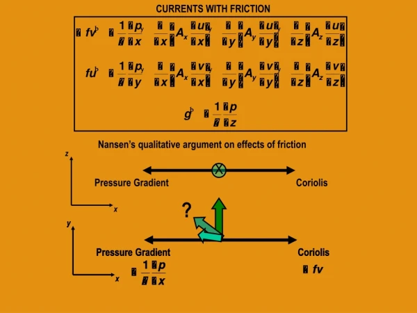
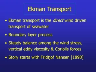
Wind + coriolis causes Ekman transport velocity vectors: each layer of water drags on next deeper layer (friction) and coriolis operates on each layer 90° to right of downwind direction coriolis displacement to right in No. Hemisphere 50 m deep
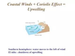
Coastal Upwelling Due to offshore Ekman transport off coast Nutrient rich water comes up from the bottom of the ocean
coastal upwelling due to offshore Ekman transport along coast coriolis displacement to left in So. Hemisphere
Which direction (N,S, E, or W) will the mass movement of water be directed from a westerly wind in the northern hemisphere? • Wind is coming from the west and blowing to the east • Therefore mass water movement will be 90 degrees to the right or to the south Wind direction Mass water movement due to Ekman transport
U. S. West Coast cold cool warm coastal upwelling due to offshore Ekman transport along coast
coastal upwelling due to offshore Ekman transport along Oregon coast Oregon coast: temperature: phytoplankton: upwelling cooler deeper water to surface more nutrients more photo- synthesis
coastal upwelling due to offshore Ekman transport along Oregon coast summer upwelling winter downwelling (north winds) (south winds) water temperature
coastal upwelling due to offshore Ekman transport along Oregon coast summer upwelling winter downwelling (north winds) (south winds) coriolis displacement to right in No. Hemisphere
greater reflection solar heat + atmosphere surface winds
solar heat + atmosphere surface winds
solar heat + atmosphere surface winds atmospheric airpressure high dry Horse Latitudes (deserts) low wet high dry
surface winds + coriolis effect surface currents coriolis displacement to right in No. Hemisphere
Measuring surface currents • The modern message in a bottle • Surface buoy designed to track ocean currents
surface winds + coriolis effect surface currents
MARINE ENVIRONMENT • Equatorial Counter-Current • strong equatorial currents move water to west • sea surface is 0.5m higher on west side of equatorial seas • some water flows back east along calm doldrums
boundary currents = north-south surface currents eastern western
coriolis effect makes western boundary currents stronger than eastern boundary currents
MARINE ENVIRONMENT boundary currents easternvs.western USA example: California C. Gulf Stream temperature: cool (NS) warm (SN) width: wide (~1000 km) narrow (~100 km) depth: shallow (~0.5 km) deep (~2 km) speed: slow (~10 km/day) fast (~100 km/day) upwelling: high low productivity: high low
MARINE ENVIRONMENT surface + vertical currents sea surface temperature (SST)
MARINE ENVIRONMENT surface + vertical currents sea surface temperature (SST)
MARINE ENVIRONMENT surface + vertical currents sea surface temperature (SST)
thermocline pycnocline MARINE ENVIRONMENT thermocline depth zone of rapid change in water temperature
thermocline pycnocline MARINE ENVIRONMENT thermocline stratification deep nutrients separated from shallow light limits photosynthesis in about 90% of oceans light shallows: photosynthesis depletes nutrients barrier to vertical mixing dark depths: nutrients sink and accumulate
MARINE ENVIRONMENT upwelling vertical mixing removes thermocline and moves deep nutrients to well-lit shallows fertilizes photosynthesis in about 10% of oceans, which accounts for about 50% of marine fisheries greener = more chlorophyll (phytoplankton)
MARINE ENVIRONMENT upwelling coastal, and equatorial
coriolis displacement to right in No. Hemisphere coriolis displacement to left in So. Hemisphere MARINE ENVIRONMENT equatorial upwelling due to Ekman transport in opposite directions on either side of equator and nutrients
Limits on Marine Primary Productivity • Most autotrophs require: • Water • CO2 • Inorganic nutrients • Sunlight
Light Zones • Euphotic zone (good light) • Sunlit zone • Enough sunlight for photosynthesis • Most marine lifer found here • Disphotic zone (bad light) • Twilight zone • Very little light • No photosynthesis • Aphotic zone (no light) • Midnight zone • Entirely dark
Zonation of Pelagic Environment 0 m Euphotic Zone Region of sufficient light for photosynthesis Epipelagic 200 m Mesopelagic Depth varies due to water clarity, available light, etc. 1000 m Bathypelagic 4000 m Abyssopelagic