Download
1 / 29
410 likes | 825 Vues
Middle course of the river. Quick revision for spot test. What is erosion? I am a type of erosion that is like sandpaper How does Hydraulic action work? I am the type of erosion that knocks off edges off rough rocks. What is solution/corrosion? What is weathering?

E N D
Middle course of the river Quick revision for spot test
What is erosion? • I am a type of erosion that is like sandpaper • How does Hydraulic action work? • I am the type of erosion that knocks off edges off rough rocks. • What is solution/corrosion? • What is weathering? • How does physical weathering work? • Plants and animals break the rock apart- what am I? • The slowest form of mass movement
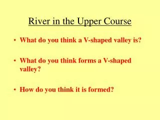
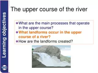
River Profiles – a cross-section through a river’s course from source to mouth. DONE
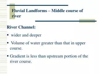
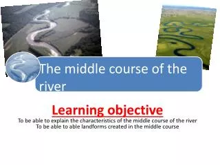
What are the main processes that operate in the middle and lower course of a river? • The river is now flowing over flatter land and so the dominant direction of erosion is lateral (from side to side). • The river has a greater discharge and so has more energy to transport material (load). • Deposition is also an important process and occurs when the velocity of the river decreases or if the discharge falls due to a dry spell of weather. Why do you think that a river in the middle and lower course has a higher discharge than near the source?
Attrition = Solution = Abrasion = Hydraulic Action = Types of erosion?
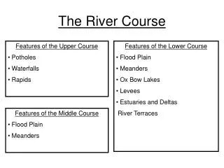
What landforms are found in the middle and lower course? DEPOSITION and EROSION create these landforms • Meanders • Oxbow Lakes • Flood plains and Leveés • Deltas DEPOSITION created these landforms
Hold hands and run go in a wave- who goes fastest? Q: Do you think there will be erosion or deposition on the outside of the bend? Watch youtube clip http://www.youtube.com/watch?v=4qKS_Nk7UmY&safe=active Draw a diagram of how meanders and oxbow lakes form (p69 and 70)
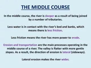
Meanders Water is pushed to the outer bend . This reduces friction with the bed and banks. So the river has more energy for transporting material which can erode the outside bank via abrasion. As the course of a river approaches its middle stages it flows over flatter land. Lateral erosion dominates as the river swings in large bends known as meanders. Meanders constantly change their shape and position.
Explain the formation of an oxbow lake http://www.youtube.com/watch?v=PWkGgM6b_Yk&feature=related When the river floods it breaks through the thin meander neck and the river takes the easier, straight course. This leaves the meander loop ‘cut off’ as an oxbow lake. Over time, the oxbow lake will become colonised by vegetation. new course of the river Meander neck becomes smaller oxbow lake
Explain why there is more deposition at ‘A’ rather than at ‘B’ (4 marks) Meander bend on the River Conwy A B
Examination question Study the photograph below: B A C Name the 3 features labelled A, B and C (3) Choose one of the features and explain its formation. You may use diagrams to help you.(6)
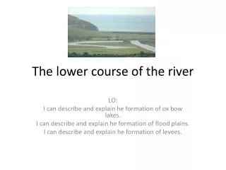
How are floodplains and levees formed? Floodplains and leveés are formed by deposition in times of river flood. The river’s load is composed of different sized particles. When a river floods it deposits the heaviest of these particles first. The larger particles, often pebble-sized, form the leveés. The sands, silts and clays are similarly sorted with the sands being deposited next, then the silts and finally the lightest clays. Every time the river floods deposition builds up the floodplain.
Floodplain formation This is a cross section of a floodplain.
How are Deltas formed? • Deltas are found at the mouth of a river, where the river meets the sea. • At this point the river is carrying too much load for its velocity and so deposition occurs. • The top of the delta is a fairly flat surface. This is where the coarsest river load is dropped. • The finer particles are carried into deeper water. The silt is dropped to form a steep slope on the edge of the delta while the clay stays in suspension until it reaches the deeper water.
Key ideas on the middle and lower course of rivers. • Depositionis the main process operating in the middle and lower upper course of a river. • Erosion is still important and occurs laterally (side to side). • Discharge is greater than at the source. • River Velocity is greater than at the source. • Meanders and Oxbow lakes are formed by erosion and deposition. • Deltas and leveés are formed by deposition.
v-shaped valleys rapids interlocking spurs deltas meanders floodplains leveés oxbow lakes waterfalls Which of the following landforms are the result of a mixture of erosion and deposition? (2 marks)