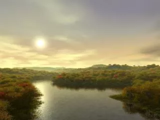
The River Course
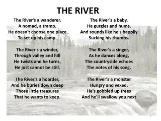
The River Course. Features of the Upper Course Potholes Waterfalls Rapids. Features of the Lower Course Flood Plain Meanders Ox Bow Lakes Levees Estuaries and Deltas River Terraces. Features of the Middle Course Flood Plain Meanders. The Hydrologic Cycle.

The River Course
E N D
Presentation Transcript
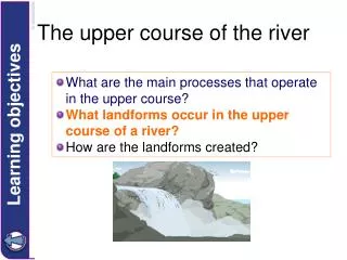
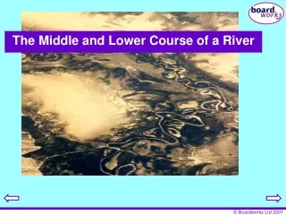
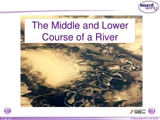
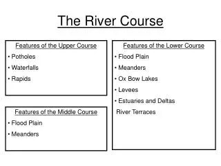
The River Course • Features of the Upper Course • Potholes • Waterfalls • Rapids • Features of the Lower Course • Flood Plain • Meanders • Ox Bow Lakes • Levees • Estuaries and Deltas • River Terraces • Features of the Middle Course • Flood Plain • Meanders
Resistant, hard rock lies on top of softer rock type in a river channel. The underlying softer rock is eroded more quickly than the harder rock and so the resistant rock is undercut. Over time the resistant rock will become increasingly unsupported. The harder rock will eventually collapse under its own weight. Once it has collapsed, the rocks which have shattered will be swirled around at the base of the waterfall, due to the force of the water. This will cause the formation of a plunge pool at the base of the waterfall. This process will happen continuously, causing the waterfall to move backwards (retreat). Formation of a Waterfall Waterfall retreats upstream Overhang collapses Hard Rock Soft Rock Plunge pool develops undercutting Where the 2 layers of rock are very thin, there will be no obvious collapse, so the water will just swirl round, causing rapids
The river widens its valley by lateral erosion (horizontally) The river uses much of it’s energy transporting large quantities of material When the river floods, after a period of heavy rainfall, the alluvium (sedimentary deposits) are spread across the valley floor, and deposited. Every time the river floods another layer of alluvium is deposited and a flood plain is formed. When the river is losing energy, for example after a flood, the coarsest, heaviest material is deposited first, as this uses the most energy to transport. Over time this can form a natural embankment, called a levee. Formation of a Flood Plain
In every river channel, even very straight channels, riffles and pools develop. Pools are deeper stretches of slow moving water, usually with fine alluvial deposits Riffles are shallower sections of faster flowing water, flowing above coarser material Once pools and riffles have developed in a river channel, the river swings from side-to-side This side-to-side motion is then assisted by erosion and deposition of the river channel The meander becomes more curved as a result of erosion Erosion occurs on the outside bend where velocity is strongest and the water is deepest. On the other side, deposition occurs, where the current is weakest Over time, the meander becomes more and more curved, due to erosion and deposition, but also because of the movement downstream. Formation of a Meander
Oxbow lakes form during periods of flood The water is looking for the fastest, most direct route and so instead of flowing round the meander, it cuts straight across. Eventually the water inside the Oxbow lake will either evaporate or silt up Formation of an Ox Bow Lake
Task 1: Describe fully, with the aid of an annotated diagram, how one of the following river features is formed: • Waterfall • Flood Plain • Meander • Ox Bow Lake (6)
During glaciation, the land was pushed downwards under the weight of the massive ice sheets Since the ice age ended, the land has been slowly rising to its former position Rivers try to adjust to this by eroding back into its former flood plain Areas of the floodplain remain as river terraces Formation of a River Terrace
When a river enters the sea its flow characteristics become very different Velocity is reduced, and the load has been deposited The mouth of the river broadens to form an estuary Tides sweep up the mouth of the river clearing it of any remaining material, which is then taken into the sea The sediments that is not transported into the sea from the estuary forms sand and mud banks Formation of Estuaries and Deltas
Task 2: For either a River Terrace or an Estuary, describe in detail, how it is formed (4)