Parallels and Meridians
Parallels and Meridians. In order to find any place on Earth , a sytem of imaginary lines is used - Geographic co-ordinates.

Parallels and Meridians
E N D
Presentation Transcript
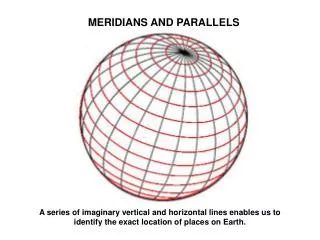
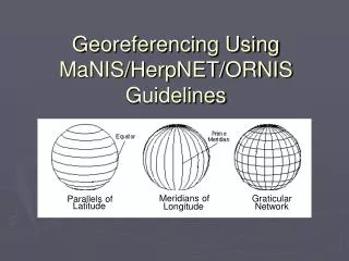
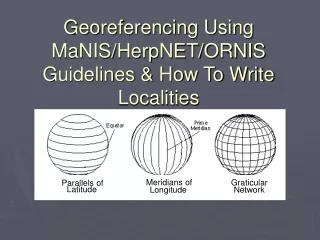
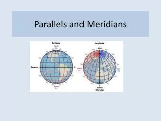
In ordertofindany place onEarth, a sytem of imaginarylinesisused- Geographicco-ordinates • are imaginarylinesthatcircletheEarth. Theselines are paralleltotheequator. Parallels are numberedfromtheequatortothepoles in degreesfrom 0º to 90º • Theymeasurelatitude. LatitudeisthedistancebetweenanypointontheEarthtoequator. ( northorsouth) Parallels
Meridians • are imaginarylinesthatrunfrom pole to pole. The Greenwich meridianismeridianzeroorthe principal meridian. Meridians are numbered in degreesfrom 0 to 180º, east and west of Greenwich meridian. • Theyenableustomeasurelongitude. LongitudeisthedistancebetweenanypointontheEarth and the Greenwich meridian.