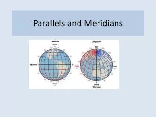
Parallels of
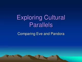
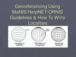
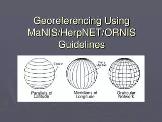
Meridians of. Graticular. Parallels of. Latitude. Longitude. Network. Georeferencing Using MaNIS/HerpNET/ORNIS Guidelines. Geographical Concepts:. Datum(Geodetic) :

Parallels of
E N D
Presentation Transcript
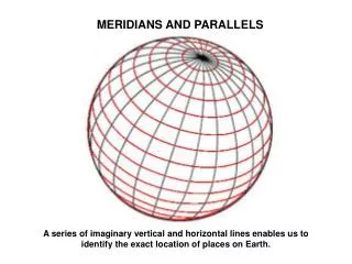
Meridians of Graticular Parallels of Latitude Longitude Network Georeferencing Using MaNIS/HerpNET/ORNIS Guidelines
Geographical Concepts: • Datum(Geodetic): Defines the position of the origin, scale, and the orientation of the axes of a coordinate system. A model of the earth used for geodetic calculations. • Coordinate reference system: a coordinate system that relates a system of numbers (latitude, longitude) to the real word via a datum.
Map Projections: • Projections are the mathematical transformation of the three-dimensional surface of the earth into a flat map sheet, or the projection of the 3-D spheroid into a 2-D map (e.g. conical, cylindrical, azimuthal and these types can be equal area or equidistant). • They all suffer from distortions, either in area, shape, distance, or direction. • When measuring distances on paper maps, use an equal distant projection or equal area if near the central meridian.
Extents: • Extent:the geographic range, magnitude or distance that a location may actually represent. (With a town, the extent is the polygon that encompasses the area inside the town’s boundaries.) • Linear extent- what we use for the Point-Radius Method. Defined as the distance from the geographic center of the location to the furthest point of the geographic extent of the location.
MaNIS/HerpNET/ORNIS (MHO) Guidelineshttp://manisnet.org/GeorefGuide.html • The “point-radius” method of georeferencing • Uses the coordinate (point) of the center of a place, and an uncertainty (“error”) around it to account for extent of the named place, uncertainty of direction and distance, datum used, etc. • We assume that the point and radius will contain the actual collection locality • Purpose behind these methods is to provide assumptions that will produce consistent results that can be replicated, to enhance the value of specimen collections, and to design a “paradigm that could be easily adopted by other disciplines with similar needs.”
Data Quality • “Fitness of use” of the data • As a collector, you may have an intended use for the data you collect but data you collect but data have the potential to be used in unforeseen ways…. The value of your data is directly related to the fitness for a variety of uses. • As data become more accessible many more uses become apparent. – Chapman 2005, Chapman and Wieczorek 2006 • We are using the MHO methods as a tool to enhance data quality
MHO Guidelines • If more information is known about a locality and the georeferencer wants to use this information, then state any assumptions made in the “LatLong Remarks” field of your database • Document the georeferencing rationale for each record (by using MHO guidelines exactly or document differences in “Latlong remarks”). • Always state your assumptions. • Think of georeferencing as “many-stepped process” – this is a first pass. Then you can go back to do more refining and verification of the records using itineries, field notes, collector verification and by mapping the localities and making these maps available on-line.
Maximum Error Distance from Uncertainties: • Uncertainty is a “measure of the incompleteness of ones knowledge or information about an unknown quantity whose true value can be established if a perfect measure device were available.” (Cullen & Frey 1999) • In MHO Guidelines, this is defined as the numerical value for the upper limit of the distance from the coordinates of a locality to the outer extremity of the area within which the whole of the described locality must lie (i.e., what can be mistaken for that locality based on the description given).
Scale Uncertainty (ft) Uncertainty (m) 1:1200 3.3 ft 1.0 m 1:2400 6.7 ft 2.0 m 1:4800 13.3 ft 4.1 m 1:10,000 27.8 ft 8.5 m 1:12,000 33.3 ft 10.2 m 1:24,000 40.0 ft 12.2 m 1:25,000 41.8 ft 12.8 m 1:63,360 106 ft 32.2 m 1:100,000 167 ft 50.9 m 1:250,000 417 ft 127 m Causes of uncertainty: • Map scale • The extent of the locality • GPS accuracy • Unknown datum (results in >100 m • Imprecision in distance measurements • Imprecision in direction measurements
Precision and Accuracy: • Always use as many decimal places as given by the coordinate source. • A measurement in decimal degrees give to five decimal places is more precise than a measurement in degrees minutes seconds. • False precision will result if data are recorded with a greater number of decimal points (e.g. when converting from DMS to decimal degrees). • Always record the accuracy of your GPS readings (how well the GPS measures the true value of the location). The accuracy is given at the same time as the coordinate, but usually will not be recorded with the coordinates when you output them on most GPS units.
Types of Localities: • Named Place – Used to refer to traditional and non-traditional features (towns, cities, mountains, ranches, highway mile markers, townships). We take the extent of the named place. • Named Place - Urban Area Locality consists of a reference to a geographical feature having a spatial extent, example is “Las Vegas, Nevada” If the geographic center does not fall within the shaded urban area, choose the nearest point to the center within the shape.
Locality Types: • Named Place – Street Address “#10 Downing St., London, England” Extent is the smallest area possible that cannot be mistaken for another address, sometimes ½ a city block.
Locality Types: • Named Place – Remote A locality that does not have a clear boundary on the map “Amargosa Valley (town), NV” • Extent is half the distance to the center of the nearest named place (or feature).
Locality Types: • Named Place – Lake, Mountain, Cultural Land, or Other Geographic Entity “Mount Vesuvius, Italy” • Extent is usually half the length from the coordinates of the center of the named place to the furthest point within the named place.
Offsets: • Distance from a named place using the location of the named place as a starting point. Used with a heading to give direction and distance from named place. • These can be in a direction, direction and distance, direction along a path, etc. “5 miles north of Beatty, on US 95”
Acknowledgements: • MaNIS/HerpNET/ORNIS Georeferencing Guidelines • Guide to Best Practices in Georeferencing, edited by Arthur Chapman and John Wieczorek, 2006 • “The point radius method for georeferencing locality descriptions and calculating associated uncertainty” by John Wieczorek, et al., 2004. Available at (#9) http://herpnet.org/documents.html • Figures from MHO Guidelines, Terrain Navigator, Geographer’s Craft, Robert Hijmans and Carla Cicero