Download
1 / 8
80 likes | 231 Vues
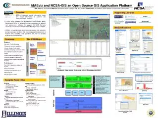
Open GIS: USGS CEGIS’ Technical and Implementation Issues. Michael P. Finn. Lightning Talk, Open GIS Workshop, Pre-AAG, 2014 (07 Apr). Data/ Software. Data: Open? -- mostly Example: USGS Data holdings 8 Layers of the National Map Soon: Hyperspectral cubes and LiDAR point clouds

E N D
Open GIS: USGS CEGIS’ Technical and Implementation Issues Michael P. Finn Lightning Talk, Open GIS Workshop, Pre-AAG, 2014 (07 Apr)
Data/ Software • Data: Open? -- mostly • Example: USGS Data holdings • 8 Layers of the National Map • Soon: Hyperspectral cubes and LiDAR point clouds • Software: Open? – mostly not in GIS • Source Code: Open/ Modifiable? • Software Package: tight/ coherent system? • Functional? • Example software: mapIMG (based on CGTP)
Open GIS: Technology and Applications • 2 of D. Sui’s “Four Opportunities of Open GIS” • GIS: combining data & software GIS Packages • Legacy of primarily commercial software • Early wide-spread but often spotty “open” GIS • e.g. QGIS • Foundation for maturity, expansion, and further openness
CyberGIS • CEGIS participation • Cyberinfrastructure(eScience) • HPC & GIScience • A balance/ interaction between theory/ data (S. Rey) • Collaborative Research • Standards (for interoperability) • Openness • e. g. OGC; XCEDE
Toolkits Eliminate/ Remove/ Reduce License confusion Hide compute complexity Assist with modeling/ analytics e.g. CyberGIS Toolkit (pRasterBlaster as a component) Lessons learned; contribution: parallel I/O for raster; NetCDF and GeoTIFF
Spatial Modeling/ Analytics (GeoViz) • Solving “Changing World” Problems • Democratizing Science • Products and Services for society and its citizens
Open GIS: USGS CEGIS’ Technical and Implementation Issues Data & Software Solving (Spatial) Problems Lightning Talk, Open GIS Workshop, Pre-AAG, 2014 (07 Apr)