Download
1 / 12
130 likes | 665 Vues
Chapter 5 Forms of Condensation and Precipitation. Notes. Cumulonimbus Cloud. Cloud Formation Clouds – visible aggregate of minute droplets of water, or tiny crystals of ice, or a mixture of both.

E N D
Cumulonimbus Cloud Cloud Formation Clouds – visible aggregate of minute droplets of water, or tiny crystals of ice, or a mixture of both. Clouds are a form of condensation produced when water vapor condenses in the atmosphere. The cloud formation process includes adiabatic cooling, and condensation of water vapor as a parcel of air rises above the lifting condensation level. Condensation occurs when two conditions are met: 1) The air is cooled to it dew point. 2) A surface is available on which the water vapor can condense For condensation to occur aloft, tiny particles known as cloud condensation nuclei must be present. Hygroscopic nuclei – particles that are the most effective sites for condensation Hydrophobic nuclei – water repelling particles Dust storms, volcanic eruptions, and pollen are major sources of cloud condensation nuclei. Also, by-products of combustion act as hygroscopic particles.
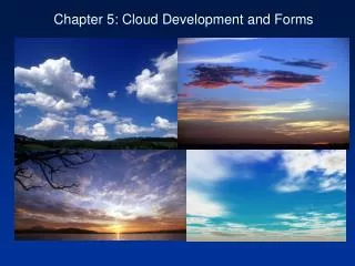
Cloud Types Cloud Classification Clouds are classified on the basis of two criteria: form and height. Three basic cloud forms are recognized: 1) Cirrus – high, white, and thin clouds. They appear as delicate veil-like patches, extended wispy fibers 2) Cumulus – consist of globular individual cloud masses. They exhibit a flat base and appear as rising domes or towers. 3) Stratus – appear as sheets or layers that cover much or all of the sky. There are no distinct individual cloud units. All clouds have one of these three basic forms or combinations or modifications of them. Three height levels are used to classify clouds: High clouds – normally have bases above 6,000 meters (20,000 feet) Middle clouds – occupy heights from 2,000 to 6,000 meters Low clouds – form below 2,000 meters Clouds of vertical development – clouds that extend vertically to span more than one height range.
Advection Fog in San Francisco Types of Fog Fog – a cloud with its base at or very neat the ground. Physically, the is no difference between a fog and a cloud; their appearance and structure are the same. The difference is the method and place of formation. Clouds result when air rises and cools adiabatically. Fog results from cooling or by the addition of enough water vapor to cause saturation. There are three types of fog: 1) Radiation fog – results from radiation cooling of the ground and adjacent air. It is a night time phenomenon requiring clear skies and a fairly high relative humidity. 2) Advection fog – when warm and moist air is blown over a cold surface, it becomes chilled by contact. If cooling is sufficient, the result will be a blanket of fog. Advection refers to air moving horizontally, so warm, moist air moving horizontally across a cold surface will lose heat. 3) Upslope fog – created when relatively humid air moves up a gradual sloping plain, or up steep mountain slopes. Because of the upward movement, air expands and cools adiabatically. If the dew point is reached an extensive layer of fog may form.
Other fogs When saturation occurs primarily because of the addition water vapor, the resulting fogs are called evaporation fogs. Two types of evaporation fogs are recognized: Steam fog – When cool air moves over warm water, enough moisture may evaporate from the water surface to saturate the air immediately above. As the rising water vapor meets the cold air, it condenses and rises with the air that is being warmed from below. Frontal fog – when frontal wedging occurs, warm air is lifted over colder air. If the resulting clouds produce rain, and the cold air below is near the dew point, enough rain can evaporate to produce fog. This fog is more or less a continuous zone of condensed water droplets reaching from the ground up through the clouds. Steam Fog Rising from a Lake
Days per Year with Heavy Fog Dew and Frost Dew – the condensation of water vapor on objects that have radiated sufficient heat to lower their temperature below the dew point of the surround air. Because different objects radiate heat at different rates, dew may form on some surfaces but not on others. White frost – forms when the dew point of the air is below freezing. Frost forms when water vapor changes directly from a gas into a solid without entering the liquid state.
Raindrops Are much Larger than Cloud Droplets • Although all clouds contain water droplets not all clouds produce precipitation. • Clouds droplets are very small – 20μm (0.02mm) • Clouds droplets result from the abundance condensation nuclei • Because of their small size, droplets would fall very slowly and would evaporate before is fell a few meters from the cloud • A typical raindrop has a diameter of about 2000μm (2.0mm) • The volume of atypical raindrop is a million times that of a cloud droplet
Snowflake Being Formed by the Bergeron Process • Precipitation from Cold Clouds – The Bergeron Process • The Bergeron Process is the process that generates much of the precipitation in the middle latitudes. • The upper portions of the clouds must be cold enough to produce ice crystals • As the ice crystals fall through the cloud they enlarge by collecting cloud droplets • The type of precipitation that reaches the ground depends on the temperature profile in the lower few kilometers of the atmosphere
Precipitation from Warm Clouds The Collision-Coalescence Process Precipitation from warm clouds (clouds located below the freezing level) do not form by the Bergeron Process. Clouds made entirely of water droplets—no ice crystals—must contain some droplets larger than 20μm if precipitation is to form. These large droplets can form when “giant” condensation nuclei are present, or when hygroscopic particles exist. The large droplets fall rapidly through the cloud. As the droplets fall they collide with smaller, slower droplets and coalesce. The larger the droplet becomes, the faster they fall and the greater their rate of growth. To get droplets of sufficient size to fall as precipitation a tremendous number of collisions must occur. So, the cloud must have great vertical thickness and contain large cloud droplets to have a chance of producing precipitation. Updrafts within the cloud help the collision-coalescence process because they allow the droplets to move up and down repeatedly in the cloud allowing for more collisions. The collision-coalescence process is most efficient in the tropics where the air is very humid and very few condensation nuclei are present. Raindrop Forming by Collision and Coalescence
Temperature Profiles for Rain, Snow, Sleet and Glaze (Freezing Rain) • Forms of Precipitation • Because atmospheric conditions vary greatly both geographically and seasonally, several different forms of precipitation are possible. • Rain • Defined meteorologically as drops of water that fall form a cloud and have a diameter of at least 0.5 millimeter. • Most rain originates in either nimbostratus clouds or in towering cumulonimbus clouds • Drizzle and mist are not considered forms of rains because of the small size of the water droplets that form them • Snow • Precipitation in the form of ice crystals (snowflakes) or aggregates of ice crystals • Sleet and Glaze • Sleet is a wintertime phenomenon and refers to the fall o9f small particles of ice that are clear to translucent. • Glaze forms when raindrops become supercooled as it falls through cold air and turns to ice. • Hail • Hail is precipitation is the form of hard, rounded pellets or irregular lumps of ice. • Most hailstones have diameters between 1.0 centimeter and 5.0 centimeters. • Rime • A deposit of ice crystals formed by the freezing of supercooled fog or cloud droplets on objects whose surface temperature is below freezing.
Doppler Radar Image of a Band of Heavy Precipitation • Measuring Precipitation • Instruments: • Standard rain gauge, tipping-bucket gauge, weighing gauge • Measuring snowfall: • Two measurements taken – snow depth and water equivalent