Download
1 / 20
200 likes | 211 Vues
This event discusses the importance of standardizing geographic names for national security, emergency preparedness, regional planning, site selection, and more. The Geographic Names Information System (GNIS) is highlighted as the official source for geographic names in federal products.

E N D
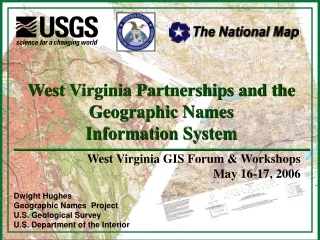
West Virginia Partnerships and the Geographic NamesInformation System West Virginia GIS Forum & WorkshopsMay 16-17, 2006 Dwight Hughes Geographic Names Project U.S. Geological Survey U.S. Department of the Interior
Why Standardize Geographic Names? • National Security • Emergency Preparedness & Response • Regional & Local Planning • Site Selection & Analysis • Cartographic Application • Environmental Problem-solving • Tourism • All Levels of Communication
GNIS The Geographic Names Information System • Supports the U.S. Board on Geographic Names • Federal body authorized by law to ensure names standardization (not regulation) • Official source for geographic names on Federal products depicting areas under U.S. jurisdiction • Maps, electronic products, documents, etc. • One Feature, One Name, One Location • As specified by data owner within Board guidelines • Normally Federal, State, County, Local authority-You
GNIS Public Web Query http://geonames.usgs.gov/pls/gnispublic
GNIS in The National Map http://nmviewogc.cr.usgs.gov/viewer.htm
GOS Geographic Names Community http://gos2.geodata.gov/wps/portal/gos
Why GNIS? • Conforms to BGN principles, policies, guidelines • 30 Years of Data from authoritative sources • Like you – local stake holders • Stable, mature system • Full national coverage, consistent, seamless • Quality assured, prevents duplication • Open, interoperable, available • Functioning partner base – Federal, State, Local • Large user community of long standing • Data readily available to all levels of Government and to the public through multiple services and options • Provides unique feature identifier, official name, and official location If your features are in GNIS, they are official
Two Million – And Growing Fast • 502,000 hydrographic features – Synchronized with NHD • 395,000 cultural features – Mostly structures • Cemetery, Dam, Locale, Mine, Military (historical), Oilfield, Tower, Trail, Well • 376,000 structural features • Airport, Building, Church, Hospital, School, Post Office • 257,000 landforms – In no other layer of The National Map • (Other than hydro) • 170,000 populated places • 100,000 admin features • Civil, Forest, Park, Reserve • 97,000 historical features – In no other layer • 14,000 transportation point features • Bridge, Crossing, Tunnel • (14,000 Antarctica features) Thousands added per month. If its not in GNIS, it should be.
GNIS Features A feature is an Entity on the landscape with • A Feature ID • A location • A name • A Geometry? • Other Secondary Attributes Attributes
GNIS Official Feature ID • Unique, permanent, national feature identifier • System assigned number - no information content • Superseded FIPS55 Place Code • Discussions concerning ANSI Standard • Added to local data sets for future reference/maintenance • Immediately assigned upon web data entry • For comparing, reconciling, merging data sets • Eliminates need for difficult attribute matching in data from multiple, overlapping jurisdictions & sources • Available to all levels of government and the public • No confusion or doubt about identity of feature
GNIS Official Feature Location • Single point at 24k – The primary point • Official point to which official name is attached • Independent of size, extent, spatial representations • 80% of GNIS features are point features • Easily added, corrected, or modified • Apply to Address Standard? • Vital for correctly identifying & locating features • Boundaries not reliable as official feature location • Boundaries: Don’t exist, change, are undetermined,cannot be determined, subject to disagreement, multiple versions at differing scales/resolutions
GNIS Official Name • Official because data owner (you!) says it is • (In all but a very few cases, mostly natural features) • Resolves confusion from multiple, overlapping, conflicting jurisdictions and sources • Subject to general guidelines of the BGN • All sources authorized and verified • All data validated & QA’d • Names complete, standard, nationally consistent • Available to all levels of Government & the public
Batch Partner Partner Files TransactionEntry/Edit Data Maintenance Full Service – Data In Web Services &Applications Working Synchronizedby Feature ID GNIS Partner Data
TNM Feature Any other App Look up National Map Any other GIS File Download Custom Files Full Service – Data Out GNIS Web Site GNIS MapService GNIS XMLService FeatureService GNIS
Electronic Maintenance Program Since 1987 • U.S. Board on Geographic Names • U.S. Geological Survey • U.S. Forest Service (1997) • Office of Coast Survey (1997) • National Hydrography Data Set (NHD) Partners • Synchronized 1997 • National Park Service (1999) • Bureau of Land Management (2005) • Fish & Wildlife Service (soon) • General Services Agency (MOU in for signature)
State Partners • North Carolina – GNIS only official source • Delaware – GNIS only official source • Florida – State Gazetteer based on GNIS • West Virginia • Oregon – working • Hawaii – discussions • Nevada – startup • Missouri – preliminary discussions • New York – discussions • Others – preliminary contact
Partnerships Are Critical USGS GeographicNames Project For West Virginia • Paul Liston • Kurt Donaldson Long Standing Working State NamesAuthorities State/Local GISAuthorities Develop
Contacts • Louis Yost – Executive Secretary U.S. Board on Geographic Names (Acting) • (703) 648-4552 • lyost@usgs.gov • Robin Worcester • (703) 648-4551 • rworcest@usgs.gov • Jennifer Runyon • (703) 648-4550 • jrunyon@usgs.gov • Eve Edwards • (703) 648-4548 • eedwards@usgs.gov • Dwight Hughes • (703) 648-5793 • dshughes@usgs.gov
The End Thank you for your interest! Questions?