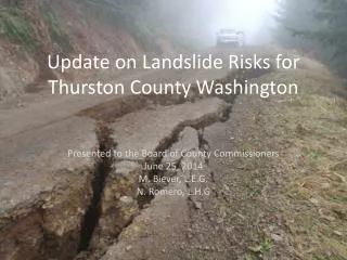
Update on Landslide Risks for Thurston County Washington
290 likes | 450 Vues
Update on Landslide Risks for Thurston County Washington. Presented to the Board of County Commissioners June 25, 2014 M. Biever, L.E.G. N. Romero, L.H.G. Today’s Presentation - June 25, 2014. Update on landslide identification work (completed since April 2014) - Preliminary

Update on Landslide Risks for Thurston County Washington
E N D
Presentation Transcript
Update on Landslide Risks for Thurston County Washington Presented to the Board of County Commissioners June 25, 2014 M. Biever, L.E.G. N. Romero, L.H.G
Today’s Presentation - June 25, 2014 • Update on landslide identification work (completed since April 2014) - Preliminary • Share new findings • Discussion of findings • WA DNR – State Geologist – Tim Walsh
Activity Conducted (A Basic Geomorphic Exercise) • Using LiDAR maps we identified ‘steep slope’ areas (mountains, coastlines & river banks) • We then identified landform shapes thatwe know to be landslide features (scarps, slumps, etc) • We used WA DNR land hazards viewer to compare to our findings (new website feature) • We identified about +70 landslides (small to medium)
7 Key Physiographic Areas: • Summit Lake Area • Black Hills Range (Rock Candy Mountain) • Tenino Mountain Range (Skookumchuck Res) • North Side of Tenino (Old Hwy 99 Corridor) • Nisqually River Bank • Deschutes River Bank • Coastal Areas
Summit Lake ExampleNext Slide:LiDARGeology Landform Identification(Secondary Effects Found Too)
Types of Landslides & Secondary Hazards 1. Deep Seated Slow Moving – Carlyon Beach Type Slide • Large (feet/year) Thousands to Millions of tons of material 2. Shallow Fast Moving - Coastal Bluffs and Rock Candy Mountain • > 50 miles per hour (instantaneous) 3. Hybrid Landslides - Oso, Washington Landslide in this category • Combination: Large & Fast Moving (millions of tons) 4. New Category – Secondary Effects of Landslides – • Seiche – Landslide generated “Tsunami” in lakes or enclosed water bodies • Backwater Flooding – Caused by debris blocking a waterway • Summit Lake & Skookumchuck Reservoir (Two potential T.C. Examples)
Type 1. Deep Seated Landslide- Failure plane is below the root line This slide is approximately 500 thousand tons of material
Type 1. Deep Seated Landslide Sunset Beach Landslide, EldInlet, Olympia, Washington Third documented re-activation was in 2007 Three homes severely damaged Typical geometry with arc-shaped scarps in “Step formation”
Type 2. Shallow Undifferentiated – Fast moving debris and water rich soils
We Did Not Identify Type 3 Landslides In Thurston County • This is good news: • The March 22nd, 2014 Oso, Washington Slide was a type 3 landslide • They are responsible for most damage and fatalities • Fast moving and can be HUGE • They are not common in South Puget Sound • They occur where glacial geology , topography and rainfall have the right mix to start the unstable ground moving
Type 3. Oso Landslide – Hybrid Deep Seated with massive blocks of soil and trees – very fast moving killed 44 people also impounded the Stillaguamish River for weeks
Type 3. LiDAR View of the Oso, Washington landslide and other slides near it. Very clearly shows up on this type of image
Type 4 Landslide Hazard • A critical secondary hazard we’ve identified in Thurston County is a “Seiche” (a water wave) • Caused by landslide debris falling into a lake or underwater landslide • An Inland Lake ‘Tsunami’ • Waves can knockout homes or infrastructure
We Found 2 Locations in Thurston County Susceptible to Seiches – Closed Water Body tsunamis Summit Lake Skookumchuck Reservoir (Coastlines Possible Too)
Type 4. Seiche generated by a landslide impacting Lituya Bay- Alaska (1950’s) Wave Height 300 meters !!
Type 4. Seiche Generated by Large Landslide impacting Lake with a 400 meter high dam (Italy)
Summary of Preliminary Exercise • We Identified: • +70 Landslides in geomorphic exercise • Preliminary ‘risks’ • 7 Physiographic Areas for Higher Landslide Potential • Two Lakes with “Seiche” susceptibility (could be more) • Scoping out latest research on what is known • Including WA DNR Viewer • We did not identify an “Oso” Type Slide
Next Steps: • WA DNR Landslide Consortium (DNR Partners)- • Two meetings and prep for 2015 legislature • 2 regional meetings attended in 2014 so far • Explore grant funding for landslide identification • Funding for ‘Automated Landslide ID’ software • (GIS Staff)