Download

1 / 69
730 likes | 1.11k Vues
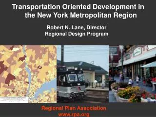
THE DEVELOPMENT OF NEW YORK METROPOLITAN AREA Gayaza High School Geography Department. Location of New York Metropolitan area. The New York metropolitan area includes New York City, Jersey City, Newark City, Yonkers city and Paterson city.

E N D
THE DEVELOPMENT OF NEW YORK METROPOLITAN AREAGayaza High School Geography Department
Location of New York Metropolitan area. • The New York metropolitan area includes New York City, Jersey City, Newark City, Yonkers city and Paterson city. • It is located in the Eastern part of the country at the Atlantic coast. • It covers parts of New York State, New Jersey State as well as small parts of Connecticut and Pennsylvania.
The site and relief of New York metropolitan area • The area is sited at the coast and on a number of Islands separated by rivers and bays. • The relief is generally flat or gently undulating. • The average height of land is 40 metres above sea level
The drainage features of New York metropolitan area. • The major rivers include Hudson River, East River, Harlem River, river Arthur kill, river Passaic and river Hackensack. • The bays include Upper bay, Lower bay, Newark bay and Jamaica bay. • other water bodies include the Atlantic Ocean and the Long Island sound.
New York City. • It is also the largest and most populous city in the U.S.A. • The city is sited on Manhattan, Staten Island, Long Island, Coney Island and Governors Island. • The boroughs of New York City include Manhattan, Queens, Brooklyn, Bronx and Staten Island.
Historical background of New York City • New York City originated as a Dutch settlement in 1624 as New Amsterdam. • In 1664, it was taken over by the British settlers who renamed it New York. • The population of the city continued to increase due to the Islands’ attractions to the immigrants.
The factors that attracted European settlers to Manhattan, New York • The warm climatic conditions . • The existence of fertile soils . • The existence of a natural harbour. • The strategic position . • It was relatively secure from hostile Red Indian tribesmen. • The existence of a gently sloping or rather flat land.
Reasons for the rapid growth and development of New York. • Its position as a port . • The increasing population in the area. • The suitable location of the area with easy access to raw materials . • New York port has ice free conditions . • Availability of market for goods manufactured in New York. • Availability of capital and easy access to finance. • The location or situation of the city at the end of the Hudson Mohawk gap.
FUNCTIONS OF NEW YORK CITY/ METROPOLITAN AREA • Transport and communication centre. • Industrial Centre. • Administrative centre. • Recreationaland tourist centre. • Business and commercial centre. • Educational centre. • Medical/ health centre. • Religious and cultural centre. • Research centre. • Residential centre.
THE DEVELOPMENT OF NEW YORK PORT • New York Port is one of the largest ports in North America and handles almost half of North American trade. • It is a natural harbour. • A harbour refers to a sheltered stretch of water at a coastal area where ships can shelter and obtain protection from storms or tidal waves and currents.
Factors favouring New York port as a natural harbour • Deep waters of up to 14 metres. • Sheltered waters/ bays. • Low tidal range of about 2 metres. • Ice free conditions throughout the year. • Clear entrance into the harbour. • Hard rocks to construct quays and dock yards on a firm foundation.
Factors that have favoured the development of New York port • Good physical conditions e.g. deep waters, low tidal range, ice free and sheltered conditions. • The port has a rich industrial and agricultural hinterland. A Hinterland is an area served by a port. • Availability of capital for the establishment of port facilities and use of containers. • Advanced technology has enabled the growth of the port. • Easy accessibility of the port from various places.
PORT FACILITIES • Dock: This refers to an enclosed area of water at a port where ships can be stationed be loaded, offloaded or repaired. • Dry dock: This is a dock from which water can be emptied. It is used for the repair and building of ships. • Quay: This refers to a place or platform constructed of concrete or wood beside a dock where goods are loaded and offloaded from a ship.
Dock yard: It is a place or area at a port with facilities for receiving ships as well as equipment or supplies for repairing or building ships. • Berths/ Wharves: These are sections at a dock where ships are anchored for loading and unloading of cargo.
Containerisation at the port of New York • Containerisation refers to the use of large standardized metallic boxes for the packing of cargo or goods to be transported when sealed. • Containerisation has developed at the port of New York and this has greatly facilitated water transport in the region. • Port Elizabeth which is well known for handling containers in New York.
Advantages of containerisation at New York port • Easy loading and unloading of cargo. This is due to the use of use of equipment like cranes. • Cargo is protected against bad weather. • protection of the goods against damage by insects or pests. • The cargo is protected against contamination by Pollutants.
Cargo is protected against loss through theft or carelessness. • It tends to be time saving i.e. less time is spent on loading and unloading as well as clearing of the goods. • The load capacity of vessels is increased i.e. more goods can be carried with containers.
Disadvantages of Containerisation • The use of containers results into the unemployment of stevedores or longshore men. • It is unsuitable for the transportation of small volume or quantities of freight (cargo). • It is quite expensive to acquire containers and to install container handling equipment or facilities like cranes. • Some containers tend to be rigid in application. They are meant only for a specific type of cargo. • It has resulted into overcrowding at the port.
Commodities handled by the port of New York Exports handled: • Agricultural products e.g. wheat, corn, fruits, beef etc. • Textiles and a variety of clothing e.g. woolen, cotton, silk and synthetic textiles. • Iron and steel products e.g. vehicles, roofing material, household utensils etc. • Electrical appliances e.g. flat irons, cookers, refrigerators, television sets, radios etc. • Petro-chemical products e.g. plastics, paints, detergents, insecticides etc.
Imports handled by New York Port: • Minerals e.g. iron ore. • Forestry products e.g. wood pulp, plywood, timber etc. • Petroleum/ crude oil especially from the Middle East. • Agricultural products e.g. cotton, food crops for the food processing industries etc.
Problems facing the port of New York • Congestion and overcrowding of sea vessels and containers. • Occurrence of fog that tends to reduce on visibility. • Silting of the waters since the harbour is located at the river mouths. • Unexpected tidal changes.
Measures that have been taken to solve the problems of the port • Extension of dock facilities to create more space for maritime traffic. • The regulation of the traffic to avoid overcrowding. • The use of fog vision equipment and fog lights in order to avoid the possibilities of accidents. • Dredging of the silt.
THE PORT OF MOMBASA • Mombasa Port is located at the Kenyan coast of the Indian ocean. It is the largest and busiest port in East Africa. • It is sited on a natural harbour. • The main port city is sited on an Island i.e. Mombasa Island. • Mombasa harbour is sheltered by the Nyali and Likoni headlands.
Comparison between New York port and the port of Mombasa Similarities between the two harbours • Both have deep waters. • Both have low tidal range. • Both have ice free conditions. • The harbour of Mombasa is sheltered by the headlands of Likoni and Nyali, i.e. both harbours have sheltered waters.