Download

1 / 18
180 likes | 344 Vues
Overview of the Cooperative Institute for Research in the Atmosphere (CIRA). Cooperative Institute with NOAA NESDIS NWS ESRL Non-degree granting unit in Engineering Multi-disciplinary focus . Coop Institute with NPS USFS USGS Center for Geosciences - DOD funded

E N D
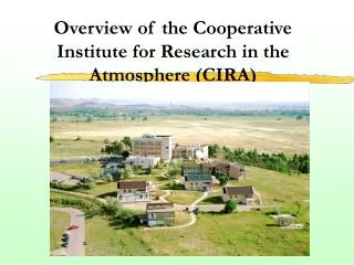
Overview of the Cooperative Institute for Research in the Atmosphere (CIRA)
Cooperative Institute with NOAA NESDIS NWS ESRL Non-degree granting unit in Engineering Multi-disciplinary focus Coop Institute with NPS USFS USGS Center for Geosciences - DOD funded Satellite and remote sensing center of excellence CIRA Description CIRA
NOAA CI Research Themes • Global and Regional Climate Studies • Local Area and Mesoscale Weather Forecasting and Evaluation • Modeling and Data Assimilation • Applications of Satellite Observations • Air Quality and Visibility • Education, Training, and Outreach • Societal and Economic Impacts • Cloud Physics CIRA
Satellite Ingest and Infrastructure These three images are the first full disk images from GOES-8, GOES-9, and GOES-10 and as captured at CIRA. GOES-11 also being ingested at this time. CIRA archives all GOES, GMS, Meteosat, CloudSat and AVHRR satellite info at full data and JPG formats. Current holding are over 10,000,000 files and 100 TBytes of satellite data. CIRA
Thin Cirrus Detection and CharacterizationDr. Stan Kidder, Mr. Ken Eis & Dr. Mike Kelly Objective • Detect and characterize thin cirrus which is not detectable from conventional surface observations, yet contaminates satellite observations of land and water features as well as aerosol detection. Aircraft operating at the same altitude as the cirrus (aerial refueling and surveillance missions) are severely impacted. 3.9 µm Albedo Cirrus is black CIRA
Satellite Microwave Retrievals Over Ocean and LandMr. John Forsythe, Dr. Andy Jones, Dr. Stan Kidder & Prof. Tom Vonder Haar Objectives • To Implement and validate a combined Microwave Optimal Estimation (MOE) water vapor profiling algorithm over ocean and land. • Simultaneous retrieval of temperature and moisture profiles, surface emissivity, and cloud liquid water. • To apply this tool to relate research in CG/AR. Need moisture profiles over land as well as ocean! CIRA
5 -20 o LWC Temperature ( C) -15 IWC Height (km) 4 -10 3 -5 0.00 0.05 0.10 0.15 0.20 0.25 -3 (g m ) Water Content New CLEX Results Confirm Maximum of Supercooled Liquid Water Near Tops of Altostratus Not the “classic” cloud profile! Altostratus deck observed during CLEX from North Platte Airport The vertical profile of LWC (black diamonds) and IWC (blue diamonds) during the 14 October 2001 straight-line ascent from 1440 to 1510 UTC. In collaboration with NC State, Texas A&M, UW-Milwaukee and USAF (AFIT) CIRA
Applications of Satellite Observations Roadmap • Assist NOAA in determining what satellite data will be candidates for data assimilation. In the next decade there will be 100 new environmental satellites launched and hundreds of new sensors/data streams. NOAA will be unable to assimilate all of these new data into its forecast process so the question will be which mix will provide the most bang for the buck. • Develop new exploitation techniques for: • Multi-platform, multi-sensor assimilation • Hyperspectral assimilation and frequency weighting • Improved vertical resolution using hyperspectral techniques • Improve timeliness in NESDIS’s exploitation of newly launched sensors • Continue to train NWS forecasters in these new techniques. • Improve infrastructure techniques to allow larger and more computationally intensive exploitation methods to be implemented. One of the specific issues is the packaging of ancillary data for scientists to allow the better utilization of satellite data. CIRA
Surface wetness product - trafficability, agriculture, flood forecasting, fog transportation safety New trend in remote sensing merge models and satellite sensor data to produce customer-usable products Image on left shows the soil wetness measured from satellite and interpreted by model, giving unprecedented resolution that will help agriculture, and forecasters. Left figure represents current capability. Working on data assimilation using microwave and temperature data from satellites CIRA
Basic CASC2D Watershed Model Expanded for Sediment and Chemical Transport Use CASC2D Conceptual Model • CASC2D model from CSU supported by USACE–WES • New applications for managing environmental quality on military lands 2-Hour Forecast of Zinc Concentration: California Gulch CO Potential application to Homeland Security issues CIRA
Observations Assimilation Methods Forecast Models Forward Models IR Radiation Micro. Radiation Radar Ensemble Bayesian OI Satellite VIS & IR RAMS ETA LIDAR BFM Radar MM5 WRF ECMWF RF PROP LIDAR SFC Physics 4DVAR 3DVAR UAV GPS Sat. Micro COAMPS Physics Parameterizations Cloud Surface Fluxes Convective Rain Data Assimilation – The Process CIRA
CG/AR’s Data Assimilation Project Has Developed a Unique Mesoscale Satellite Data Assimilation Technique for Cloudy Atmospheres Reduced Extent Increased Extent Observed Visible Image 9-Hour Forecast Cloud Without Assimilation 9-Hour Forecast Cloud With Assimilation • Uses RAMS model for data assimilation (RAMDAS) • GOES weather satellite visible and infrared data assimilated here Result: Improved Forecasts of BOTH Cloud and Wind Fields CIRA
Hurricane Intensity Forecast Research • GOES and satellite altimetry data used for improving NHC’s operational SHIPS statistical intensity model • GOES predictors improve east Pacific forecasts by almost 10% • GOES and Ocean Heat Content improve Atlantic forecasts by 2-3% • Larger improvement for storms in high OHC areas • Data from aircraft recon flights also being used to improve SHIPS TPC’s operational OHC product for Hurricane Katrina from satellite altimetry CIRA
Community Outreach Activities • GLOBE Program * • National Emergency Management Training • National Weather Service Warning Coord training for Meteorologists/Hydrologists • COMET Hydro/Met training • VISIT program CIRA
The GLOBE Program A K-12 science education program that brings together students, teachers, and scientists to: Enhance environmental awareness of individuals throughout the world Contribute to scientific understanding of the Earth Support improved student achievement in science and mathematics (CSU, UCAR (Boulder, CO) and NASA) Science Protocols: • Atmosphere / Climate • Hydrology • Soil • Landcover / Biology • Phenology Research Serving our Community Schools: • 24,000 teachers trained • 14,000 schools involved • 10 million measurements taken CIRA
Conclusion • Subsequent Briefings will clarify details • Please forward any questions to Ken Eis at eis@cira.colostate.edu CIRA
Poster Session • 1 minute advertisements • Viewing will be in CIRA building • Best poster winner will be announced by Mark DeMaria at the end of the Symposium CIRA