Download
1 / 29
290 likes | 302 Vues
This study investigates the properties of cirrus clouds in subtropical and polar regions using ground-based lidar observations and CALIPSO/CALIOP satellite data. The radiative impact of these clouds is examined, including their altitude, cooling effects, and alteration of properties. The study also analyzes how these clouds vary with season and region.

E N D
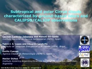
Subtropical and polar Cirrus clouds characterized by ground-based lidars and CALIPSO/CALIOP observations Carmen Cordoba-Jabonero and Manuel Gil-Ojeda Instituto Nacional de Tecnica Aeroespacial (INTA), Spain Fabio J. S. Lopes and Eduardo Landulfo Instituto de Pesquisas Energéticas e Nucleares (IPEN), Brazil Emilio Cuevas Agencia Estatal de Meteorología (AEMET), Spain Hector Ochoa Instituto Antártico Argentino/Dirección Nacional del Antártico (IAA/DNA), Argentina VIII WLMLA 2015, Cayo Coco (Cuba), 6 – 10 April 2015
Earth-Atmosphere system: Cirrus clouds Altitude Properties cooling Cirrus Clouds Alteration of their properties ??? Modulators Earth-Atmosphere system warming • GHG effect • Aircraft traffic increase Human-induced climate changes
Cirrus clouds: Radiative impact • Cloud height has an evident impact: • High tropical Cirrus can be particularly effective infrared greenhouse modulators (warming). • Lower Cirrus over Polar Regions could be more efficient for solar albedo effects (cooling). • Mid-latitude Cirrus clouds are assumed to reveal radiative implications varying with the season. • They are product of weather processes: their occurrence and properties can vary significantly over different regions of the world.
G-B lidar stations: Geographical location The Sta. Cruz de Tenerife observatory (SCO, Canary Islands-Spain, 28.5°N 16.3°W), managed by the Agencia Estatal de Meteorología (AEMET) The Metropolitan city of Sao Paulo station (MSP, Brazil, 23.6°S 46.8°W), managed by the Instituto de Pesquisas Energéticas e Nucleares (IPEN) The Antarctic Belgrano II base (BEL, Argentina, 78ºS 35ºW), managed by the Dirección Nacional del Antártico (DNA, Argentina)
Santa Cruz de Tenerife observatory (SCO) SCO site area (sea view) Subtropical coastal site Location: 28.5ºN 16.2ºW Aerosol networks: • NASA/AERONET • NASA/MPLNET Lidar: Micro Pulse Lidar v.3 (MPL-3), INTA Cimel Lidar Lab. CIAI roof (Lidar laboratory and Cimel sun-photometer installed on the terrace) INTA/Micropulse lidar v.3 (MPL-3)
Metropolitan city of Sao Paulo station (MSP) Subtropical site Location: 23.6ºS46.8ºW Aerosol networks: • LALINET a.k.a. ALINE (Latin America LIdar NETwork) Lidar: Raman SPL (homemade), IPEN Optical receiver Laser beam CLA/IPEN laboratory: MSP lidar system
Antarctic Belgrano II base (BEL) Polar site Location: 78ºS 35ºW Lidar: Micro Pulse Lidar v.4 (MPL-4), INTA MPL-4 installed in the laboratory Aerial view ~ 1 m Belgrano II observatory (polar night) and lidar laser beam through optical window
G-B Lidar systems (*) (*) (*) Used in this work. Detection of Cirrus clouds
Space-borne lidar: CALIOP • On board CALIPSO satellite (www-calipso.larc.nasa.gov) • Nd:YAG laser, diode-pumped • Emission at 1064 and 532 nm • Energy: 110 mJ/pulse (both channels) and repetition rate: 20.16 Hz • Operational system on global scale in full-time continuous mode (24 h/day, 365 days/year) since June 2006 • Polarization module (p- and s- channels) for 532-nm detection CALIPSO satellite Backscattering ratio profiles (Level 1 data products): Total horizontal range: 100 km (= 300 profiles x 0.333 km h.r.p.) 20 profiles with a 5-km averaged horizontal resolution (= 15 profiles x 0.333 km h.r.p.)
Cirrus cloud properties Retrieved by using a modified version of the methodology shown in Larroza et al. (2013): • Macrophysical features: • vertical extent, • top and base heights, and • thickness. • Optical parameters: • Backscattering ratio profile (R, = total-to-molecular backscattering coefficient ratio), • Cloud Optical Depth (COD), and • Lidar Ratio (LR, = extinction-to-backscatter ratio).
Results Subtropical and polar Cirrus clouds: a case study is selected for each station • Evolution along the day and classification of Cirrus profiles depending on their COD (): sub-visual (svCi, < 0.06), semi-transparent (stCi, 0.06 < < 0.3), and opaque (opCi, > 0.3). • Correlation of LR and top/base heights vs COD for each case. • Backscattering ratio (R) vs temperature profiles depending on the Cirrus category (svCi, stCi and opCi). • Comparison with CALIPSO/CALIOP observations
Subtropical Cirrus clouds over SCO: Evolution and Ci category depending on COD Late autumn stCi* CALIPSO overpass: 14:38 UTC / 98.9 km A progressive drift into larger COD values together to a lowering of the base and top heights
Subtropical Cirrus clouds over SCO: Correlation LR and top/base vs COD LR values are lower for svCi and they are found at higher altitudes than for the other stCi and opCi clouds
Subtropical Cirrus clouds over SCO: R vs temperature for each Ci category (COD) svCi are formed at lower temperatures (mostly < -50ºC) than the other stCi and opCi categories, with the tropopause found at around 13.5 km height.
Subtropical Cirrus clouds over SCO: G-B lidar vs CALIPSO/CALIOP comparison 14:38 UTC LR < 10 sr LR = 10-15 sr LR = 10-15 sr LR = 25 sr LR = 25 sr • Altitude: similar heights for stCi • LR: a poorer agreement is achieved. Likely due to: a) CALIPSO overpass is rather far from the station: 98.9 km, or b) CALIPSO uses a fixed value of 25 sr
Subtropical Cirrus clouds over MSP: Evolution and Ci category depending on COD Early austral winter stCi opCi CALIPSO overpass: 17:08 UTC / 72.5 km A layered structure composed of one or two layers with alternating COD values between stCi and opCi clouds, but no svCi are observed for this case.
Subtropical Cirrus clouds over MSP: Correlation LR and top/base vs COD LR values are higher for stCi than for opCi clouds, but their occurrence is found at similar altitudes between 8 and 11 km height.
Subtropical Cirrus clouds over MSP: R vs temperature for each Ci category (COD) stCi and opCi clouds are mostly formed at temperatures ranging from -50ºC to -30ºC, with a lower tropopause height (around 12.5 km) than that observed in the SCO case.
Subtropical Cirrus clouds over MSP: G-B lidar vs CALIPSO/CALIOP comparison LR = 20-30 sr LR = 10-20 sr LR = 25 sr LR = 25 sr 17:08 UTC • Altitude: good agreement. • LR: similarities for stCi, but lower values for opCi as compared to CALIOP (Note: CALIPSO uses a fixed value of 25 sr).
Polar Cirrus clouds over BEL: Evolution and Ci category depending on COD Late austral autumn opCi CALIPSO overpass: 01:34 UTC / 75.3 km opCi observed for the first two hours, followed by svCi and stCi (COD for stCi are close to 0.08, almost within svCi category). Cirrus persist at similar heights along the day (unfortunately, no data available from 16:00 UTC on).
Polar Cirrus clouds over BEL: Correlation LR and top/base vs COD LR for polar Cirrus: higher than those for the subtropical SCO case, independently on COD, and similar to those derived for the MSP case but with a contrary behavior respect to the COD. In addition, they are also found at lower altitudes, as expected for polar latitudes.
Polar Cirrus clouds over BEL: R vs temperature for each Ci category (COD) svCi (also stCi) and opCi are formed at lower temperatures than for both the subtropical cases.
Polar Cirrus clouds over BEL: G-B lidar vs CALIPSO/CALIOP comparison LR = 15-30 sr LR = 30 sr LR = 30 sr LR = 22 2 sr 01:34 UTC • Altitude: good agreement observed for opCi clouds (only this Ci-type is observed by CALIOP) • LR: lower values are derived by CALIOP
Summary (1/4) • LR results: • SubtropicalsvCi/ opCi clouds: < 10 sr / 10-20 sr. • PolarsvCi/ opCi clouds: 15-30 sr / ~ 30 sr. • CALIPSO comparison: • NOsvCi are detected. • Subtropical/polaropCi: a larger fixed (25 sr) / smaller low-variable (222 sr) are used / derived. • Subtropical and polarstCi clouds are mixed cases.
Summary (2/4) • Altitude-related results: • SubtropicalsvCi are located higher than opCi clouds: from 10 km and 8 km height, respectively, up to tropopause height-levels. • Polar Cirrus are observed, in general, at lower altitudes than for subtropical ones up to the tropopause (Note: Tropopause is lower in Polar Regions). • CALIPSO comparison: Ci clouds are detected at similar altitudes, in general.
Summary (3/4) • Temperature-related results: • SubtropicalsvCi / opCi: < -50ºC / -50ºC -30ºC. • PolarsvCi and opCi: < -50ºC. • Indeed, as expected, a higher svCi presence is observed over the polar station along the day, since svCi clouds are formed at lower temperatures, as those observed at polar latitudes.
Summary (4/4) • It should be noted that these results are specific for those study cases analyzed. However, in general, subtropical Cirrus clouds present lower LR values and are found at higher altitudesthan those detected at polar latitudes. Similarities and differences can be plausibly provided, as long as a larger dataset can be available to be analyzed in each station. • In addition, such results can be into consideration in validation assessments of the retrieval of their properties from satellites (i.e., next future ESA/EarthCARE and Sentinels missions), in relation with the Cirrus clouds radiative forcing impact.
Thank you for your attention Acknowledgements This work is supported by the Spanish Ministerio de Economía y Competitividad (MINECO) under grant CGL2011-24891 (AMISOC project). Authors thank the staff of all the stations responsible for instrumentation maintenance and support. C.C.-J. thanks the Fundação de Amparo à Pesquisa do Estado de São Paulo (FAPESP) for their support under grant 2013/11836-2 during her research stay in the Instituto de Pesquisas Energéticas e Nucleares (IPEN). 5th Workshop on Lidar Measurements in Latin America – Buenos Aires (Argentina), 30 November – 3 December 2009