Download
1 / 11
110 likes | 215 Vues
Explore the utility of incorporating the GOES-R Geostationary Lightning Mapper (GLM) using hybrid variational-ensemble data assimilation in regional weather applications. Achieved milestones involve integrating WRF-NMM data assimilation with operational NOAA observations and testing the system in severe weather scenarios. Initial evaluations have been completed, showing promising results in enhancing forecast accuracy. Lightning observation operators have been developed to incorporate flash rates, aiding in cloud prediction. Ongoing collaboration aims to further refine the system and improve forecasting capabilities.

E N D
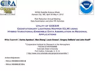
NOAA Satellite Science Week,Kansas City, MS, April 30-May 4, 2012Risk Reduction Annual Meeting Data Assimilation and other RR ActivitiesUtility of GOES-R Geostationary Lightning Mapper (GLM) using Hybrid Variational-Ensemble Data Assimilation in Regional ApplicationsMilija Zupanski1, Karina Apodaca1, Man Zhang1, Louis Grasso1, Gregory DeMaria1 and John Knaff21 Cooperative Institute for Research in the Atmosphere2NOAA/STAR/RAMMBColorado State UniversityFort Collins, Colorado, U. S. A.[ http://www.cira.colostate.edu/projects/ensemble/ ] Acknowledgements: - NOAA NESDIS/GOES-R - NOAA NESDIS/JCSDA
Goal of the project • Title: Utility of GOES-R Geostationary Lightning Mapper (GLM) using hybrid variational-ensemble data assimilation in regional applications • Lead: • Milija Zupanski, CIRA • Participants: • Louis Grasso, CIRA • John Knaff, STAR/RAMMB • Karina Apodaca, CIRA • Man Zhang, CIRA • Outside Collaboration: • Stephen Lord, NCEP/EMC • Goals: • (1) Demonstrate the utility of the GOES-R GLM in severe weather data assimilation application. • (2)Use NOAA operational codes and scripts: • - WRF-NMM • - NCEP operational observations (forward GSI, CRTM) • - additional assimilation of all-sky MW satellite radiances and lightning flash rates
Year-1 milestones and accomplishments • Year-1 Milestones: • (1) Interface the WRF-NMM based data assimilation system with NOAA operational observations and MW cloudy radiances • Status: Completed • (2) Make initial evaluation of the system in application to severe weather and make benchmark experiments (without lightning data) • Status: Completed • (3) Develop/adopt the forward observation operator for lightning data and make initial evaluations • Status: Completed • (4) Present the results on the web page, and at the conferences/ workshops • Status: Completed/ongoing Apodaca, K., M. Zupanski, M. Zhang, M. DeMaria, L. D. Grasso, J. A. Knaff, and G. DeMaria:Evaluating the potential impact of assimilating GOES-R GLM satellite lightning observations. To be submitted to Mon. Wea. Rev. Zhang, M., M. Zupanski, M.-J. Kim, and J. Knaff, 2012: Direct Assimilation of all-sky AMSU-A Radiances in TC inner core: Hurricane Danielle (2010). To be submitted to Mon. Wea. Rev. All Year-1 milestones are accomplished and the work on Year-2 milestones is underway
Severe weather outbreak over the southeastern U.S. on April 25-28, 2011 Tornado reports for April 27, 2011 Surface map, valid 1200 UTC April 27, 2011 9 km 27km WRF-NMM model domain and resolution
Benchmark system setup (Milestone 1) • Data Assimilation system setup: • WRF-NMM model at 27km / 9km resolution • Use Maximum Likelihood Ensemble Filter (MLEF) as a prototype HVEDAS • 32 ensembles • 6-hour assimilation interval • Control variables are model predictive variables: PD, PINT, T, Q, U, V, CWM • Observations: • NOAA operational observations using GSI and CRTM forward operators • All-sky AMSU-A radiances: Use the approach originally developed by M.-J. Kim for global DA system, adapted by M. Zhang for use in regional DA system and for hurricanes Experiments: 1) Benchmark experiment (without lightning observations): assimilation of NCEP operational observations AND all-sky AMSU-A MW radiances 2) Control experiment: no data assimilation Focus on 9 km model grid
Benchmark system evaluation (Milestone 2) Analysis Cost function shows the combined impact of all observations Consistent improvement in all DA cycles in the benchmark experiment 6-hour forecast (valid 0000 UTC April 28, 2011) GOES-13 visible CWM control CWM difference: Benchmark - Control Data assimilation indicates a strengthening of the middle cloud band, as observed
Lightning observation operator (Milestone 3) Utilize empirical relationships between lightning flash rate and: 1- cloud properties (e.g., graupel flux, vertically integrated ice – McCauletal. (2009)) - adequate for cloud-resolving model with explicit microphysics - requires ensemble-based (or hybrid) DA error covariance for cloud control variables 2- maximum vertical velocity - adequate for model with simple (e.g., bulk) microphysics or convective parameterization - applicable to standard DA (e.g., 3D-Var) with dynamical control variables only • For current applications with WRF-NMM at 9 km use approach (2) • For future applications with HRRR WRF in high resolution use approach (1)
Lightning observation operator (Milestone 3) Observations: Create lightning flash rate “super-observations” at 0.1 degree (~10 km) resolution by calculating the number of flashes per square km per hour Forecast guess: Calculate wmaxfrom approximate vertical velocity Time tendencies not calculated, used from the model output Advection terms calculated using reduced WRF-NMM codes Model-produced wat 500 hPa Calculatedwmax Lightning flash rate Calculated wmax agrees with the actual WRF-NMM model output
Accomplishments anticipated at end of Year 2 Combine all components into a complete HVEDAS, including the lightning observations, and compare the complete system with the benchmark system. Evaluate the impact of GOES-R GLM observations in severe weather. Produce lightning forecast using WRF-NMM. Preliminary results: Assimilation of WWLLN lightning observations using WRF-NMM WWLLN Observations Information content Forecast RMS error • Information content shows the utility of lightning observations in the analysis • 6-hour WRF-NMM forecasts improved due to lightning observations
What could be accomplished with a 3rd year of funding? • 1- Possibility of utilizing GLM lightning observations in operational data assimilation: • - Vertical velocity in WRF-NMM is a function of standard model predictive variables • - This means that lightning observations impact PD, T, Q, U, V initial conditions • - Straightforward application with current operational GSI • - Operational use of lightning observations is straightforward, it does not require complex new development! • Great opportunity to add lightning observations to current operational data assimilation! • 2- Prepare for future assimilation of GLM and the use with HRRR WRF • - Use lightning observation operator based on cloud microphysics (McCauletal.) • - Adjust DA for new (e.g., cloud) control variables
Summary • WRF-NMM model with regional prototype HVEDAS • - assimilated operational observations • - assimilated all-sky AMSU-A radiances • - forward GSI and CRTM • Assimilation of WWLLN lightning flash rate observations • - positive impact on the 6-hour WRF-NMM forecast • - opportunity for immediate applications in operations Future Work • Demonstrate the utility of GLM (proxy) observations in regional DA • - in-depth experiments with assimilation of all available data, including lightning and all-sky radiances • - include assimilation of lightning observations in hurricane DA (HWRF) • Prepare for possible use in current operational DA (in collaboration with NOAA) • - enhance GSI (and HVEDAS) capability by adding lightning observations • - assist NOAA in preparation for assimilation of lightning assimilation • Prepare for future GLM assimilation with HRRR WRF • - add cloud microphysics-based lightning observation operator