Download

1 / 28
280 likes | 426 Vues
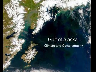
INTEGRATED SCIENCE. DATA MANAGEMENT. Gulf of Alaska and Argo Delayed-Mode QC by : Mathieu Ouellet Integrated Science Data Management Ocean Science-Canadian Hydrographic Service Department of Fisheries and Oceans Canada. Argo DMQC3. Thursday, Sep 11 2008.

E N D
INTEGRATED SCIENCE DATA MANAGEMENT Gulf of Alaska and Argo Delayed-Mode QC by: Mathieu Ouellet Integrated Science Data Management Ocean Science-Canadian Hydrographic Service Department of Fisheries and Oceans Canada Argo DMQC3 Thursday, Sep 11 2008
INTEGRATED SCIENCE DATA MANAGEMENT • Gulf Of Alaska • Circulation and characteristic water masses • Vertical structure and inversions • Eddies
Q at halocline: RDW < SACW < ACW Freeland & Cummins (2004) Musgrave et. al (1992) ACW Alaska Current Water SACW Sub Arctic Current Water RDW Ridge Domain Water Onishi (2001) Royer and Emery (1987) observed a displacement of the Gyre in 1981. Freeland and Cummins (2004) report meridional excursion of the NPC/Subarctic Current of [40 52] ° N (@ 150 ° W)
Musgrave et. al (1992) Freeland & Cummins (2004) 4900630 4900630
INTEGRATED SCIENCE DATA MANAGEMENT • Gulf Of Alaska • Circulation and characteristic water masses • Vertical structure and inversions • Eddies
http://www.pac.dfo-mpo.gc.ca/sci/osap/projects/argo/default_e.htmhttp://www.pac.dfo-mpo.gc.ca/sci/osap/projects/argo/default_e.htm Institute of Ocean Sciences
Temperature inversions occur in most of the subarctic North Pacific Ocean (>42°N). Ueno and Yasuda (2000) did not find inversions ~50°N and east of 170°W, because of the smoothing involved in the building of WOA94, which they used for their research. They found inversions in the said area in another study in 2005 (Ueno and Yasuda, 2005) Frequencies of temperature inversions exceeding 0.1°C (%, yearly) (figure has been cropped and zoomed)
Inversion reported by Musgrave et al. (1992) at 56.5°N 148°W ~56.5°N ~148°W Musgrave et. al (1992) Ueno & Yasuda (2005)
~56.5°N ~148°W Inversion reported by Musgrave et al. (1992) at 56.5°N 148°W vs. Inversion reported by Argo float 4900868 at 58.52°N 146.36°W (245 km)
Need data below theta=3°C to properly asses drift (>800 m); difficult to do with alternating profiles
INTEGRATED SCIENCE DATA MANAGEMENT • Gulf Of Alaska • Circulation and characteristic water masses • Vertical structure and inversions • Eddies
Main types of Eddies according to formation region : <T> (core)<S> (core) Rotation EAST GOA Haida warmer fresher anticyclonic < 55ºN, between QCI and ~145ºW Sitka warmer fresher anticyclonic eastern North Pacific GOA Yakutat (variable) fresher anticyclonic northern GOA: Kodiak Island, Alaskan stream WEST GOA / PACIFIC Aleutian warmer more saline anticyclonic ~50ºN move westward along the Aleutian Archipelago Kamchatka (variable) fresher anticyclonic ~50ºN move southward from Bering Sea Kuro-shio warmer more saline anticyclonic ~45ºN move northwards as far as Strait of Boussole
Sitka eddies (warmer, fresher) Yakutat eddies ( ~ , fresher) Sitka Rogachev et. al (2007) Haida eddies (warmer, fresher) Henson and Thomas (2008)
Musgrave et. al (1992) 4900867
objective way of finding eddies ?? Remote-sensing altimetry Henson and Thomas (2008) using Sea Level fields from AVISO: ftp://ftp.cls.fr/pub/oceano/AVISO/SSH/duacs/global/dt/upd/msla/merged/h/ (1) geostrophic velocity field = -g/f Ñ.(SLA) (2) Okubo-Weiss parameter = normal strain² + shear strain² + vorticity² (from (1))
~ACW 1-16 28 ~SACW 17-27 29-50 ~RDW
Conclusion : Because of eddies, water masses, fronts, inversions: Use Q <3°C
Argo float 4900072 was caught in the eddy (March April 2003) before being kicked out and headed off to the northwest.The eddy moved southwestward and by September 21 was near 501N, 1701E (Fig. 8B). One Argo buoy was trapped early in eddy A02b and remained within the eddy from January 2003 until fall 2004 (Fig. 8C). Maximum temperature in the core of this eddy as measured by the drifter was 4.43 1C in January 2003 (Fig. 8D). In December the maximum temperature recorded was 4.18 1C at 160 db. Temperature remained 4 1C on 200 db in September 2004, when the eddy was to the west of 1611E. Fig. 9 presents the drift track and a temperature section across the eddy A04 in summer 2004; it is identified as an Aleutian eddy by its warm core (Fig. 9C). plots from 1990 ctd and 2004 argo show the prominent cold core located on 26.6 sigmatheta created by the presence of a halocline and increase in t & s below the halocline. Profiles from 2004 in Alaskan Stream are >4 warmer than those crossing a Kamchatka eddy Isopycnal deepening (up to 2000 m) or doming in the core region