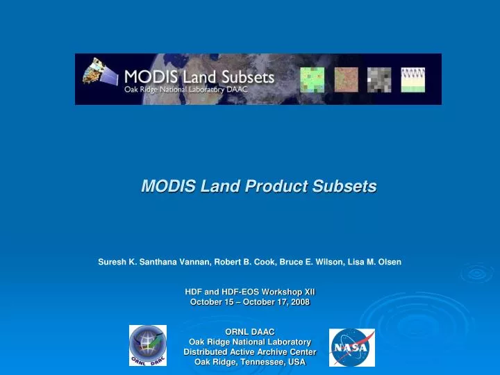
MODIS Land Product Subsets
190 likes | 320 Vues
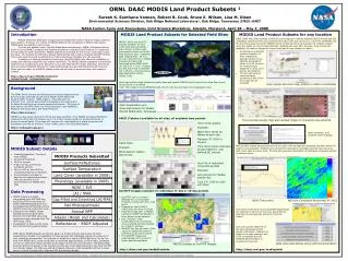
This workshop presentation discusses the challenges faced by users of MODIS (MODerate Resolution Imaging Spectroradiometer) land products, such as data volume, accessibility, format, and processing time. Presented by experts from ORNL DAAC, the session covers solutions for improving MODIS data usability, including the introduction of easy-to-use formats and tools for data subsetting and visualization. Additionally, the presentation highlights a case study on deforestation in the Amazon from 1975 to 2001 and showcases available services like the MODIS Subsetting Web Service.

MODIS Land Product Subsets
E N D
Presentation Transcript
MODIS Land Product Subsets Suresh K. SanthanaVannan, Robert B. Cook, Bruce E. Wilson, Lisa M. Olsen HDF and HDF-EOS Workshop XII October 15 – October 17, 2008 ORNL DAAC Oak Ridge National Laboratory Distributed Active Archive Center Oak Ridge, Tennessee, USA
What is MODIS • MODerate Resolution Imaging Spectroradiometer • Hyper-Spectral sensor onboard two satellites (Terra and Aqua) • Terra MODIS and Aqua MODIS are viewing the entire Earth's surface every 1 to 2 days, acquiring data in 36 spectral bands, or groups of wavelengths • Data stored in HDF-EOS gridded file format Source : http://aqua.nasa.gov
MODIS is great! but …….. Users (Field researchers) have some inconveniences :
Accessibility • Data Format • Processing Time
What ORNL-DAAC offers? User community requested that we prepare MODIS Land Products in an easy-to-use format and size • To validate remote sensing products • To characterize field sites
Tools Used • hdp dumpsds from The HDF group • Customized for our need • MODIS Reprojection tool from LPDAAC • GDAL (Geospatial Data Abstraction Library) • Minnesota Map server • Custom Perl code
MODIS Subsets for Selected sites Data Formats Offered • ASCII – 7x7 km subsets • GeoTIFF – 25x25 km subsets
Subsetting and Visualization Tool for Any location on Globe Demo: http://daac.ornl.gov/modisglobal
1975 2001
1975 2001 2000 2008
MODIS Subsetting Web Service f(x) SOAP Client Server ################# ORNL DAAC MODIS Web service - Perl client#################use SOAP::Lite@params= SOAP::Lite -> service(‘WSDL_URL') -> xmlschema('http://www.w3.org/2001/XMLSchema') -> getsubset(lat,lon,product,start_date,end_date,size); MOD11A2.A2003001.h26v05.005.2007264203857.Clear_sky_days,MOD11A2,A2003001,Lat37.7Lon110Samp1Line1,2007264203857,Clear_sky_days,NA,0.000,2 MOD11A2.A2003001.h26v05.005.2007264203857.Clear_sky_nights,MOD11A2,A2003001,Lat37.7Lon110Samp1Line1,2007264203857,Clear_sky_nights,NA,0.000,254 …….
Scope • Tool for scientific research (Environmental Impact assessment, carbon budgeting, etc.) • Classroom education and projects for students • Time series, trend analysis • GIS overlay analysis • Statistical analysis (Across many years and across different land cover types) • Validation of MODIS products and other remote sensing products
Questions? Links • http://www.modis.ornl.gov/modis/index.cfm • http://daac.ornl.gov/MODIS/modis.html