Download
1 / 39
390 likes | 539 Vues
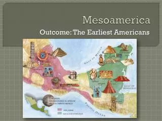
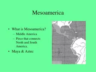
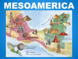
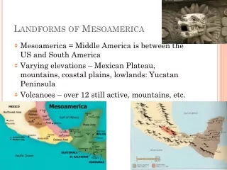
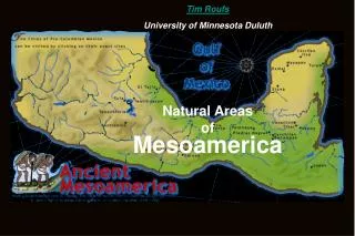
Tim Roufs. University of Minnesota Duluth. Natural Areas of Mesoamerica. http:// www.odci.gov/cia/publications/factbook/reference_maps/north_america.html. Physiographic Regions of Middle America. Central High Plateau. Western Sierra Madre. Coastal Plain of the Gulf of Mexico.

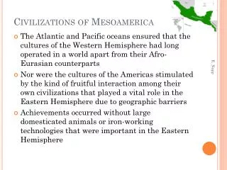
E N D
Tim Roufs University of Minnesota Duluth Natural Areas of Mesoamerica
http://www.odci.gov/cia/publications/factbook/reference_maps/north_america.htmlhttp://www.odci.gov/cia/publications/factbook/reference_maps/north_america.html
Central High Plateau Western Sierra Madre Coastal Plain of the Gulf of Mexico Yucatán Peninsula Neovolcanic Axis Mountains of northwestern Central America Southern Sierra Madre Isthmus of Tehuantepec Isthmus of Costa Rica- Panama Volcanoes of El Salvador and Nicaragua Coastal Plains of the Pacific Ocean Coastal Plains of the Caribbean Sea Principal Geological Provinces of Middle America
nonagricultural areas agricultural areas limit of high cultures limits of “Mesoamerican” Culture (Kirchoff, 1943) Major Cultural Areas of Middle America, ca. A.D. 1500
http://www.d.umn.edu/cla/faculty/troufs/anth3618/maKirchhof_handout.html#titlehttp://www.d.umn.edu/cla/faculty/troufs/anth3618/maKirchhof_handout.html#title
“Middle America” (geological) “Mesoamerica” (cultural)
The Huasteca Central Highlands Central Veracruz Western Mexico and the Northern Frontier Southern Veracruz-Tobasco Maya Lowlands Central Mexico Oaxaca Guerrero Maya Highlands Southern Periphery Regional Divisions of the Mesoamerican Cultural Area
Popocatepetl http://members.tripod.com/~Maverickpage/imagenes/Mex15.jpg
Popocatepetl and Istaccihuatl http://volcano.und.nodak.edu/vwdocs/kids/legends.html#mexico
Schematic Diagram of the Central Highland Area – Patrick F. Gallagher
Interior Drainage and Lakes of the Central Plateau of Mexico, ca. A.D. 1500
The Northern Portion of Tulancingo Basin, Northeastern Mesa Central
A Portion of the Highly Dissected Mesa Del Sur, East of Oaxaca City
Tim Roufs University of Minnesota Duluth Who Were the First Americas?
Tim Roufs University of Minnesota Duluth
http://www.d.umn.edu/cla/faculty/troufs/anth3618/mastages_handout.htmlhttp://www.d.umn.edu/cla/faculty/troufs/anth3618/mastages_handout.html