Download
1 / 31
320 likes | 614 Vues
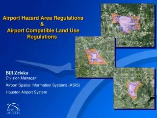
Airport Hazard Area Regulations & Airport Compatible Land Use Regulations. Bill Zrioka Division Manager Airport Spatial Information Systems (ASIS) Houston Airport System. ORIGINS OF AN ORDINANCE.

E N D
Airport Hazard Area Regulations & Airport Compatible Land Use Regulations • Bill ZriokaDivision Manager • Airport Spatial Information Systems (ASIS) • Houston Airport System
ORIGINS OF AN ORDINANCE Extension of Runway 15R-33L Impacts Greenview Manor • Runway 15R-33L • Greenview ManorSubdivision
ORIGINS OF AN ORDINANCE 2005-2006 IAH Master Plan
PURPOSE OF THE AIRPORT LAND USE COMPATIBILITY ORDINANCE 2006 FAA Letter • Admonished the City of Houston for allowing incompatible development to encroach into areas affected by airport operations • Asked the City to adopt measures that ensure compatible land development and would protect the FAA’s investment of grant funds in the three airports • FEDERAL ASSISTANCE FOR FUTURE AIRPORT DEVELOPMENT AND BUY-OUTS MAY BE LIMITED WITHOUT CONTROLS AND MAY EVEN REQUIRE CITY TO REPAY PAST GRANT FUNDING
PURPOSE OF THE AIRPORT LAND USE COMPATIBILITY ORDINANCE • Incompatible land uses hinder airport expansion • Development could encroach on airport operations • Threat to the public’s quality of life and safety • Prevention is cost efficient
HOUSTON AIRPORT SYSTEM’S IMPACT • Provides more than $27 billion to Houston’s economy annually. • Creates or supports more than 230,000 jobs. • 4th-busiest multi-airport system in the U.S. • 6th-largest multi-airport system in the world. • New Federal Inspection Services Building being built at Hobby for International Flights. • International Terminal Renovation Planned at Intercontinental.
AIRPORT GROWTH • Over 50 million passengers in 2013 • Passengers projected to grow to 80 million by 2020 • To accommodate this growth, will need to continually improve and expand airport facilities and capacity
AUTHORITY TO REGULATE LAND USE Chapter 241 of the Texas Local Government Code • Cities with public airports can adopt compatible land use and height regulations around the airport (s) The regulated area is 3 miles by 5 miles long • 1.5 miles on each side of the center line of each runway • 5 miles from the ends of the runways
REGULATING THE LAND AND THE AIR Two Types of Regulation Around Airports • Land Use • Height Hazard. Since a Height Hazard Ordinance exists, Land Use was given priority.
DESIGNATION OF TEIRS • Tier 1 – Primarily based on future noise contours, including 65 DNL extended to property line boundaries • Tier 2 – Followed natural boundaries (i.e. streets, bayous, etc.) • Tier 3 – Predefined by state law (3 x 5 mile box)
NOTES: • 1 Must meet certain notification requirements. • 2 Sound insulation required if enlargement of the structure is more than 51% of the appraised value of the livable area. • 3 “Casualty” means destruction by accidental or natural causes. • Legend: • Compatible Compatible Only With Sound Insulation Measures Not Compatible(May be subject to further conditions or exceptions)
OPEN DIALOGUE Jurisdictional Agency Involvement • Land Use Team briefed City of Houston Council members. • Land Use Team met with nearby and affected jurisdictional representatives.
RE-ESTABLISH CONTACT Development Community Revisited • Land Use Team gathered information involving sound attenuation products and associated costs. • Land Use Team was educated on how the development community does business.
LOCAL PUBLIC OUTREACH Community Meetings to Inform the Public • Affected property owners were notified. • Community meeting for public near each airport. • Questions and comments were submitted by written media in order to control meeting.
ORDINANCE APPROVAL City Council Approves The Land Use Ordinance • Land Use Ordinance was passed without City Council tag in 2007 and was put into effect in early 2008.
Airport Compatible Land Use Planning Tiers • IAH – George Bush Intercontinental Airport • Legend • Tier 1 • Tier 2 • Tier 3 • Airport Property • NOTE: All acreage figures are net airport property and net each Tier
Airport Compatible Land Use Planning Tiers • HOU – William P. Hobby Airport • Legend • Tier 1 • Tier 2 • Tier 3 • Airport Property • NOTE: All acreage figures are net airport property and net each Tier
Airport Compatible Land Use Planning Tiers • EFD - Ellington Field • Legend • Tier 1 • Tier 2 • Tier 3 • Airport Property • NOTE:All acreage figures are net airport property and net each Tier
IMPLEMENTATION • The Houston Airport System has staff members working in conjunction with both the Planning and Development Department & the to review all incoming plats and replats for compliance with the regulations • These same staff members also works with Public Works and Engineering’s Code Enforcement Division and has integrated this function into the building permit plan review and inspection process
AIRPORT HAZARD AREA REGULATIONS Statutory Governing Authority: Chapter 241 of the Texas Local Government Code • Cities with public airports can adopt compatible land use andheight regulationsaround the airport (s) The regulated area is 3 miles by 5 miles long • 1.5 miles on each side of the center line of each runway • 5 miles from the ends of the runways • AIRPORT HAZARD AREA ORDINANCE
AIRPORT HAZARD AREA REGULATIONS City Ordinances For Height Already Existed – Except For Ellington • Intercontinental - Height Ordinance In Effect Since 1983 • Hobby - Height Ordinance First Passed in 1957 – Last Amended in 1986 • Ellington - No Height Ordinance Existed Before or After Transfer of Air Force Base to City of Houston in 1984 • AIRPORT HAZARD AREA ORDINANCE
AIRPORT HAZARD AREA REGULATIONS Proposed Action • Modernize Existing Ordinances For Intercontinental & Hobby • Follow Both FAA Rules AND Federal Requirements for Aircraft Operators • Create Regulations for Ellington • Protect Airspace for FAA Approved Master Planned Runways for All Three Airports • Work Closely with Stakeholders to Develop a Regulation that Does Not Over-Regulate • AIRPORT HAZARD AREA ORDINANCE
AIRPORT HAZARD AREA REGULATIONS Airspace Surfaces – Three Kinds • Protect aircraft approaches and departures and aircraft movement areas from the ground up (Part 77.25 Imaginary Surfaces) • Protect aircraft operating during low visibility conditions using their onboard instruments as pilots monitor signals emanating from equipment, or NAVAIDS, located in the air (onboard the aircraft or satellites) or on the ground (Part 77.23 Terminal Instrument Procedures (TERPS)) • Flight paths for emergency procedures (One Engine Inoperative (One Engine Out)) • AIRPORT HAZARD AREA ORDINANCE
AIRPORT HAZARD AREA REGULATIONS Structure of Ordinance • Hazard Area Regulations Would be Part of Same City Ordinance Article as Land Use Regulations—Code of Ordinances of the City of Houston, Chapter 9 for Ease of Locating Regulations Pertinent to Airports • Regulations Would Govern Only the Height of New Construction or Modifications of Existing Structures Whose Proposed Structural Heights Would Penetrate the Airspace Surfaces • Maps will identify permissible heights as part of the regulations. • AIRPORT HAZARD AREA ORDINANCE
MAXIMUM BUILDING HEIGHT • Maximum Building Height Includes All Rooftop Appurtenances, Obstruction Lights, Lightning Arresting Devices, etc. as Shown Below. All Elevations Are Above Mean Sea Level • AIRPORT HAZARD AREA ORDINANCE
AIRPORT HAZARD AREA REGULATIONS City Council Approves The Hazard Area Ordinance • Hazard Area Ordinance was passed without City Council tag in 2008 and was put into effect in early 2009. • AIRPORT HAZARD AREA ORDINANCE
INTERCONTINENTAL AIRSPACE SURFACES • Yellow – Part 77 • Blue – TERPs • Pink – OEI • AIRPORT HAZARD AREA ORDINANCE
HOBBY AIRSPACE SURFACES • Yellow – Part 77 • Blue – TERPs • Pink – OEI • AIRPORT HAZARD AREA ORDINANCE
ELLINGTON AIRSPACE SURFACES • Yellow – Part 77 • Blue – TERPs • Pink – OEI • AIRPORT HAZARD AREA ORDINANCE
AIRPORT HAZARD AREA REGULATIONS Questions? • AIRPORT HAZARD AREA ORDINANCE