Download
1 / 24
240 likes | 422 Vues
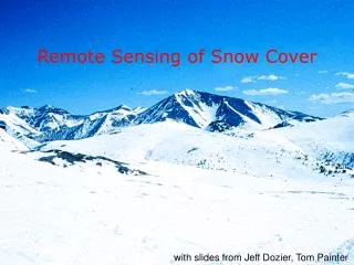
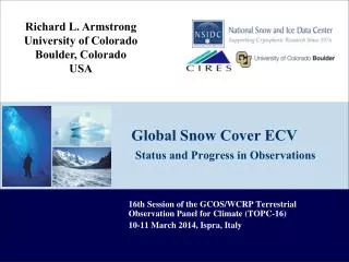
Richard L. Armstrong University of Colorado Boulder, Colorado USA. Global Snow Cover ECV S tatus and Progress in Observations. 16th Session of the GCOS/WCRP Terrestrial Observation Panel for Climate (TOPC-16) 10-11 March 2014, Ispra , Italy. Outline Why a snow cover ECV?

E N D
Richard L. Armstrong University of Colorado Boulder, Colorado USA Global Snow Cover ECVStatus and Progress in Observations 16th Session of the GCOS/WCRP Terrestrial Observation Panel for Climate (TOPC-16) 10-11 March 2014, Ispra, Italy
Outline • Why a snow cover ECV? • Users and requirements • Previous ECV documents • Review of currently available products • Some user statistics • Enhanced data set activities • Innovative data sources • Snow cover trends • Community activities/efforts TOPC-16, 10-11 March 2014, Ispra, Italy – Richard Armstrong, University of Colorado
Snow Cover ECV – Why? Relevance and Benefits: Recognized as a fundamental indicator of climate variability and change. Highly sensitive to changes in temperature and precipitation regimes. Affects albedo, soil moisture, permafrost state, growth conditions for vegetation. Required for snow melt runoff forecasts and flood prediction. Approximately 1/6 world’s population relies on snow melt runoff for water supply. (As much as 75-80 percent of water in the western US results from snowmelt.) Assessment and improvement of climate model performance. TOPC-16, 10-11 March 2014, Ispra, Italy – Richard Armstrong, University of Colorado
Snow Cover ECV The ECV “snow cover” may include four categories; snow covered area (SCA), snow water equivalent (SWE), snow depth, and snow wetness (presence of liquid water in the snow cover). There is a remote sensing capability to determine, with varying degrees of accuracy, all four of these parameters. The primary monitoring product with the longest time series is a continuous data record of hemispheric/global snow covered area. TOPC-16, 10-11 March 2014, Ispra, Italy – Richard Armstrong, University of Colorado
Users and Requirements – Snow covered area (SCA) – (binary, percent) - presence or absence of snow - surface reflectance - trend analysis/climate variability - cal/val NWP and GCM products Snow water equivalent (SWE) - (mm) - hydrology - frozen soil/permafrost - trend analysis/climate variability Time period and spatial resolution ? - Typically first question asked by potential user - both being continually enhanced TOPC-16, 10-11 March 2014, Ispra, Italy – Richard Armstrong, University of Colorado
2009 GTOS ECV T5 Snow Cover • “Assessment of the status of the development of the standards for the Terrestrial Essential Climate Variables” • Definition and Units of Measure • Existing Measurement Methods, Protocols and Standards • In situ and satellite • Contributing Networks and Agencies • Available Data and Products • Recommendations TOPC-16, 10-11 March 2014, Ispra, Italy – Richard Armstrong, University of Colorado
2011 GCOS -154 Systematic Observation Requirements for Satellite Data Products for Climate – 2011 Update The primary monitoring product is a continuous data record of global snow areal extent (SCA). Also desirable to have supplemental global information of three additional properties: snow depth, snow water equivalent, and the presence of water in the liquid phase. Passive microwave sensors provide reasonable estimates of snow depth, water equivalent and wetness in many areas. Combined or integrated products linking two or more snow products have been generated by research groups e.g. ESA Globsnow. TOPC-16, 10-11 March 2014, Ispra, Italy – Richard Armstrong, University of Colorado
Satellite Remote Sensing of Snow Hemispheric to Global Scale SCA: Visible = GOES, AVHRR, MODIS, ASTER Higher resolution (30 to 500 m) Clouds and darkness obscure surface Limited to surface characteristics SWE: Passive Microwave = SMMR, SSM/I, AMSR-E Lower resolution (~ 10-25 km) All weather & day/night Sub-surface characteristics (mass estimate, soil state ) -- for dry snow only TOPC-16, 10-11 March 2014, Ispra, Italy – Richard Armstrong, University of Colorado
“Primary Monitoring Product” Continuous Record of SCA NOAA visible climate data record 1973 2007 1998 ESSA, NOAA, GOES Series Weekly 190 km digitized METEOSAT & GMS added Reanalysis of 1966-71 Nov 1966 Oct 1972 May 1975 1980-81 1990s May 1999 Moving back in time decreases spatial resolution, spatial coverage, temporal resolution, and retrieval/algorithm sophistication. Feb 1997 Feb 2004 IMS 24 km IMS 4 km Slide courtesy of Dave Robinson/Rutgers Univ.
Satellite-derived Data Sets at NSIDC - pre-NASA EOS 2000 NSIDC Northern Hemisphere EASE-Grid Weekly Snow Cover and Sea Ice Extent Product, beginning October 1966 - derived from weekly NOAA (AVHRR optical sensor) snow maps, 25 km. Evolved to NOAA IMS (Interactive Multisensor Snow and Ice Mapping System) in 1997, daily data at 24 km, and 4 km data starting in 2004. http://nsidc.org/data/nsidc-0046.html NSIDC Monthly Snow Water Equivalent Climatology Product. (25 km EASE-Grid) beginning November 1978 . Snow water equivalent derived from SMMR and SSM/I passive microwave sensors. http://nsidc.org/data/nsidc-0271.html(no longer being updated)
NASA EOS Global Snow Cover Products at NSIDC Visible/Infrared - Snow Covered Area (SCA) MODIS (Moderate Resolution Imaging Spectroradiometer) 500 m and 0.05 deg (CMG) resolution, daily and 8-day,derived from two EOS visible/infrared instruments: Terra satellite beginning December 1999, and Aqua, May 2002. http://nsidc.org/data/modis/index.html Passive Microwave – Snow Water Equivalent AMSR-E (Advanced Microwave Scanning Radiometer) 25 km resolution, daily, 5-day, monthly, Aqua, May 2002 to Oct. 2011. http://nsidc.org/data/amsre/index.html Near-Real-Time SSM/I-SSMIS EASE-Grid Daily Global Ice Concentration and Snow Extent (NISE) 25 km resolution, updated daily. http://nsidc.org/data/nise1
MODIS Snow Cover Products • Number of users between 2010 and 2013: 10,174 (12 products) • Number of countries acquiring data between 2010 and 2012: 70 • Product summary: 12 snow cover products at daily, 8-day, and monthly temporal resolution. Temporal coverage is February 2000 to present.
Ongoing and future activities Various efforts are underway to develop new satellite data products to extend length of records, increase spatial resolution, and frequency of observation. For example: as recommended by 2011 GCOS Sat. Supp. * Exploit capability of the full resolution (1 km) AVHRR data to extend data back to 1985. * Take advantage of extensive oversampling of multi-sensor footprints to enhance gridding resolution for passive microwave data. * Provide percent snow cover rather than only binary. * Integrate data types.
A snow cover climatology for the European Alps derived from AVHRR data (1985-2011) Hüsler, F. et al. 2014. The Cryosphere, 8, 73-90 • Data archive: AVHRR 1-km, daily, back to 1985, pan-European coverage • Snow detection algorithm applicable to any kind of AVHRR generation • Extensively validated and tested for long-term consistency (inter-sensor) • Overall accuracy around 90% POD • Application-dependent parameters and products can be delivered (for climatology, phenology, hydrology, etc.)
Objective: Produce an improved, enhanced-resolution, gridded passive microwave ESDR for monitoring cryospheric and hydrologic time series • Full record will include SMMR, all SSM/I-SSMIS and AMSR-E • Use newly recalibrated L1B SSM/I-SSMIS FCDRs • Enhance gridded resolution to as much as ~1 km (channel-specific) • EASE-Grid 2.0 Passive Microwave Earth System Data Record (ESDR)(a NASA MEaSUREs project) Before After Investigators: M. J. Brodzik, NSIDC D. G. Long, BYU R. L. Armstrong, NSIDC Image reconstruction takes advantage of extensive oversampling in sensor footprints to enhance gridding resolution. Resolution enhancement using these techniques depends on frequency. Highest-frequency (~85 GHz) data resolution may be enhanced to ~ 1-3 km." http://nsidc.org/pmesdr
MODSCAG – MODIS snow covered-area and grain size, percent w/in 500 m grid cell --- T. Painter, JPLProvides Fractional Snow Cover MODSCAG is a multiple endmember spectral mixture analysis model combined with radiative transfer directional reflectance: spectrally unmixes allowing number of endmembers and the endmembers themselves to vary on pixel by pixel basis.
Combined or integrated products linking two or more data sources. Matias Takala,et al. 2011, Estimating northern hemisphere snow water equivalent for climate research through assimilation of space-borne radiometer data and ground-based measurements, Remote Sensing of Environment, Volume 115, Issue 12, 15 December 2011, Pages 3517–3529 ESA Globsnow - www.globsnow.info/.
Combined or integrated products linking two or more data sources, contd. CMC Global Snow Depth Analysis: Daily from March 12, 1998; Resolution: 1/3° Uses all available real time snow depth observations from synops, metars (meteorological aviation reports) and sa’s (special aviation reports) on the WMO information system. Updated every 6 hours using the method of optimum interpolation with an initial guess field provided by a simple snow accumulation and melt model. The dataset includes monthly snow depth and SWE, the latter based on snow density estimates. Data are provided on a 24-km polar stereographic grid covering the NH. (http://nsidc.org/data/nsidc-0447)
Snow Cover Extent Anomalies produced by D. Robinson
iSWGR NASA (international) Snow Working Group for Remote Sensing Dr. Matthew Sturm et al. 2013
Snow from Air & Space:Building a Vision Mission: To engage U.S. and international science communities in building a vision for future snow remote sensing efforts, including but not limited to, future NASA missions, to promote international collaboration, and engage in capacity-building within the U.S. and international snow remote sensing communities. Encourage snow & snow remote sensing research.
MODIS Albedo Product Global Albedo is a MODIS Standard Data Product that began routine production in 2000. Products are operationally produced operationally every 16 days at a 1km spatial resolution and archived as equal area tiles in a sinusoidal projection (HDF-EOS format) at the EROS Data Center (EDC) DAAC. (currently available daily by special request) Products include: Global Albedo (MOD43B3), BRDF Model Parameters (MOD43B1), Nadir-BRDF Ajusted Reflectance (NBAR) (MOD43B4) http://www-modis.bu.edu/brdf/product.html
Snow Cover Product Validation • - SCA -- Common approach is to validate a given spatial resolution against a higher spatial resolution satellite product, typically assuming the higher resolution to be “truth” often without objective evidence. • SWE – validation data are in situ point and • transect manual measurements. • Problems associated with validating area-integrated satellite data against sparse point data will always exist (sub-grid heterogeneity, especially in mountain regions). Recent applications of downscaled reanalysis data. TOPC-16, 10-11 March 2014, Ispra, Italy – Richard Armstrong, University of Colorado