Download
1 / 24
240 likes | 254 Vues
This presentation discusses the quality control of ionospheric corrections for the adoption of wide area augmentation in low latitude regions. It focuses on the QZSS program and the broadcast of GPS-like supplemental signals for improved accuracy in positioning.

E N D
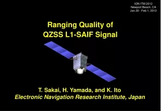
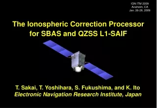
ION ITM 2015 Dana Point, CA Jan. 26-28, 2015 Quality Control of Ionospheric Corrections for Adoption of Wide Area Augmentation at the Low Latitude Regions T. Sakai, T. Aso, K. Hoshinoo, and K. Ito Electronic Navigation Research Institute, Japan
Introduction • QZSS (Quasi-Zenith Satellite System) program: • Regional navigation service broadcast from high-elevation angle by a combination of three or more satellites on the inclined geosynchronous (quasi-zenith) orbit. • Broadcast GPS-like supplemental signals on three frequencies and two augmentation signals, L1-SAIF and LEX. • L1-SAIF (Submeter-class Augmentation with Integrity Function) signal offers: • Submeter accuracy wide-area differential correction service; • Integrity function for safety of mobile users; and • Ranging function for improving position availability; all on L1 single frequency. • ENRI has been developing L1-SAIF signal and experimental facility: • L1-SAIF signal achieves good accuracy less than 1 meter in RMS manner at the mainland of Japan. • Ionosphere disturbance sometimes degrades the position accuracy, especially at the low latitude regions including the southwestern Islands of Japanese territory. • In order to improve the accuracy at the low latitude regions during ionospheric storm, quality control of ionospheric corrections may be introduced.
GPS/GEO QZS QZSS Concept • Broadcast signal from high elevation angle. • Applicable to navigation services for mountain area and urban canyon. • Augmentation signal from the zenith could help users to acquire other GPS satellites at any time. • Footprint of QZSS orbit. • Centered at 135E. • Eccentricity 0.075, Inclination 43deg.
25.3m Radiation Cooled TWT TWSTFT Antenna Successfully launched on Sept. 11, 2010 and settled on Quasi-Zenith Orbit (IGSO). Nickname: “Michibiki” C-band TTC Antenna Laser Reflector L1-SAIF Antenna L-band Helical Array Antenna Space Segment: QZS-1
Broadcast Ranging Signals Supplemental Signals • Supplemental Signals by JAXA • GPS-like L1C/A, L2C, L5, and L1C signals (PRN 193) working with GPS. • Improves availability of navigation. • Minimum modifications from GPS signals. QZS-1 satellite • L1-SAIF by ENRI • SBAS-like C/A code (PRN 183) signal on GPS L1 freq.; Reasonable performance for mobile users. • Augmentation to GPS; Potentially plus GLONASS and Galileo. • LEX by JAXA • For carrier-based experimental purposes. • Original CPSK signal on E6 frequency. • Member organizations may use LEX as 2kbps experimental data channel. Augmentation Signals
L1-SAIF Signal L1-SAIF Signal Ranging Function QZS satellites GPS Constellation Error Correction Ranging Signal Integrity Information • SBAS-like augmentation signal on PRN 183. • Three functions by a single signal: ranging, error correction (Target accuracy: 1m), and integrity. • User receivers can receive both GPS and L1-SAIF signals with a single antenna and RF front-end. • See IS-QZSS for detail (Available at JAXA HP). User GPS Receivers SAIF: Submeter-class Augmentation with Integrity Function
GNSS Satellites QZS Ranging Signal L1-SAIF Signal K-band Uplink Ranging Signal Measure- ments L1-SAIF Message GEONET L1SMS QZSS MCS GSI Server (Tokyo) ENRI (Tokyo) JAXA TKSC (Tsukuba) ENRI L1-SAIF Master Station • L1-SAIF Master Station (L1SMS): • Generates L1-SAIF message stream in realtime and transmits it to QZSS MCS developed by and installed at JAXA. • Installed at ENRI, Tokyo; 90km from JAXA Tsukuba Space Center. • Dual frequency GPS measurements at some locations in Japan (monitor stations) necessary to generate L1-SAIF messages are sent from GEONET in realtime.
System Horizontal Error Vertical Error Standalone GPS L1-SAIF Augmentation Standalone GPS RMS 1.45 m 2.92 m Max 6.02 m 8.45 m w/ L1-SAIF RMS 0.29 m 0.39 m Max 1.56 m 2.57 m L1-SAIF Performance GPS Only Result 6 reference stations User location for this test L1-SAIF expe- rimental area • Example of user position error at Site 940058 (Takayama). • Realtime operation with MSAS-like 6 reference stations in Japan. • Period: 19-23 Jan. 2008 (5 days). Note: Results shown here were obtained with geodetic-grade antenna and receivers at open sky condition.
Problem: Ionosphere Ionosphere Density (NASA/JPL) • The largest error source: Ionospheric propagation delay. • Varies on the local time, solar activity, earth magnetic field, and so on. • Cannot be predicted; Causes large effect in the low magnetic latitude region.
Accuracy at Southwestern Island LT 14:00 At Southwestern Island (960735 Wadomari) At Northernmost City (950114 Kitami) • During severe ionospheric storm condition (Kp~7+), position accuracy with differential correction largely degrades at the Southwestern Islands. • The effect is not so large at the mainland of Japan. • It is known that increase of the number of GMS shows a little improvement.
PRN28 PRN20 Actual Ionosphere Corrections 5m At Southwestern Island At Northernmost City • Ionospheric correction continuously differs from the true delay by 5m or more. • Degradation of position accuracy during storm is due to inaccurate ionospheric correction.
60 60 45 Latitude, N 30 30 15 IGP 0 IGP 0 IGP 120 150 180 IPP Longitude, E L1-SAIF Ionospheric Correction • Vertical ionospheric delay information at IGPs (ionospheric grid point) located with 5-degree interval will be broadcast to users. • User receiver computes vertical ionospheric delays at IPPs with bilinear interpolation of delays at the surrounding IGPs. • Vertical delay is converted to slant delay by multiplying so-called obliquity factor which is a function of elevation angle.
Broadcast Message • MT26: Broadcast Ionospheric Vertical Delay • Contains vertical delay and its uncertainty at IGP. • A MT26 message contains information for 15 IGPs. • Each IGP has two attributes: vertical delay and its uncertainty (GIVE). Message Type 26: Ionospheric Delay Information
Vertical Delay Cutoff Radius IPP Fit Plane IGP Planar Fit and GIVE • Planar Fit: An algorithm to estimate vertical delay at an IGP. • Developed for WAAS; MSAS and L1-SAIF employ the same algorithm. • Assume ionospheric vertical delay can be modeled as a plane. • Model parameters are estimated by the least square fit. • GIVE (grid ionosphere vertical error): Uncertainty of the estimation basically computed from residuals of fit and including spatial and temporal threats. • GIVE Equation Formal Sigma Spatial Threat Temporal Threat
Difference, m Difference, m Over 2.5m Estimation Error Difference between observation and estimation at user IPPs 4:30 At Northernmost City (950114 Kitami) 4:30 At Southwestern Island (960735 Wadomari)
Difference, m | I(fIPP_i, lIPP_i) -IIPP_i | ^ Quality of Estimation • The MCS Can Examine the Quality of Estimation. • Based on the observations used for estimation. • Ex. Storm Detector Algorithm: Chi-Square test for residual errors (already implemented). • Use the difference between observation and estimation for all IPPs: • Ionospheric delay observed at an IPP observed by MCS; and • The associate delay estimation at the location of the IPP interpolated based on surrounding four IGP delay information generated by the MCS. • The large difference means invalidity of ionosphere estimation used for correction at the location of IPP. Difference between observation and estimation at the IPPs of MCS
Difference, m Quality Control of Corrections • Action to Detected Invalidity. • Due to the equatorial anomaly, irregularity of ionosphere may exist in south side. • In case that the difference at an IPP is larger than the threshold, all IGPs in the south from the IPP are set to: • ‘Not Monitored’ (NM) with threshold THNM (QC-NM); or • Maximum GIVE (45m) with threshold TH45 (QC-45). • QC-45: IGPs in the south from 20N are set to 45m due to two IPPs (red circled) having the difference larger than TH45 = 3.0m. • QC-NM: IGPs in the south from 15N are set to NM due to an IPP (black circled) having the difference larger than THNM = 5.0m.
Compute Estimation for IPP i: I(fIPP_i, lIPP_i) ^ |I(fIPP_i, lIPP_i)-IIPP_i| : TH ^ Quality Control of Corrections For All IPPs For All IGPs For All IGPs > fIGP_k : fIPP_i Planar Fit Algorithm for IGP k < Set GIVE = NM or 45m for IGP k > < Observation Estimation Conventional Planar Fit Implementation New: Quality Control Algorithm
Experiment Setup • Observation Data from GEONET: • GPS network operated by Geospatial Information Authority of Japan. • Archive of 30-sec interval data. • L1-SAIF Master Station: • Runs in offline mode with RINEX files. • Using 6 GEONET stations (a) to (f) near MSAS/L1-SAIF GMS (Ground Monitor Station) locations to generate augmentation message. • User Stations: • 5 stations from North to South: (1) to (5) for performance evaluation. • Compute position estimates with the L1-SAIF message output from L1-SAIF Master Station
Baseline Performance At Southwestern Island (5) Wadomari At Northernmost City (1) Kitami • Period: 2011/10/23 to 2011/10/26 (severe storm: Kp~7+) • L1SMS Parameters: # of GMS = 6, Iono Correction = Planar Fit
Quality Control (QC-45) At Southwestern Island (5) Wadomari At Northernmost City (1) Kitami • Quality Control with TH45=1.0m (QC-45) and THNM= (No QC-NM). • Possibility of some improvement at southwestern islands. • Availability of position solution is not affected.
Quality Control (QC-45 and QC-NM) At Southwestern Island (5) Wadomari At Northernmost City (1) Kitami • Quality Control with TH45=2.0m (QC-45) and THNM=3.0m (QC-NM). • Improvement is not clear. • Availability of position solution is degraded.
Effects of Quality Control 10% No loss of Availability Apply QC-45 Only Apply QC-45 and QC-NM • QC-45 (Quality Control with setting Max GIVE) has a potential of 10% improvement. • QC-NM (Quality Control with setting Not Monitored) has unclear improvement and degraded availability.
Conclusion • ENRI has been developing L1-SAIF signal: • Signal design: GPS/SBAS-like L1 C/A code (PRN 183). • Planned as an augmentation to mobile users. • Ionosphere disturbance is a concern: • L1-SAIF signal achieves good accuracy less than 1 meter in RMS manner at the mainland of Japan. • Ionosphere disturbance sometimes degrades the position accuracy, especially at the Southwestern Islands of Japanese territory. • This time we tried Quality Control of ionospheric corrections based on the difference between observation and estimation at IPPs. • Expected performance improvement: ~10% in RMS. • Further Investigations will include: • Other methods to improve the quality of ionospheric corrections for wide area augmentation. • Consideration of using external data sources (space weather and other sensors). • Performance improvement at other Asian Countries.