Download
1 / 29
290 likes | 501 Vues
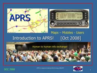
From GPS to Maps and Beyond Delaware Instructional Technology Conference – Spring 2008. Thursday, April 10, 2008 Presenters: Miriam Pomilio and Nicole M. Minni. GIS in Education Subcommittee .

E N D
From GPS to Maps and Beyond Delaware Instructional Technology Conference – Spring 2008 Thursday, April 10, 2008 Presenters: Miriam Pomilio and Nicole M. Minni
GIS in Education Subcommittee • GIS professionals from state government, academia and private sectors dedicated to helping expand the use of GIS and other geospatial technologies in Delaware schools. • Assist with planning and carrying out classroom geospatial activities/lessons • Resource for educators
Outline • Introductions • Presentation • Google – Excel to KML • ArcExplorer Java Edition for Education • Resources • Wrap up • Questions
Why is GPS to GIS Important… the connection • “Have students engaged in something meaningful that gives back to the community AND encompasses spatial thinking. ” Joseph Kerski, ESRI • Meaningful field experience, interdisciplinary topics • Visualize points in relation to other data.. Provides more than just a database • Ask questions • Begin to see relationships and patterns • Find Solutions to get the BIG IDEA!
GPS Point Ideas • Historical Locations • Stormdrains • Riparian data collection i.e. trash, native plants, invasive plants • Trees/ shrubs • Building entrances • Discovery of insects and other critters • Parking lot use • Your neighborhood • Good and bad locations in a neighborhood • USE YOUR IMAGINATION!
The data table for your GPS points • It is always good to have a paper back up when possible / feasible • Data includes: ID NUM, latitude, longitude, description or other notes, photographs • MS Excel to KML for Google
Google Earth possibilities • Google Earth – FREE - //earth.google.com/ • Can share with other classrooms around the world!! • Blackbird Creek Reserve • Historical Tours, Dover, Milton and Lewesftp://aeri2.dgs.udel.edu/pub/DITCConference2008 • Miriam provides a demonstration • Now its your turn!
Geographic Information Systems (GIS) • GIS gives the end user the ability to think spatially, which approaches the process of problem solving. How? • Exploring • Investigating • Establishing questions • Obtaining conclusions *Dueker, K. J., and D Kjerne, Multipurpose Cadastre Terms and Definitions, Am Soc for Photogrammetry and Remote Sensing and Am Congress on Surveying and Mapping, Falls Church, VA, 1989.
GIS Ideas • Historical Locations – understanding the history of your town, city, neighborhood • Water • Stormdrains • Riparian data collection i.e. trash, native plants, invasive plants - link between land and water • Discovery of bugs – soils, climate, seasons • Trees/ shrubs – shade buffer, seasonal timeline • Building entrances –handicap accessibility • Parking lot use – pervious vs. impervious • Your neighborhood • grocery stores, fire department, parks, etc. • Good and bad locations - helping kids stay safe and make good choices • USE YOUR IMAGINATION!
Who Uses GIS • Before GIS technology, only a few people had the skills necessary to use geographic information to help with decision making and problem solving. • Today, GIS is a multi-billion-dollar industry employing hundreds of thousands of people worldwide. • GIS is taught in K-12 schools, colleges, and universities throughout the world. • Professionals in many fields are increasingly aware of the advantages of thinking and working spatially.
Soho + Cholera death Water pump London cholera epidemic 1854, map by Dr. John Snow, “GIS” pioneer
Examples of GIS Municipal Planning
Ingram Pond Nature Center • Bluebird nesting boxes • Osprey nesting sites • Bald Eagle nesting sites
Police Washington D.C. Area Sniper Shootings, 2002
Watershed Analysis www.wr.udel.edu/publicservice/chbasin.html
Delaware K-12 Students http://edcommunity.apple.com/ali/story.php?itemID=786
Geographic Inquiry • Use GIS to answer your research question • Aquire geographic resources and data • Explorer geographic data • Analyze geographic information • Act upon geographic knowledge Acquire Ask Explore Act Analyze
Acquire Geographic Resources and Data • What types of data do you think we will need to assist in our research question? • Stormwater management on the DelTech campus • Water, ponds, rivers, streams • Roads • Aerial photography • Watershed boundaries • Elevation • Other data for reference • i.e. Parks
Explorer and Analyze Geographic Data • Relationships • Patterns • Querying our data • What areas use which storm drain? • Understanding elevation and flow • Identify streams around the DelTech Campus • Which subwatershed does the DelTech Campus fall within? • How much area on campus is impervious surface? • Can we slow down the rate in which the stormwater moves?
Act Upon Knowledge • Outreach and Education • Placement of storm drain medallions • Opportunities to implement best management practices with the students • i.e. native plantings, pervious surfaces, etc. • Are there areas which more storm water could be captured, filtered and/or reused?
ArcExplorer Java Edition for Education • ArcExplorer Java Edition for Education – FREE - http://www.esri.com/aejee • Pan and zoom through multiple map layers • Query spatial and attribute data • Create a buffer around selected features • Measure distances on a map • Create map layers with one symbol, unique symbols, and graduated symbols • Label map features, with many options for effects (such as highway shields) • Locate an address • Incorporate image formats (BMP, TIFF, PNG, JPG, and GIF) • Save and retrieve projects • Print maps • Incorporate overview maps • Add legends, scale bars and north arrows • Quickly access the Geography Network, a collaborative system that connects users with data and services via the Internet
Hands-on ArcExplorer Java Edition for Education • Nicole will demonstrate • Now it is your turn!
GPS Resources • Play find your longitude • http://www.pbs.org/wgbh/nova/longitude/find.html • Geocaching Ideas • http://www.eduscapes.com/geocaching/kids.htm • Apple Learning Interchange • http://edcommunity.apple.com/ali/galleryfiles/786/FieldTripTemplate.pdf • U.S. Army Corps of Engineers, Corpscon Web site • http://crunch.tec.army.mil/software/corpscon/corpscon.html • THE GIS 2 GPS Portal • http://www.gis2gps.com/ • GPS Lesson Plans • http://www.gis2gps.com/GPS/lessonplans/gpsplans.htm • The Science Spot, Learning with GPS • http://sciencespot.net/Pages/classgpslsn.html • NOVA Online, Find Your Longitude • http://www.pbs.org/wgbh/nova/longitude/find.html • Downloading directly from your Garmin unit • http://www.dnr.state.mn.us/mis/gis/tools/arcview/extensions/DNRGarmin/DNRGarmin.html • Getting started with Geocaching • http://www.geocaching.com/about/
GIS Resources • Environmental Systems Research Institute (ESRI) • ArcExplorer - www.esri.com/software/arcexplorer/index1.html • What is GIS? – Flash Demo www.esri.com/industries/k-12/education/demos.html • Apple Learning Interchange – 4th Grade Land and Water Unit • //edcommunity.apple.com/ali/story.php?itemID=786 • Printable Map from the National Atlas • //nationalatlas.gov/printable/satellite.html#list • National Geographic Xpeditions Lesson Plans and printable maps • www.nationalgeographic.com/xpeditions/lessons/ • Thomson, Brooks/Cole – GIS Investigations for the Earth Sciences • //www.brookscole.com/earthscience_d/special_features/GIS/gis.html • Washington Nature Mapping Program • //depts.washington.edu/natmap/resources/
GIS Resources cont. • Towson State University, Chesapeake Bay & Mid-Atlantic from Space K-12 Education • //chesapeake.towson.edu/education/ • GIS@UD - //maps.rdms.udel.edu/gis/ • Enchanted Learning – printouts for labeling • www.enchantedlearning.com/label/geography.shtml • GISMAPED – a vehicle for providing professional development in the use of GIS as a teaching tool • www.gismaped.co.nz/gislink.htm • www.esri.com/industries/k-12/education/demos.html • University of Delaware, College of Martine and Earth Studies, K-12 Teaching Resources • www.ocean.udel.edu/public/teacher.html • Delaware Geographic Alliance • www.udel.edu/Geography/DGA/web/index.htm • Evergreen Learning Groundswww.evergreen.ca/en/lg/plans_listing.html
Thank youQuestions?ftp://aeri2.dgs.udel.edu/pub/DITCConference2008