Download
1 / 36
360 likes | 377 Vues
2017 ATLANTIC BASIN HURRICANE SEASON: IRMA AUG. 30—SEPT. ?, 2017. Walter Hays, Global Alliance for Disaster Reduction, Vienna, Virginia, USA.

E N D
2017 ATLANTIC BASIN HURRICANE SEASON:IRMAAUG. 30—SEPT. ?, 2017 Walter Hays, Global Alliance for Disaster Reduction, Vienna, Virginia, USA
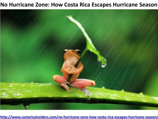
WILL HURRICANE IRMA CAUSE DISASTERS IN THE CARIBBEAN, IN FLORIDA? ALONG THE EAST COAST OF THE USA?ALONG THE GULF COAST? OR, MIRACULOUSLY DIE IN THE COLD ATLANTIC WATERS?
2017: THE FIRST SIX NAMED ATLANTIC BASIN STORMS • ARLENE – JUNE 9; DIED QUICKLY • BRET – JUNE 13; RAIN • CINDY – JUNE 19-23; LOTS OF RAIN • DON – July 17, DIED IN ATLANTIC • EMILY – July 17, DIED IN CARIBBEN • FRANKLIN—August 6; a RAINMAKER in NW Caribbean and Yucatan
2017: ADDITIONAL NAMED ATLANTIC BASIN STORMS • GERT – AUG 13; DIED IN ATLANTIC • HARVEY – AUG. 17, Reformed Aug 23; A HUGE RAINMAKER IN TEXAS AND LOUISIANA AFTER LATE AUG, 25 LANDFALL; NOW DYING SLOWLY • IRMA – AUG 30, CAT 2, SEPT. 5, CAT 5; COULD HIT FLORIDA SEPT. 8-9.
IRMA: AUGUST 30--? • Irma replaced the name Irene after HURRICANE IRENE caused widespread destruction in the Caribbean and the USA in 2011 and was retired as a name.
Irma is considered a “Cape Verde hurricane” forming in the far eastern Atlantic — near the Cape Verde Islands
SEPT. 4: IRMA’S POSITION • As of 5 p.m., the storm had grown from a Category 3 to a Category 4 as it approached the northwest Caribbean, where it is expected to strike Puerto Rico and other island nations on Wednesday, SEPT. 6.
IRMA GREW VERY QUICKLY FROM A CAT 4 TO A CAT 5, BECOMING THE WORST HURRICANE IN HISTORY TO BECOME CAT 5 IN THE OPEN ATLANTICNOTE: 1 CAT 5 = 500 CAT 1’s
MONDAY, SEPT. 4: FLORIDA BEGINS PREPARATION • Gov. RICK SCOTT declared a state of emergency in all of Florida’s 67 counties as HURRICANE IRMA. now a CAT 4, makes its way toward the state, possibly arriving on Friday, SEPT. 8th.
MONDAY, SEPT. 4: FLORIDA PREPARING FOR IRMA • Although it’ s still too soon to know if, or on which side of Florida the storm will hit, the declaration gives local governments the time and resources to act swiftly in the best interest of Floridians.
NOTE: IT COULD TAKE UP TO 52 HOURS TO EVACUATE 500,000 FLORIDIANS, SO STARTING NOW IS VERY IMPORTANT FOR SAVING LIVES
WHAT CAN ISLAND NATIONS EXPECT? • The National Meteorological Service warned officials to expect prolonged high winds, storm surge, and as much as 20 cm (8 inches) of rain along Irma’s path.
SEPT. 6-7:URGENT QUESTIONS FOR THE CARIBBEAN:HOW LARGE AND DEADLY WILL THE 15-20 FOOT STORM SURGE AND HEAVY RAIN FALL BE IN PUERTO RICO, US VIRGIN ISLANDS, ANTIGUA, BARBADOS, HISPANOLA, CUBA, OTHER LOCATIONS WHEN CAT 5 IRMA ARRIVES?
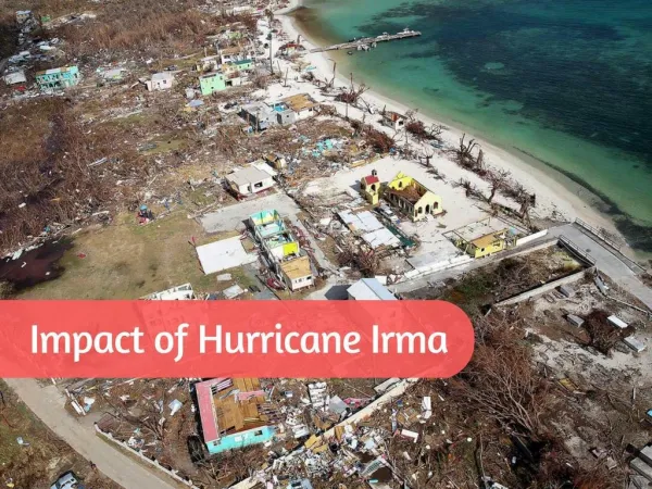
SEPT 6: ANTIGUA SPARED; BARBUDA LEVELED • The Category 5 storm leveled ANTIGUA’s sister island, BARBUDA (separated by 66 km (40 miles), damaging 95 percent of its buildings and leaving the island that is home to 1,600 “barely habitable”.
SEPT. 6: President Trump declared a state of emergency in Florida, (where the storm is expected now to reach Florida on Friday) Puerto Rico and the United States Virgin Islands.
SEPT. 6: UNITED NATIONS TO HELP IN CARIBBEAN • UN spokesman Stephane Dujarric said the UN had deployed a humanitarian team to work with the Caribbean Disaster Emergency Management Agency to help in the Caribbean where 37 million are likely to be impacted.
PUERTO RICANS PREPARE THEN GO TO ISLAND SHELTERS • Puerto Ricans remember: Nearly 30 years ago, a weaker storm, Hurricane Hugo left 28,000 homeless • By Wednesday afternoon, some 300,000 had already lost power and 4,000 water services
SEPT. 6: URGENT UNKNOWS FOR FLORIDA, GEORGIA, SOUTH CAROLINA: WILL IRMA’s TRACK TURN NORTHWARD BEFORE REACHING FLORIDA? AFTER A DIRECT HIT ON FLORIDA? OR AFTER SKIRTING ALONG THE EAST COAST OF FLORIDA?
WORST CASE: HURRICANE IRMA COULD CAUSE A $300 BILLION+ LOSS IN FLORIDA;BEST CASE: IRMA MISSES FLORIDA AND DIES IN THE COLD WATERS OF THE ATLANTIC
REASONS FOR FLORIDA’s VULNERABILITY • Drive along any coastline in Florida today and you'll find construction cranes as plentiful as palm trees because developers rushed after Hurricane Andrew to build high-rises in the most beautiful and most vulnerable parts of the state.
HURRICANE WILMA (2005) EXPOSED A WEAKNESS • Wilma (2005), as a CAT 2 hurricane with 100 mph winds----far weaker than Irma and Andrew (1991), shattered windows in Miami’s high rises when it crossed over downtown Miami, leading to many total losses.
REASONS FOR FLORIDA’s VULNERABILITY • If Hurricane Ima hits downtown Miami and its growing collection of new skyscrapers, the losses could reach $300 billion+, according to one insurance underwriter, and that doesn't include loss of taxes or tourism.
CAUSES OF DAMAGE WIND PENETRATING BUILDING ENVELOPE UPLIFT OF ROOF SYSTEM FLYING DEBRIS STORM SURGE HURRICANES IRREGULARITIES IN ELEVATION AND PLAN “DISASTER LABORATORIES” SITING PROBLEMS FLOODING AND LANDSLIDES
WINDSTORM HAZARDS • PEOPLE & BLDGS. • VULNERABILITY • LOCATION • PREPAREDNESS • PROTECTION • EARLY WARNING • EMERGENCY RESPONSE • RECOVERY and • RECONSTRUCTION WINDSTORM RISK POLICY OPTIONS ACCEPTABLE RISK RISK UNACCEPTABLE RISK GOAL: WINDSTORM DISASTER RESILIENCE COMMUNITIES DATA BASES AND INFORMATION HAZARDS: GROUND SHAKING GROUND FAILURE SURFACE FAULTING TECTONIC DEFORMATION TSUNAMI RUN UP AFTERSHOCKS