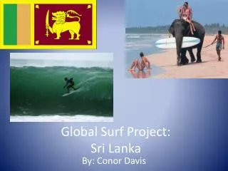
Global Surf Project: Sri Lanka
220 likes | 688 Vues
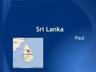
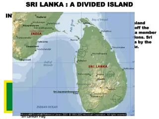
Global Surf Project: Sri Lanka. By: Conor Davis. Quick Facts:. Sri Lanka is located to the south of India in the Indian Ocean and gets the same swells as the Indonesian islands. Sri Lanka has a tropical climate and November to March is the driest and sunniest time of year.

Global Surf Project: Sri Lanka
E N D
Presentation Transcript
Global Surf Project:Sri Lanka By: Conor Davis
Quick Facts: • Sri Lanka is located to the south of India in the Indian Ocean and gets the same swells as the Indonesian islands. • Sri Lanka has a tropical climate and November to March is the driest and sunniest time of year. • The south west of the country has been the most popular destination for travelling surfers, being cheap, safe and having access to quality waves. • April to October is the time of year that brings the most consistent swells, but onshore winds can be a problem during this time.
Quick Facts: • Morning is the time to go out with the best chance of offshore conditions. During the surf season you can expect swells from 3-8ft, and at the rest of the year the surf is in the smaller 2-6ft range. • The multiple breaks around Hikkaduwa are rarely flat, and would be a good choice to base a surf trip around. • Sri Lanka is approximately 225km (140 miles) from the West to East coast, with approximately 400km (250 miles) of coastline. • The beaches are primarily made of sand. The sediment comes from the Ganges River.
Travel Costs • 15 to a couple thousand dollars depending on if you stay in a hut on the beach or a 5-star hotel • Flight Cost: Minimum of $1,500 with 2+ stops
The Good, the Bad & the Ugly • Surfing Sri Lanka - The GoodNice Mellow WavesCheap • Surf Sri Lanka - The Bad and the UglyNo Truly World Class WavesLocalismHistory Of Civil Unrest Poisonous snakes
Banded Sea Krait While the venom of banded sea kraits ranks among the most toxic in the world, they are so docile and non-aggressive that humans are rarely bitten, even in situations where the animal feels threatened.
References • Slide # 1: • Agency, Central Intellegence. The CIA World Factbook. 30 12 2011. 19 03 2012 <https://www.cia.gov/library/publications/the-world-factbook/geos/ce.html>. • Destination-Surf. 2008. 19 03 2012 <http://www.destination-surf.com/img_zs/291016Elephant_Surf_SriLanka.jpg>. • Surf-forecast.com. 2012. 09 03 2012 <http://www.surf-forecast.com/breaks/Aragum-Bay>. • Slide # 2 &3: • Surfing Waves.com. 2003-2012. 19 03 2012 <www.surfing-waves.com/travel/sri_lanka.htm>. • Slide # 4: • Go-lanka.com. 2004-2007. 19 03 2012 <http://www.go-lanka.com/>. • Travelocity.com. 1996-2012. 19 03 2012 <www.travelocity.com>. • Slide # 6: • Ward, Simon. Simonward.com. n.d. 19 03 2012 <http://www.simonward.com/cgi-bin/page.pl?large/asia/phuketdive,5,>. • Farm6.staticflickr.com. n.d. 19 03 2012 <http://farm6.staticflickr.com/5250/5233619307_40b7c04375.jpg>. • Ferrebeekeeper.wordpress.com. n.d. 19 03 2012 <http://ferrebeekeeper.wordpress.com/2011/08/31/the-yellow-lipped/>. • Slide # 7: • Maravot's News of the World. 1981-2005. 19 03 2012 <http://www.maravot.com/Maravot_News12.31.04.html>. • Slide # 8: • "Bay of Bengal." Encyclopedia Britannica. Encyclopedia Britannica Online. Encyclopedia Britannica Inc., 2012. Web. 19 Mar. 2012. <http://www.britannica.com/EBchecked/topic/60740/Bay-of-Bengal>. • Slide # 9 & 11: • WannaSurf.com. n.d. 19 03 2012 <http://www.wannasurf.com/spot/Asia/Sri_Lanka/>.
References • Slide # 10: • Go-lanka.com. 2004-2007. 19 03 2012 <http://www.go-lanka.com/>. • Slide # 13: • CIMSS Tropical Cyclones. 2012. 19 03 2012 <http://tropic.ssec.wisc.edu/#SPECIAL>. • Slide # 15: • Travel4Me Ltd. Sri Lanka Climate & Weather. 2011. 19 03 2012 <http://srilanka.holidays4.me/html/sri-lanka-climate-weather.html>. • Slide # 16: • You Tube. 7 08 2009. 19 03 2019 <http://www.youtube.com/watch?v=dBXGpLu1iN0>. • Slide # 17: • Destination 360. Sri Lanka Beaches. 2012. 19 03 2012 <http://www.destination360.com/asia/sri-lanka/sri-lanka-beaches>. • Slide # 18: • Sri Lanka - The Small Miracle. 27 03 2011. 19 03 2012 <http://ceylonthesmallmiracle.blogspot.com/2010/03/arugam-bay.html>. • Slide # 19: • Sri Lanka - Best One. 04 07 2010. 19 03 2012 <http://srilankabestone.blogspot.com/>. • Slide # 20: • Gunawardene, Nalaka. Tsunami - Moving Images. 22 12 2009. 19 03 2012 <http://nalakagunawardene.com/category/tsunami/page/2/>.