Download
1 / 43
430 likes | 585 Vues
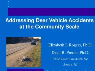
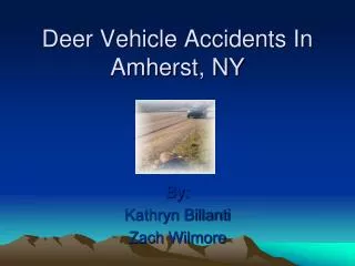
Deer Vehicle Accidents In Amherst, NY. By: Kathryn Billanti Zach Wilmore. Town of Amherst DVAs. Hot Spots are the areas in which the DVAs are most likely to occur:. North French Hotspot: 32 DVAs in 2004. Youngs Hot Spot: 30 DVAs in 2004. Wherle Hotspot: 9 DVAs in 2004.

E N D
Deer Vehicle Accidents In Amherst, NY By: Kathryn Billanti Zach Wilmore
Hot Spots are the areas in which the DVAs are most likely to occur: North French Hotspot: 32 DVAs in 2004 Youngs Hot Spot: 30 DVAs in 2004 Wherle Hotspot: 9 DVAs in 2004 This is out of a total of 511 DVAs for 2004
Purpose • Trees add levels of value to a campus • Beautification • Lowers stress of student • Provides shade for landscaped areas and buildings
State Park Placement Overlooking Canandaigua Lake Nicole S. Chanler Geo 479 April 20, 2005
Viewshed from Bare Hill Overlaid on DEM in 3D Observation Point
Suitability Map for Western New York’s Grocery Store Edwin Timothy GEO 559 Environmental Modeling
IS THE CARRIER RECREATION CENTER IN A SUITABLE LOCATION ? Takara Gray
After putting 3 straight line distance maps into the raster calculator, this is the resulting map… The yellow area is where the center is most suitable for children ages 5 – 17.
Geographical Analysis on Pedestrian Accidents in Buffalo, NY using GIS Applications Geo 559 Hoe-Hun Ha (Bryan)
Determining the Location of a Recreational Trail in Cherry Creek, New York:An Application of Suitability Mapping Merissa D. Harvey April 25, 2005
Introduction • Problem Statement • Determine the most suitable location for a recreational trail within Cherry Creek, New York • Objectives • Use a suitability mapping technique in GIS to weigh layers according to their suitability for trail construction • Evaluate trail location in terms of minimizing environmental impacts
Results Trail Potential Map Trail Potential Map with Hypothetical Trail
Loki Patera, Io Jennifer Lougen Graduate Project Environmental Modelling April 2005
What does this tell me? • Heat spreading outward • Temperatures are warmer throughout most of patera
Voyager 1 Galileo, map-a-planet • fissure increased • lake increase in size or is it the angle that the image was taken?
Using GIS to predict natural hazards and evacuation zones associated with the opening of a new vent along the East Riftzone of Kilauea, Hawaii By Craig McClarren
Lava inundation hazard map for new vent along Kilauea East Riftzone
Using GIS to model Mosquito infestation control strategies in Erie County By C. Bryson Okeoma GEO 559 Project
Results • Suitability ranking of weighted • Population, • Elevation, • Stream • Wetland datasets • Buffer around mosquito habitats yielded suitable sites for fumigation
Modeling Phosphorus HotspotsFranklin County, Vermont Sue Roussie Geo 559 April 13, 2005
Ground Truthing Lineaments in the Eastern Finger Lakes Joshua Stroup Geo 559 4/18/2005
A Comparison of Forest Health Characteristics and Predicted Forest Change due to Global Warming in Northeastern US Chia-Chi Wu5/6/05
F E D C B A Fig2. (a) The current distribution of eastern white pine. (b) The predicted distribution of eastern white pine in 2XCO2 scenario.
Fig 5. (a) The crown condition of eastern white pine. (b) The growth rate of eastern white pine
Regional Damage Estimation and Emergency Service Routing using GIS GEO - 559 Project Presentation Jomon Aliyas Paul
Commercial Building placement along Buffalo’s Waterfront. IsmaealNaji Candice Au Geo 479