Frontogenesis: Formation & Decay of Weather Fronts
Frontogenesis and frontolysis processes explained, along with mesoscale and synoptic scale fronts. Explore the kinematics and thermodynamics involved in frontogenesis. Learn about thunderstorms, storm types, and their relationship with shear and storm propagation. Discover how storms relate to floods.

Frontogenesis: Formation & Decay of Weather Fronts
E N D
Presentation Transcript
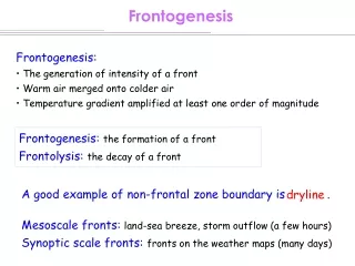
Frontogenesis • Frontogenesis: • The generation of intensity of a front • Warm air merged onto colder air • Temperature gradient amplified at least one order of magnitude Frontogenesis: the formation of a front Frontolysis: the decay of a front A good example of non-frontal zone boundary is . dryline Mesoscale fronts: land-sea breeze, storm outflow (a few hours) Synoptic scale fronts: fronts on the weather maps (many days)
Frontogenesis Kinematics and thermodynamics of Frontogenesis: 2D frontogenesis (F): Frontogenesis function First law of thermodynamics Diabatic heating (e.g., latent heat, radiation)
q - Dq y q q + Dq x Frontogenesis Assume that winds do no vary along the front and x axis // q lines, 0 [ ] [ ] [ ] [ ] [ ] [ ] Inhomogeneous diabatic heating Confluence/diffluence Tilting effect
Frontogenesis (1) Confluence/diffluence Frontogenesis, F> 0 Frontolysis. F < 0 q - Dq q - Dq y q y q q + Dq q + Dq x x q - Dq q - Dq y q y q q + Dq q + Dq x x
Frontogenesis (1) Confluence/diffluence
Frontogenesis (2) Tilting effect Frontogenesis, F> 0 Frontolysis. F < 0 q + Dq q + Dq q q z z q - Dq q - Dq y y N E q + Dq q + Dq q q q - Dq z z q - Dq y y
Frontogenesis (3) Quasi-horizontal variation due to diabatic heating Frontogenesis, F> 0 Frontolysis. F < 0 Day Night Cold, cloudy Cold, cloudy, less cooling q - Dq q - Dq y y q q q + Dq q + Dq Warm side, longwave radiative cooling, stronger cooling Warm solar heating x x
Thunderstorm Frequency Thunderstorm frequency map for the United States
Thunderstorms The upper part usually composes ice and is spread out as anvils. Types: • Short-lived cell • Multicell • Suepercell or split cell (can have hails and tornados) • Short-lived cell : when shear is weak, shear < 10 ms-1 below 6 km, • Multicell : moderate shear, 10 ~ 20 ms-1, • Supercell : strong shear, shear > 20 ms-1. Storms propagation speed = mean wind speed + propagation due to new formation of cell.
Thunderstorms Life time: short-lived cell: ~ 30 min multicell: ~ 10-15 min for each cell supercell: ~ nearly steady state (several hours) Storm dissipates because of: water loading, cut of energy supply, dry air entrainment, mixing, etc.
Reference for what type of storms but not their severity. Parameters: Bulk Richardson number ( ) Thunderstorms Storm types are strongly related to the Bulk Richardson number (an overestimated w)
Thunderstorms Why CAPE? Need energy to develop a storm (no help from large scales, like upper level trough to winter storms) Why shear? • The ability of a gust front to trigger a new cell (for multicell) • The ability of an updraft to interact with environment wind shear to produce an enhanced quasi-steady storm structure. (supercell)
Supercell • Isolated convetive storms (life time - several hours) • Usually requires large CAPE and strong wind shear • Low level moist, upper level dry ( - strong downdraft) • Shear too strong is not good either (destroy the storm structure) • Can potentially produce tornados
Shear and Storm Splitting Uni-directional shear Multi-directional shear
Shear and Storm Moving Uni-directional shear Multi-directional shear
Supercell Note: The wind vectors in the middle latitude of the northern hemisphere usually turn clockwise with height (Coriolis force effect). So, usually the split right-moving storm survives.
Supercell Anticyclonic circulation Cyclonic circulation Uni-directional shear Survival Multi-directional shear
Storms and Floods • For multicell and supercell, if the system is quasi-stationary or slowly moving, • Produce heavy rainfall • Flashflood can occur