Creating Comprehensive Metadata Records with Online Tools
Learn how to create essential metadata records using an online tool, with step-by-step instructions for each metadata field such as title, creator, data type, and distribution details. Utilize automatic keyword generation and thematic keyword tools for accurate classification and description.

Creating Comprehensive Metadata Records with Online Tools
E N D
Presentation Transcript
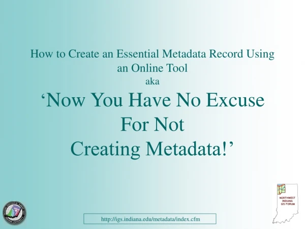
How to Create an Essential Metadata Record Using an Online Tool aka‘Now You Have No Excuse For Not Creating Metadata!’ http://igs.indiana.edu/metadata/index.cfm
Becky McKinley, GISPHammond Sanitary District, NW Indiana GIS ForumCele MorrisI.U. Northwest Data Center http://igs.indiana.edu/metadata/index.cfm
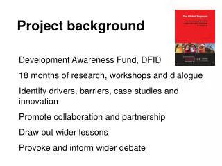
Project background • Northwest Indiana GIS Forum • Indiana Geological Survey • US-EPA Region 5 http://igs.indiana.edu/metadata/index.cfm
Indiana Metadata ProfileDocument for each dataset: • Background/basic information • Dataset Specifics • Distribution information • Spatial reference • Metadata information http://igs.indiana.edu/metadata/index.cfm
Background/basic information • Title • Who created it? • What kind of data is it (map, table, image etc.)? • When was it created? • Where was it published? • Why was it created? NOTE: use the Abstract paragraph to summarize the dataset and include anything you feel important but not covered by the other metadata fields. http://igs.indiana.edu/metadata/index.cfm
Dataset Specifics • What time period does it cover? • How often is it updated? • What is its spatial extent (bounding coordinates?)? • What themewords would be used to describe it? http://igs.indiana.edu/metadata/index.cfm
Distribution information • Who distributes it? • Is it offline only, downloadable etc? • Are there access constraints (data dissemination policy etc.?)? • Who do I contact to get it? • What formats are available? • Is there a fee? http://igs.indiana.edu/metadata/index.cfm
Spatial reference • Source scale • Vertical/Horizontal positional accuracy • Vertical/Horizontal datum • Map projection http://igs.indiana.edu/metadata/index.cfm
Metadata information • Who created it? • When? http://igs.indiana.edu/metadata/index.cfm
Web Access To The On-line Metadata Compilation Tool: http://igs.indiana.edu/metadata/index.cfm http://igs.indiana.edu/metadata/index.cfm
Online Metadata Tool Homepage http://igs.indiana.edu/metadata/index.cfm
Go to the Tool http://igs.indiana.edu/metadata/index.cfm
Entering Data Elements http://igs.indiana.edu/metadata/index.cfm
Spatial Extent Tool http://igs.indiana.edu/metadata/index.cfm
Choose the Extent by County…. http://igs.indiana.edu/metadata/index.cfm
…Or by City http://igs.indiana.edu/metadata/index.cfm
Generates Place Keywords Automatically!! http://igs.indiana.edu/metadata/index.cfm
Theme Keyword Tool http://igs.indiana.edu/metadata/index.cfm
Choose a Theme for Clearinghouse Publication http://igs.indiana.edu/metadata/index.cfm
Choose Additional Keywords to Describe Your Data http://igs.indiana.edu/metadata/index.cfm
Add All the Keywords Together http://igs.indiana.edu/metadata/index.cfm
Include a Little More Information – Then Preview http://igs.indiana.edu/metadata/index.cfm
Is There Anything You Forgot ? http://igs.indiana.edu/metadata/index.cfm
Save the Text File to Your Hard Drive http://igs.indiana.edu/metadata/index.cfm
Don’t Forget to Publish ! http://in-ulib-clark.ads.iu.edu/metadataexplorer/ http://igs.indiana.edu/metadata/index.cfm
Thanks to the Indiana Geological Survey http://igs.indiana.edu/metadata/index.cfm