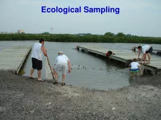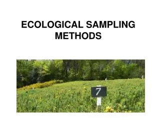
Ecological Sampling
Ecological Sampling. A portion, piece or segment that is representative of a whole. Ecological Sampling – Avoiding Bias. How does a scientist count the number of plants or animals in a forest? The area must be sampled in such a way to avoid bias.

Ecological Sampling
E N D
Presentation Transcript
Ecological Sampling A portion, piece or segment that is representative of a whole
Ecological Sampling – Avoiding Bias How does a scientist count the number of plants or animals in a forest? The area must be sampled in such a way to avoid bias. The samples can be taken either randomly (using a random number generator) or systematically (at regular intervals)
Random sampling – use a random number table and a map to choose where to sample.
Quadrat – an area used to sample the ecosystem. It can be square or round and vary in size from 0.25 m2, 0.50 m2, 1.0 m2..
Random number generator on a calculator: MATH, PRB, randint( , ) to generate the x and y coordinates.
Percent Frequency: Count the number of frames with a flower and calculate the percent frequency. (12%)
Percent Cover: Estimate the percent of squares that the plants cover. 18 % cover
Percent Cover: Estimate the percent of the quadrat that is covered by each species. Answer: 50% rockweed (green) 3% barnacles (white) 4% mussels (black)
Estimate the percent cover of the barnacles (white) the rockweed (green), and the mussels (black) Barnacles: 30% Rockweed: 30% Mussels: 15% There is some bare rock as well.
Density: Count the plants within the quadrat and calculate the average plants/m2
Density – Count the number of trees in a known area. Density = trees/Ha
How many samples should be taken? Until no more species are found. Seven samples would be enough.
Processing the data… Use the data from the quadrats to calculate the mean value and the standard deviation for each species. Texas Instruments: STAT, Edit, List 1, type in data, CALC, 1-var stats, 2nd L1, “Enter”. X is the mean value, ox is the standard deviation Excel: Type in the numbers in excel. To find the mean value: Type =AVERAGE, select numbers, hit enter To find the standard deviation: Type =STDEV, select numbers, enter
Systematic sampling – The samples are taken at regular intervals
Types of transects (A type of systematic sampling) • Line transect • Belt transect
Line transect in Udzungwa Ecological monitoring center, Tanzania
Line transects The continuous line transects involved noting the height and species of every plant which touched the line along its entire length.
Belt transect: The use of a quadrat makes the transect wide, like a belt.
Belt transect Quadrats of 0.5 m2 were recorded every 2 metres along the transect line.
Zonation • A change in the biotic community due to a changing environmental gradient. Examples: • Looking at soil moisture and plant community as it changes with distance from a stream • Looking at the concentration of a pollutant and the animal community as it varies with distance from a source of a pollution
Processing the data • Collect data from at least 3 transects. • Add the values for each species at each distance along the transect. • Make a kite diagram to show the changes in the biotic community with distance.
Kite diagram for species found along a coastline in England.
Stratified sampling. Divide the areas up due to differences and then sample each type randomly. Samples are deliberately allocated to each of the recognised different environmental patches in the sample area.
Suggest why someone would choose this sampling arrangement A set of systematic samples to compare the area near the river and far from the river. One could compare species diversity close to the river and far away, for example.
Would this sampling be useful? This is a systematic sample. It avoids bias, but it does not sample the whole area very well.
What sort of testing is shown here? This is random sampling. The quadrats were chosen with a random number table. This is a good way to get an unbiased set of samples.
Why would this arrangement be useful? This belt transect demonstrates systematic sampling. One could observe the changes in the biotic community as the distance from the river increases. (zonation)
Why would someone sample like this? I have no idea why someone would sample like this.