Download
1 / 28
280 likes | 433 Vues
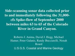
Side-scanning sonar data collected prior to and immediately following the 31,000-cfs Spike-flow of September 2000 between miles 63 to 65 of the Colorado River in Grand Canyon. Roberto J. Anima, David J. Hogg, Michael Hamer, Peter Galanis, Randy Bucciarelli, Nenah Board

E N D
Side-scanning sonar data collected prior to and immediately following the 31,000-cfs Spike-flow of September 2000 between miles 63 to 65 of the Colorado River in Grand Canyon. Roberto J. Anima, David J. Hogg, Michael Hamer, Peter Galanis, Randy Bucciarelli, Nenah Board U.S.G.S. Coastal and Marine Geology
Topics • August-September 2000 spike flow surveys • Overview of the steps necessary in the processing of digitized data. • Brief review of sections between miles 63 to 65. • Initial Results • Status of the project • Future plans
Surveys • Pre-spike flow survey was started on August 28th from Glen Canyon Dam to Diamond creek. • Post-spike flow survey started on September 10th. • Analog and digitized data was collected for both surveys. • This presentation will cover from mile 63 to 65.
Data Acquisition - Klein side-scan sonar fish sends 100 or 500 kHz ping every 0.25 seconds -Transducers mounted on the sonar fish measure strength of return signal, from time of ping until the following ping (analog signal-strength vs time data stream) -PC using MUDSEIS software captures analog data stream, converts it to digital, merges it with GPS, and records it to MO.
Pre-processing of Side-scan sonar data • Archive raw files to CDROM • Transfer PC files to UNIX system and translate into MIPS format • QMIPSIN program creates MIPS-compatible files: *.img, *.lbl,*.hst, & *.nav • Clean up navigation files (NAVEDIT, AUTOALT, and ALTEDIT programs) • First-Return correction (river bottom)
Processing • Strip Processing • SHADE and SONARSHADE: These programs correct for horizontal shading problems caused in part by sonar beam-angle • SLR2GR: Slant range to ground range program eliminates water column and corrects cross-track geometry (corrects horizontal scale) • DESTRIPE: Optional program to eliminate anomalous horizontal • striping in image. • NAVFLT: Program to smooth sharp jumps in navigation file • DELTAV: Delta velocity program corrects for along-track geometry (corrects vertical scale)
Geometric Projection • SNRGEOM: Program projects the sonar image into the desired map • Projection and pixel resolution as great as 0.1 meters/pixel are possible with side-scan sonar. • -Output form MIPS is a geo-rectified TIFF image • -The TIFF image is imported into Arc/Info and converted to Arc/Info Grid format. • -The image is imported into Adobe PhotoShop for interpretation.
Interpretations of the side-scan images • Ground-truthing from past surveys using underwater video, allows detailed interpretations. • Polygons are created along each segment of the survey according to textural patterns on the side-scan sonar record • Results in maps of the river bed showing bedrock, boulders, pebbles and cobbles, sand and areas with sand cover over one of the other three river bed types.
Side-scanning sonar data of the first area is between miles 63.5 and the Sacred Hopi Salt Mines show images of the river bed. The first image is the trackline on the orthorectified aerial photos.
Next image shows the digitized side-scanning sonar record of the pre flow cruise. Note the location of the large boulders on river right (left side of the image). The same features are visible on the side-scanning sonar image.
This is the same side-scanning sonar image as the previous image but with the addition of polygons based on various textural variations along the section.
Accomplishments • We have completed the processing and interpretation of two surveys from Lee’s Ferry to Phantom Ranch. The second of these surveys includes the area between Glenn Canyon to Lees Ferry. • We have developed and modified our equipment to the meet the demands of the Grand Canyon environment. • We have established a data collection, pre-and post-processing, and interpretive protocol, although processing time is still long. • We have proven the worth of Side-scanning sonar as a viable remote sensing technique to monitor the distribution of sand size sediment along the river corridor. And compare time variable changes in sediment distribution.
Products for the year 2001 • Complete the processing of the 1998-99 data sets. • Continue the processing of the pre-and post spike flow data for the study reaches. • All data put into a GIS format for easy accessibility to other workers. • Interact with biologist to ascertain how they can use side-scanning sonar data in their studies.
What Next??? • We know what can be accomplished using side-scan sonar alone. • Develop a protocol for continued monitoring • Improve navigation along corridor • Ultimately complete the whole corridor and begin change analyses comparing different time variable data sets.
Topographic map with side-scan sonar data. • Numbers represent river miles
Miles -4 and -3, with sand size sediment along the inner bend on the right side of the figure, and near the end of the sections on the left side of the section.
Mile -7 Line run from upper right to lower left. Note the circle of the side-scan record upon making a turn down stream.
System-Wide surveys, Sept. 1998 and May 1999 • PEP panels recommendation of surveying the entire canyon. • Sept. 1998 trip, from Lees Ferry to Diamond Creek • The May 1999 trip from Glen Canyon Dam to Diamond Creek.