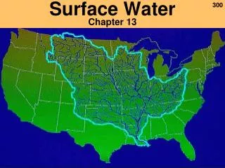
Surface Water
Fresh Water Sources. Surface Water. Groundwater. Aquifers and Springs. Rivers, Streams, and Lakes. In a state so rich in diversity, regional water issues are as broad and variable as the Texas terrain. Groundwater: Hueco-Mesilla Bolson Aquifer. BIG BEND REGION. Water Supply.


Surface Water
E N D
Presentation Transcript
Fresh Water Sources Surface Water Groundwater Aquifers and Springs Rivers, Streams, and Lakes
In a state so rich in diversity, regional water issues are as broad and variable as the Texas terrain.
Groundwater: Hueco-Mesilla Bolson Aquifer BIG BEND REGION WaterSupply Surface water : Rio Grande River
BIG BEND REGION WaterDemand 75% goes to irrigation. Surface water supplies 60% of the region’s needs.
BIG BEND REGION Characteristics Rugged Terrain Springfed creeks and cienegas
BIG BEND REGION Threats Water-hungry invasives Long term drought
BIG BEND REGION Challenges • Sharing the Rio Grande with Mexico • Declining water supply • Population exploding
GULF COAST REGION Water Supply Groundwater : Gulf Coast, Carrizo-Wilcox Aquifers Surface Water : San Jacinto, Trinity, Brazos, Nueces, San Antonio Rivers
Mid-North Coast: Surface water meets 67% of the region’s needs. South Coast: Surface water meets 75% of the region’s needs and about half goes for municipal uses. GULF COAST REGION WaterDemand
GULF COAST REGION Characteristics Supports 60%-90% of fisheries in the entire U.S. Saltwater fishing nets billions of dollars annually.
GULF COAST REGION Threats • Wetland habitats are disappearing at an alarming rate. • Pollution from upstream prevents new life from surviving. • Water supplies may be insufficient to meet the demand.
GULF COAST REGION Challenges • Upstream demands for water restrict the flow into coastal wetlands. • Increases in population cause increase in water demand.
Groundwater : Edwards and Carrizo-Wilcox Aquifers Surface water : Colorado, Guadalupe and Nueces Rivers HILL COUNTRY REGION Water Supply
HILL COUNTRY REGION WaterDemand Surface water supplies 61% of the water demand. More than half of that goes to cities.
HILL COUNTRY REGION Characteristics • Cascading streams • Deep blue reservoirs • Bubbling springs • Plants and animals found nowhere else
HILL COUNTRY REGION Threats Many Springs have dried up or stopped flowing. Rainwater is diverted away from recharge zones.
HILL COUNTRY REGION Challenges Population is expected to increase by 70%.
Groundwater : Ogallala, Seymour, Cenozoic Pecos Alluvium, Edwards-Trinity Aquifers Surface Water : Red, Pecos, Canadian, Colorado and Brazos Rivers PANHANDLE PLAINS Water Supply
PANHANDLE PLAINS Water Demand Groundwater from the Ogallala aquifer supplies 97% of the water demand. While most is for irrigation, the Ogalalla provides drinking water for millions.
PANHANDLE PLAINS Characteristics 25,000 playa lakes provide habitat for ducks, geese and migratory birds.
PANHANDLE PLAINS Threats Poor agricultural practices can destroy playa lakes. Groundwater can be contaminated by abandoned oil fields.
PANHANDLE PLAINS Challenges Managing groundwater in a right of capture state is a challenge. Pumping from the Ogallala Aquifer exceed the rate of recharge. Over time, the aquifer level is dropping.
Groundwater: Carrizo-Wilcox Aquifer Surface Water : Sabine, Cypress, Sulphur and Red Rivers PINEYWOODS REGION Water Supply
PINEYWOODS REGION Water Demand Surface water meets 88% of the demand. More than half of that is used by manufacturing.
PINEYWOODS REGION Characteristics Pine forests with seasonally wet hardwood forest bottoms.
PINEYWOODS REGION Threats Redistribution of water to other regions of the state. Loss of bottomland hardwoods.
PINEYWOODS REGION Challenges Appropriating fresh water for future demands while balancing requests for water from other regions.
PRARIES AND LAKES Water Supply Groundwater : Trinity Aquifer Surface Water : Trinity, Red, Brazos Rivers
PRARIES AND LAKES Water Demand Groundwater supplies 92% of the water for DFW. A combination of groundwater and surface water supply the rest of this region.
PRARIES AND LAKES Characteristics Known for its reservoirs and record-making fishing.
PRARIES AND LAKES Threats Widespread pollution affects waters across the region.
PRARIES AND LAKES Challenges Maintaining water quality in highly populated areas.
Surface Water :Guadalupe, San Antonio, Nueces, Lavaca and Rio Grande Rivers Groundwater : Edwards, Trinity, Carrizo-Wilcox and Gulf Coast Aquifers SOUTH TEXAS REGION Water Supply
Groundwater: Source for 76% of San Antonio’s water. About half of the groundwater pumped in South Texas goes for irrigation. Surface water: Source for 98% of the water used in the Lower Rio Grande Valley – primarily for irrigation. SOUTH TEXAS REGION Water Demand
SOUTH TEXAS REGION Characteristics Plains of thorny shrubs and trees dotted with deep blue-water lakes. Scattered patches of palms and subtropical woodlands in the Rio Grande Valley.
Population in Lower Rio Grande to increase by 175% Future Surface water rights are already taken SOUTH TEXAS REGION Threats
SOUTH TEXAS REGION Challenges Competing with Mexico for water resources. Restoring regular flow to the mouth of the Rio Grande.