Download
1 / 16
160 likes | 174 Vues
In this project, students use ArcMap software to determine the location of river channels on the Big Island of Hawaii. They analyze rainfall patterns, drainage density, and hillslope and fluvial processes to create maps illustrating different drainage area thresholds. The project emphasizes critical thinking and synthesizing geomorphic concepts.

E N D
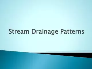
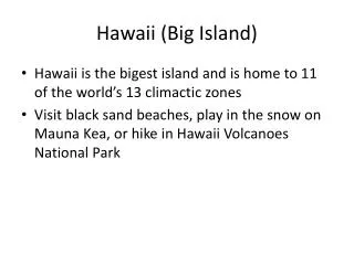
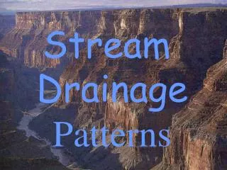
Rainfall Patterns and Drainage Density: The Big Island of Hawaii Students are asked to determine the location of river channels on the Big Island of Hawaii. Students are provided with a rainfall map, a DEM of the island, and a shape file containing the actual locations of rivers. WARNINGS: This project requires ArcMap software, with spatial analyst and a hydrology add-on! The link where you can download the hydrology extension is: http://support.esri.com/index.cfm?fa=downloads.dataModels.filteredGateway&dmid=15 Nice support page on using the hydro tools at: http://stuff.mit.edu/afs/athena/course/1/1.966/www/Lab5A/ This project is fairly advanced and probably only appropriate near the end of a course.
Goals of this project: • Synthesize many geomorphic concepts: rainfall patterns, runoff production, drainage density, hillslope processes, fluvial processes • Students decide what maps they need to complete the project, and they must create the maps themselves. • CRITICAL THINKING REQUIRED! No regurgitation of formulas or straight plugging in.
Before starting this project: • At this point in the course, the students know how to make and interpret topographic, contour, slope, and hillshade maps. They also can make and understand the concept of “blue lines”. • This was the third and final project in a series of ARC map projects that we did. • The students were given hand-outs with step-by-step directions on how to make all of the required maps. (I’ll post these if you are interested.)
http://hawaii.wr.usgs.gov/hawaii/data.html - for shape file of blue lines http://www.bigislanddeals.com/webimages/rainfall.gif - for rainfall map
NOTE: My students would get lots of points off for this and the rest of the crappy maps that I am showing you! No north arrow, no legend or title, no scale bar, no location coordinates … Big Island DEM • Lots of Hawaii GIS data, including a 10 m DEM can be downloaded from: http://www.soest.hawaii.edu/coasts/data/hawaii/dem.html • I just downloaded from the USGS NED site, http://seamless.usgs.gov/ , but I probably had to do some stitching.
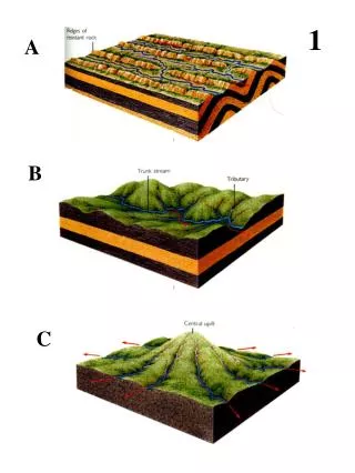
= 45 km2 Some maps one of my students made.
What the students handed in: • Maps illustrating the different drainage area thresholds they chose and why. (If slopes illustrated a change in landform, provide the slope map, etc.) • Text describing how they used the slope, contour and hillshade maps to determine the locations of rivers. • Text describing why the map of actual river locations looks different from the maps that they made. Why couldn’t they reproduce the same map?
Some general comments: • This was the third and final project in a series of ARC map projects that we did. • The students were given hand-outs with step-by-step directions on how to make all of the required maps. • None of my students had used ARC before. • This project was difficult for the students and I had to coach them a bit.
Some more general comments: • Even though this series of projects was challenging for the students, they all enjoyed using ARC, and I received very good feedback on these projects. • We did not discuss age gradients across the island, but this could be an added dimension to the project. • We did not discuss how groundwater contributes to flow in Hawaiian rivers – maybe next time?