Download
1 / 46
460 likes | 518 Vues
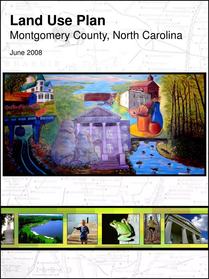
Land Use Plan Montgomery County, North Carolina June 2008. Introduction.

E N D
Introduction Montgomery County is known for its natural beauty from the lakes, rivers, farmlands, forestlands, and mountains to its built environment of small unique towns and communities to the people who care for it and each other. Our County has seen, for the most part, only slow steady growth over the years. The County’s population (unincorporated areas) increased by only approximately 5,000 people in the past 20 years, most of which occurred in the lake areas. Therefore, fortunately, the rural character of most of the County has stayed intact overtime. Unfortunately, for some, growth is unavoidable. With neighboring counties, states, and country’s growing more urbanized everyday it is inevitable that growth will draw closer to us as well. Though, where this growth occurs and how we sustain it is completely up to us. Right now we have the opport- unity to create a proactive plan versus a reactive one. Those areas that have experienced a large amount of growth, such as Randolph County, can attest that growth does not come without problems. More people mean more houses, busines- ses, and vehicles, which means more strain on public infrastructure systems and our environment. We all play a role in the future of our community and we should realize the importance of taking a proactive stance in being stewards of our community to maint- ain a high quality of life for future generations. We are not alone in our efforts. Most counties, including all of our neighboring counties have also adopted Land Use Plans to help guide healthy growth.
Regional Location of Montgomery County Montgomery County is strategically located in the center of North Carolina. It is the 46th largest county* in North Carolina at 491.6 square miles (478 sq. miles of non-municipal territory) and has the 71st highest population in the state at 27,506 total and 18,587 in the nonmunicipal areas*. The County is served by a number of highways that link the County to the adjoining region. This includes Interstate 73/74, a major roadway linking communities from Greensboro to South Carolina. Current and future development of Interstate 73/74 will continue to bring noticeable changes to the County. NC 24/27, is both one of the longest and most concurrent routes in NC running approximately 100 miles between Johnsonville and Charlotte. Other highways include NC 109, NC 135, and NC 73. Source: *NC State Demographics Troy, the County seat, is located 60 miles east of Charlotte, 50 miles south of Greensboro, and 105 miles south- west of Raleigh. Mont- gomery County lies within North Caro- lina’s Piedmont region, an area of flat to rolling terrain situated between the Blue Ridge Moun- tains to the north and west and the Coastal Plains to the east. Montgomery County is one of seven counties within the Yadkin-Pee Dee Lakes Region, a geographical area ext- ending from Salisbury to Rockingham that is focused on the chain- of-manmade lakes of the Yadkin and Pee Dee River. The grow- ing popularity of the lake area in the western portion of the County will continue to bring noticeable changes to the County. 2
Growth Issues In many communities, including Montgomery County, resulting development has been scattered and poorly planned and is consistently linked to a wide array of problems. Auto-dependent sprawl development is destroying rural areas and natural resources, drawing investment from existing communities and undermining long-term economic prosperity. Additionally, increased pollution is harming human health. And by making the use of cars a necessity, rampant sprawl is isolating children, elderly, low income, and disabled individuals. One of the most significant growth analysis factors involving Montgomery County demographics is that approximately seventy percent (70%) of its citizens reside outside of municipalities. In strict terms of land develop -ment, public costs of growth will include schools (increasing student populations requiring additional classroom space and entire schools); public safety services such as fire, police, and emergency medical services; general administration such as tax collection, public records, planning and inspections, social services, health services, solid waste, and many other services either voluntarily provided by local government, or mandated by the state government as necessary for the local government to provide. Growth if not well planned, can potentially lead to overburdening the available revenue resources, so that as unrestricted development occurs, existing funding is inadequate and may cause a reduction or degradation of the level and quality of service over time. An additional cost of development using current land use planning policies will be the loss of open space, negative impacts on active farmland, encroachment onto our natural or environmental areas, increased automobile commuting times caused by traffic congestion, the loss of rural character of the area and the loss of other types of physical, environmental and natural heritage assets not easily noticed when development occurs.
Current Montgomery County Growth Patterns The predominant pattern of development in Montgomery County over the past twenty-five (25) years can best be defined by rural sprawl. This type of development can best be defined as unlimited, large-lot or large-tract growth occurring far from areas to be served by public infrastructure and generally consuming more land and resources needed to create a livable and functional county. This type of rural residential development usually begins as a healthy sign of growth, but if left unmanaged, it can threaten growth of Montgomery County government’s ability to continue providing cost-effective services to maintain a high quality of life. Water quality and quantity problems are serious problems associated with sprawl. Buildings, roads, and parking lots can replace acres of forests, farms, and wetlands that would otherwise filter water. Development dramatically increases the amount of impervious surfaces, which in turn can increase the volume of runoff of pollutants, increase erosion, and slow groundwater replenishment, depleting water supplies. A one-acre parking lot, for example, can create 16 times more runoff than a meadow of the same size. The cumulative impacts of sprawl can be devastating. For example, the Catawba River in North Carolina and South Carolina has been identified as one of the most endangered rivers in the country due to erosion and runoff from explosive development in the Charlotte area, where approximately 40 acres of greenspace is developed daily. In addition, land cleared for roads and development can deposit silt in rivers and streams. Sprawl’s price tag is tremendous and it is rising, as is the threat it poses to successful long-term economic development. There is increasing evidence that the fiscal impact of sprawl development patterns harms localities and burdens taxpayers. Proposed develop- ments are frequently justified on the basis of the tax revenues they will bring to a city or county. All too often, however, localities are faced with the reality that growth does not pay for itself and can lead to higher tax rates. Although new development does bring new tax revenues, far-flung development often does not generate enough taxes to pay for the new roads, water lines, schools, and other infrastructure and services that need to be provided. At the same time, infrastructure that taxpayers have already paid for may be underused or abandoned as development spreads outward. Sprawl
Current land use and transportation also threaten the long-term health of regional and local economies. A recent national report found that business leaders “are recognizing that quality of life directly affects economic prosperity, and that sprawl threatens quality of life in many communities.” For one thing, traffic congestion and long commutes make an area a much less desirable place to live and work. Moreover, businesses and indiv- iduals are often forced to pay high prices for sprawl related congestion. Lower income families, however, spend the highest percentage of their income on trans- portation. According to the Bureau of Labor Statistic’ Consumer Expenditure Survey, household income between $10,000 and 14,999 for example, spend $3,697 per year on transportation – a quarter to more than a third of their income (24 to 37%), on average. In contrast, families with income of $30,000 to 39,999 spend an average of $6,973 per year on transportation (only 17 to 23%) and upper income household earning $70,000 or more spend an average of $13,363 on transportation (a fraction of one percent up to 19%, on average). This outlay is second only to housing expenditures, and is more than families in the region spend on health care and food combined. The economic vitality of existing communities suffers under sprawl. Not only does sprawl tend to lead to increased property taxes, but it also saps the vitality of existing communities since investment, jobs, and residents are lured to outlying areas. Rural economies can further suffer as productive farmland is converted and scenic landscapes, historic areas, and recreation areas that often attract vital tourist spending are harmed or destroyed. In addition, sprawl tends to be both a symptom and a cause of economic and social polarization, helping to concentrate poverty in cities and drawing people and wealth to the suburbs. This concentration in turn leads both to the increased need for local services within cities and to the erosion of the tax base (29% of Montgomery County’s expenditures went towards human services in 2005*) necessary to support these needs, spurring further flight of wealthier households. *Source: NC Department of State Treasurer, local government finance division. In addition to furthering regional polarization, as infrastructure investments help to draw more jobs to outer suburbs it is increasingly difficult for low income individuals residing in the central cities to find and to reach work. This problem is exacerbated by the relative lack of investment in transportation alternative, and has a disproportionate impact on minorities.
Smart Growth Principles Based on the experience of communities around the nation that have used smart growth approaches to create and maintain great neighborhoods, the Smart Growth Network developed a set of ten basic principles: • Mix land uses • Take advantage of compact building design • Create a range of housing opportunities and choices • Create walkable neighborhoods • Foster distinctive, attractive communities with a strong sense of place • Preserve open space, farmland, natural beauty, and critical environmental areas • Strengthen and direct development towards existing communities • Provide a variety of transportation choices • Make development decisions predictable, fair, and cost effective • Encourage community and stakeholder collaboration in development decisions Barriers To Smart Growth A host of public subsidies, regulations, and decisions typically make it cheaper and easier to develop on the fringes of existing communities. For example, a primary factor fueling explosive growth in the Southeast has been the public investment in infrastructure, such as roads, and water and sewer lines; as long as taxpayers cover the costs, there is little incentive to build where infrastructure already exists. Planning and zoning policies that require large lots and the geographic separation of commercial and residential areas encourage scattered development and driving. In addition, shorter-term hurdles such as budget shortfalls resulting from economic downturns and possible special interests that profit from current policies favoring sprawl development and road construction enables sprawl to occur more easily. Despite these barriers, substantial economic, health, environmental, and social costs of current growth trends are fueling public concern and calls for change. Montgomery County must make critical choices about how it will grow. Policies that can capture the benefits of growth while minimizing the attendant costs must be adopted if the region is to enjoy continued prosperity, vibrant and healthy communities, abundant natural resources, and a strong quality of life.
What People Have to Say A cornerstone of any successful future development plan is public involvement. Six community meetings throughout the County were held to gather citizen input. Basic information about citizens who attended include: • The vast majority of individuals (70%) that attended the community meetings have resided in Montgomery County for more than ten years. • Most people were attracted to Montgomery County by the “Small Town Character” and “Open Space.” • The most likely place of employment for participants was Troy, but the majority of attendees were retired. • A clear majority of attendees to the community meetings shopped in surrounding counties. • The two most important issues identified by Montgomery County residents are the Environment and Lake Development. Smart Growth and Open Space Preservation also received numerous votes from the residents attending the Community Meetings. • Community Meeting participants are interested in seeing the same amount of residential development in the County. However, they would like the location of the residential growth redistributed so that there would be less residential growth in rural areas and more residential growth in or near existing towns. • Additionally, participants thought that Montgomery County would be well served by having more commercial development, industrial development, community appearance standards, pedestrian amenities, water and sewer infrastructure, farmland/forestland preservation and open space/parks. • Finally, Community Meeting attendees would like to see Montgomery County grow moderately, to a population of 35,000 over the next 20 years. The “Top Five” issues ranked are: 1 Rural Conservation 2 Natural Resource Protection 3 Education of Elected and Appointed Officials 4 Improvement of existing regulations and enforcement of regulations 5 Expansion of Tourism within the County The six community meetings clearly showed that the high quality of life currently enjoyed by residents should be preserved. Residents cherish the small town character, rural spaces, and abundant natural resources that can be found in Montgomery County. In particular, attendees believed that the Land Use Plan should include definitive statements to protect what is special about the County.
Some of the specific ideas generated at the meetings included: • Creation of Voluntary Agriculture Districts • Development of natural buffers around lakes and streams to protect water quality and viewsheds • Establishment of a Board of Adjustment • Recruitment of restaurants and service establishments • Increased design standards for commercial development • National Forest Preservation • Small Town Revitalization • Halting clear cutting techniques • Implementation of Impact Fees • Balancing economic growth and natural resource protection
Elements The decisions that are being made now will shape our County for decades to come. This Plan is designed to encourage the qualities that make this County unique, by encouraging a balanced and diverse economy, promoting local self-sufficiency, by encouraging a balance in housing with jobs, stressing long-term productivity, living within our means as to availability of resources and services, providing moderate, orderly growth in harmony with our surroundings, and to provide for protection of the historical heritage and natural resources which has enriched the lives of residents and visitors throughout the years. In order to accomplish these objectives, this Plan has 10 elements by which policy recommendations will be supported by. Plan Elements are chapters, each containing goals and policies for specific plan topics. Chapter 1. Administration Element The policies established for administration of the Montgomery County Land Use Plan should result in timely and effective implementation. This Plan shall provide an efficient and predictable process for proposing, considering and acting on amendments to the Plan. Periodically this Plan shall be evaluated the effectiveness in implementing the goals and policies of the Land Use Plan. Opportunities shall be provided for citizen involvement in public decisions related to planning, zoning and transportation. Increase efforts to bring diverse interests into these processes, and involve as many people and organizations as possible is encouraged. Goal - Using the Plan Policy 1.1 Purpose of Land Use Plan. The County shall maintain land development regulations to manage future growth and development in a manner that provides needed facilities and services, protects environmental resources and discourages the proliferation of rural sprawl. Policy 1.1 Plan Elements. The Land Use Plan consists of the following chapters, or elements: 1. Administration Element; 2. Land Use Element; 3. Housing Element; 4. Community Character and Design Element; 5. Economic Development Element; vi. 6. Conservation and Environment Element; 7. Transportation Element; 8. Parks and Recreation Element; 9. Safety Element; 10. Subdivision Element;
Goal - Administration Policy 1.2 Responsibility. Administratively, the Planning Director shall be responsible for interpreting the provisions of the Montgomery County Land Use Plan. Policy 1.3 Enforcement of the Land Use Plan. Ordinances, budgets, and procedures of the County Board of Commissioners and Planning Board shall be used to enforce the provisions of the Montgomery County Land Use Plan. The Policies in the Plan are not required to be carried out in every case though reason must be warranted by conditions specifically applicable to a site for which the policies in the Plan are not executed. Policy 1.4 Plan Consistency. Applications for zoning changes, conditional use permits, and plan amendments which have been submitted after the adoption of the Land Use Plan, shall be reviewed for consistency with the Plan and must be consistent with the Land Use Plan elements. Also, the County Board of Commissioners shall consider the consistency of the proposals with the Land Use Plan in making decisions regarding the extension and location of public infrastructure. Goal - Plan Amendments Policy 1.5 Changes to the Land Use Plan. Changes to the Land Use Plan shall be approved by the Board of Commissioners only if they are consistent with the policies or language of the Land Use Plan and no element may be amended more frequently than three times a calendar year. Policy 1.6 Amendment Procedures. The Planning Director shall advise the Board Of Commissioners regarding all Plan Amendment applications. The Board of Commissioners shall advertise Plan amendments and include public comment. Goal - Plan Evaluation Policy 1.7 Evaluation and Assessment. The Planning Department shall annually prepare and present to the County Board of Commissioners an Evaluation and Assessment Report describing progress on implementing the Land Use Plan. The Evaluation and Assessment Report shall include, as appropriate: i. Accomplishments in the prior year period, describing the degree to which the goals and policies have been successfully reached; ii. Obstacles or problems in Plan implementation which resulted in underachievement of the Plan’s goals and policies; and iii. Recommendations for new or modified goals, objectives, or policies needed to correct problems.
Chapter 2. Land Use Element Montgomery County land is finite. How we use this land determines the number of homes, the amount of goods and services, and the quality of environment that will be available to Montgomery County citizens. Different strategies produce different results. This Plan proposes a flexible approach to the interaction of land uses but limits intensities and densities depending on location. The Plan balances the predicted demand for specific land uses with the need to protect our natural resources and to move towards a more efficient development pattern. Development Tiers guide growth and development in distinctive parts of the Montgomery County community. This Plan promotes new development and redevelopment activities appropriate to each Tier by establishing policies and development regulations that recognize their distinct character. The Land Use Map attempts to show generalized land use and land cover patterns across the County. The map, taken in a regional context, should give the viewer a general idea of where in the County built-up, rural, forested, open, and water areas are located. There should be a diverse range and adequate supply of housing, commercial, industrial, transportation, recreational, entertainment and employment options to create a sustainable community. • Goal 1. Development Tiers • Policy 2.1 Tiers. Establish the following development Tiers to reflect a diversity of pattern of development and ensure opportunities for choice in Montgomery County: • i. Rural; • ii. Suburban; and • iii. Urban
Policy 2.2 – Development Occurring on Boundary Line. Proposed development of parcels, including changes of zone, and subdivisions which are divided by a Growth Area Boundary Line (i.e. Rural, Suburban, Urban) may be found consistent with the Land Use Plan provided that the resulting density on one side of the boundary line complies with the designated density, notwithstanding that the resulting density on the remainder portion of the parcel, which shall not be further divided, exceeds the designated density. Policy 2.3 General Residential Densities. Establish a set of residential densities to encompass the diversity of residential densities found throughout Montgomery County. Through the Zoning Ordinance, establish and maintain densities of Residential development consistent with Table 2-1, Summary of Residential Densities. Goal – Land Use Map Policy 2.4 Future Land Use Map. Create and use the Future Land Use Map of the Montgomery County Land Use Plan in conjunction with the text to guide the location and character of development. Goal – Commercial Development Policy 2.5 Demand for Commercial Land. In designating land for commercial uses and evaluating Plan Amendments, the Planning Department shall consider the demand for commercial land and the capacity of the transportation, water, and sewer systems, and other public facilities and services. Policy 2.6 Spacing of Commercial Development. The County Planning Department shall use the following standards when evaluating requests for new commercial development: i. Cluster commercial uses at intersections of major thoroughfares to create nodes and discourage encroachment into residential areas; ii. Apply the spatial separation criteria to protect the function of the roadway system and avoid “strip commercial development”; and iii. Restrict new, isolated, mid-block commercial uses.
Policy 2.7 Strip Commercial Development. Discourage strip commercial development through using the Future Land Use Map and the application of the Spacing of Commercial Development Policy and requirements for access management plans on Major Thoroughfares. Goal – Industrial Development Policy 2.8 Demand for Industrial Space. In designating land for industrial uses and evaluating Plan Amendments, the Planning Baord, Board of Commissioners, and Planning Department shall consider the demand for industrial land and the capacity of the transportation, water, and sewer systems, and other public facilities and services. Policy 2.9 Location of Industrial Uses. Through the Future Land Use Map, ensure that new industrial uses have direct access to Major Thoroughfares, Minor Thoroughfares, or Collector Streets to protect the character of neighborhoods. Goal - Development Rights Policy 2.10 Impervious Surface Credit Transfer. Through the Zoning Ordinance, allow and establish procedures for the transfer of impervious surface credit from a donor parcel to a receiver parcel, provided that: i. The donor parcel and the receiver parcel shall be within the same water supply watershed; ii. The impervious surface credit transfer shall not be from a donor parcel in the Protected Area to the receiver parcel in the Critical Area; and iii. The portion of the donor parcel which is restricted from development shall remain in a vegetated or natural state and shall be placed in a permanent conservation easement granted to the County, or a land trust or similar conservation-oriented nonprofit organization. Use of this tool should allow a project to increase its impervious surface (reduce open space requirements) above the limits that would otherwise be required, but would not reduce the requirements to provide engineered stormwater systems for the receiver sites. Goal - Compatible Infill Development Policy 2.11 Infill Development Standards. Through the Zoning Ordinance, establish standards for infill development within the Urban and Suburban Tier to ensure that new development occurs in the context of the area, considering site and building design, factors such as lot dimensions, building dimensions, building location and orientation, parking, landscaping, and historic character (where applicable). Policy 2.12 Neighborhood Protection Overlay. Through the Zoning Ordinance, create and implement a Neighborhood Protection Overlay to limit the flexibility of underlying zoning within existing established neighborhoods to more effectively match the design, density, intensity, and/or established character of these developed areas. Policy 2.13 Transitions to Nonresidential Uses. Ensure the maintenance of established neighborhoods in areas beginning to transition to nonresidential uses by protecting their residential design and character in architectural details as well as the location of parking. .
Policy 2.14 Neighborhood Involvement. Through the Zoning Ordinance, establish procedures to ensure that neighborhoods and community groups are advised of and provided opportunities to be involved in development decisions at the earliest stages of planning and throughout the approval process. Goal – Rural Tier Policy 2.15 Rural Tier Development Focus. Ensure that new development promotes agricultural uses and single-family residential development on large lots or through cluster or conservation design to minimize demands for public infrastructure. Commercial areas shall be small scale and neighborhood oriented. Policy 2.16 Rural Tier Land Uses. Land uses that shall be allowed in the Rural Tier include: i. Natural Resource Areas and Open Space; ii. Agriculture, related activities; iii. Rural Residential, single-family development; iv. Institutional; v. Commercial, limited to neighborhood oriented uses; and vi. Industrial, limited to resource extraction. Policy 2.17 Rural Tier Residential Density. Through the Zoning Ordinance, establish and maintain densities of residential development consistent with the Residential Densities Table. Policy 2.18 Rural Tier Subdivisions. Through the Zoning Ordinance, establish and apply conservation subdivision provisions, such as conservation-by-design methods, to protect environmentally sensitive lands, preserve historic and archeological sites, protect scenic views, and conserve prime agricultural lands while encouraging more efficient use of the land and permitting up to a one-third increase in the density for projects that utilize these provisions. Policy 2.19 Farmland Preservation. The Board of County Commissioners shall employ conservation easements to assist in the preservation of farmland. Policy 2.20 Rural Tier Compatibility of Uses. Through the Zoning Ordinance, require greater buffers between active agriculture and other uses to minimize the impact of odors and dust and ensure the compatibility of any proposed development in the vicinity of Voluntary Agricultural Districts of land designated for Agriculture with those agricultural uses. Policy 2.21 Rural Service Centers. Establish Rural Service Centers in the Rural Tier to provide locations for small-scale commercial uses and community services. Standards for Rural Service Centers include: iii. Located at intersections of Major and/or Minor Thoroughfares; iv. Contain two or more neighborhood-oriented uses; v. Maximum size for any single establishment of 10,000 square feet; and vi. New, isolated, mid-block commercial uses shall be discouraged.
Policy 2.22 Rural Villages. Montgomery County shall maintain and support the rural villages as indicated on the Growth Map. i. Maximum Residential densities in Rural Villages shall be Residential, Medium (2 units per acre or less) or clustered development; ii. Encourage compatible infill in both Rural Villages; iii. Modify Montgomery County’s watershed protection provisions through the Zoning Ordinance to allow for limited growth through the use of a transfer of impervious surface credit to permit more impervious surface intensities in Rural Villages; iv. Develop plans to ensure the continued economic viability of the Rural Villages; and v. Locate community-oriented facilities and services to enhance the vitality of Rural Villages. Policy 2.23 Cost of Community Services Study. The County Engineering Department and the Soil and Water Conservation District shall prepare a cost-of-community-services study to examine the economic benefits of retaining active farming. Policy 2.24 Incompatible Zoning in the Rural Tier. The Board of County Commissioners shall initiate rezoning procedures on any property in the Rural Tier with incompatible zoning to bring those properties into compliance with the Land Use Plan. Goal – Suburban Tier Policy 2.25 Suburban Tier. Provide sufficient land in the Suburban Tier appropriately zoned for residential, commercial, institutional, office, research/research applications, and industrial purposes. Policy 2.26 Suburban Tier Land Uses. Land uses that shall be allowed in the Suburban Tier include: i. Natural Resource Areas and Open Space; ii. Agricultural; iii. Residential; iv. Institutional; v. Commercial; vi. Office; vii. Research/Research Application; and viii. Industrial. Policy 2.27 Suburban Tier Residential Density. Through the Zoning Ordinance, establish and maintain densities of Residential development consistent with the Residential Densities Table.
Policy 2.28 Suburban Tier Mixed Use. Through the Zoning Ordinance, encourage mixed uses by allowing mixed use developments where one of the uses is shown on the Future Land Use Map, except that industrial uses shall not be allowed in mixed use developments. Through the Zoning Ordinance, provide incentives for vertical integration of residential and nonresidential uses in order to achieve true mixed-use projects rather than the multiple use projects that typically result from only horizontal integration. Policy 2.29 Suburban Tier Open Space. Through the Zoning Ordinance, require that new residential developments include useable open space which is appropriate to the size and nature of the development, accessible from the street and within a ½ mile walking distance from the majority of homes within the development. Policy 2.30 Suburban Tier Landscaping. Through the Zoning Ordinance, establish standards for landscaping that emphasize preservation of tree cover and both natural and manicured visual appearance. The standards shall encourage the use of native species and water-wise landscaping to minimize the impacts of drought events on the suburban landscape. Require measures to ensure the long-term stability and survival of required landscape materials. Policy 2.31 Suburban Tier Buffers. Through the Zoning Ordinance, establish standards for buffers that minimize potential adverse impacts associated with differing uses by focusing on opacity and physical separation of uses. Policy 2.32 Suburban Tier Nonconforming Uses. Through the Zoning Ordinance, establish and enforce amortization periods for nonconforming uses that contribute to visual blight and inhibit redevelopment of areas within the Suburban Tier. Goal – Urban Tier Policy 2.33 Urban Tier Development Focus. Ensure that new development enhances the street level experience by requiring that development within the Urban Tier have an urban form with small lot sizes and proximity of uses. Policy 2.34 Urban Tier Land Uses. Land uses that shall be allowed in the Urban Tier include: i. Natural Resource Areas and Open Space; ii. Residential; iii. Institutional; iv. Commercial; v. Office; and vi. Industrial. Policy 2.35 Urban Tier Residential Density. Establish and maintain densities of Residential development consistent with the Residential Densities Table.
Policy 2.36 Urban Tier Housing Types. Provide for a variety of housing types with varying setback requirements to encourage a more urban form and efficient use of infrastructure. Policy 2.37 Urban Tier Build-To Lines. Establish and apply “build to” lines rather than setbacks to bring projects close to the street and encourage walkability. Policy 2.38 Urban Tier Open Space. Require that new residential developments include useable open space that is visible from the street and within a ¼ mile walking distance from the majority of homes within the development. Policy 2.39 Urban Tier Parking. Establish and apply parking provisions to direct new surface lots to the side and rear of buildings rather than to street yards to avoid creating expanses of surface parking and encourage more walkable communities. Policy 2.40 Urban Tier Landscaping. Provide standards for landscaping that result in a more formal and manicured visual appearance. Such standards shall rely less on preservation of trees and vegetation in areas where they are not visible from rights-of-way, but focus on the visual appearance of the community from the streets. Policy 2.41 Urban Tier Buffers. Establish alternative buffer standards that focus on issues, such as opacity rather than physical separation of uses, respecting the urban form in these areas. Policy 2.42 Urban Tier Nonconforming Uses. Establish amortization periods for nonconforming uses that contribute to visual blight and inhibit redevelopment.
Housing Units by Type in Montgomery County, 2000 Chapter 3. Housing Element The majority of housing units in Mont- gomery County are owner occupied, with a median home value of just over $77,000. Of the comparison areas, Montgomery County has the lowest proportion of single family units, the lowest proportion of multi- family units, and the highest proportion of mobile homes and other housing structures. In fact, almost 7% of housing structures are RV’s or other structures. This is by far the highest proportion of any county in NC. This data coincides with high growth areas in the County being located near the lake areas. Montgomery County’s seasonal and recreational housing stock grew significantly in the past decade. Between 1990 and 2000, a total of 3,724 new housing units were added (net) in the County. Of those, 2,233, or 60%, were seasonal, recreational, or occasional use units, primarily added in and around Badin Lake and Lake Tillery. This growth rate, mirrors both the County’s continued steady population growth and increased popularity of Montgomery County as a vacation destination. A number of factors suggest that Residential Planned Developments (RPD), Cluster Development, Conservation Based Developments, and other smaller size, higher density housing types has become increasingly important. These factors include increasing costs for land, labor, and materials, proximity to urban services, smaller household sizes, and environmental concerns such as farmland and rural preservation, air quality, and energy conservation. The degree to which higher density is accommodated by Land Use Plans has become a major issue. Of course, higher densities do not automatically mean that more affordable housing will become available, since it could result in high densities, high-priced apartments or condominiums. However, higher densities may make it more feasible to produce low- to moderate-income housing. Local governments owe a responsibility to their residents to protect the health, safety, and welfare of their community. It is recognized that Federal and State housing subsidy programs, alone, are not sufficient by themselves to relieve the housing shortage experienced by persons of lower incomes. The County seeks the cooperation and assistance of the private housing developer in assuring that a variety of housing sizes, types, and prices is made available, because the private market is the most efficient producer of new homes. One method proposed in the housing element is the use of a “density bonus,” or an increase in allowable density when a developer agrees to reserve a certain percentage of units for low income people. Goal – Affordable Housing Policy 3.1 Density Bonus. In the Zoning Ordinance, provide workable density bonuses as an incentive for provision of affordable housing units. Policy 3.2 Community Development Block Grant. Encourage the use of CDBG funds to aid low- to moderate-income housing development. Policy 3.3 Rehabilitation Programs. Public and private rehabilitation programs should be supported to assist in low and moderate income household to maintain property, neighborhoods, and communities.
Goal – Existing Housing Policy 3.4 Existing Housing. New development should not infringe on or detract from existing adjacent housing. Policy 3.5 Urban Tier Deterioration. Present deterioration in the Urban Tier should be eliminated. Policy 3.6 Overtaxing. Housing supply should not be allowed to overtax present available resources. Goal – Concentrating Housing Policy 3.7 High Density Developments. Adequate usable open space, landscaping, and facilities standards should be required in new developments, particularly in Residential Planned Developments (RPD’s) and higher density developments. Policy 3.8 Residential Planned Developments. RPD’s shall require a conditional use permit. Policy 3.9 Energy and Water Conservation. All new developments should use the most up-to-date energy and water conservation techniques. Policy 3.10 Accessory Dwellings. Through the Zoning Ordinance, allow accessory units as secondary dwelling co-located on the same lot as single-family residences as a use by right in residential zoning districts. Allow only one accessory dwelling unit associated with each primary dwelling.
Chapter 4. Community Character and Design Element Montgomery County offers a breathtaking sense of the South’s natural beauty, from the sparkling, clear lakes and streams to the rolling hills and mountains covered in lush vegetation. The scenic aspects of rural areas, entranceways to urban areas, and transition areas between Urban, Suburban, and Rural Tiers of Montgomery County significantly contribute to the County's character. The concept of designated growth tiers is a very useful tool to protecting the rural areas and reducing the costs to taxpayers of serving growth by guiding development to targeted areas. Development in the growth tiers needs to be done properly for the concept to work well. There has been significant concern among citizens and decision makers about overbuilding in the rural areas of the County, and there continues to be broad public support for protection of the rural areas. The County should recognize that all development in the growth tiers is not beneficial. If a proposal is not well designed, it will undermine the County’s plans and generate more adverse impacts. The County is fortunate to be in a strong position as a desirable retail location, and it should insist on quality growth that is far less destructive and costly to serve. Other communities in North Carolina and around the country have done more to insist on quality development and then permit the market to respond to the meet that standard. Goal – Design Guidelines and Standards Policy 4.1 Tier Design Standards. Through the Zoning Ordinance, develop design standards tailored to each development Tier to maintain each area’s unique character. Policy 4.2 Building Arrangement. Through the Zoning Ordinance, establish Tier-appropriate standards for build- ing placement in relation to the street. In all Tiers allow for flexibility in setback distance to encourage smaller setbacks which encourage smaller lawns and greater common open space. Policy 4.3 Design Plan Required. All commercial, industrial, and residential developments, shall be required to submit a design and landscaping plan to the County for approval. Goal – Design Quality Policy 4.4 Quality in Development. The County should insist on quality development in the design and landscaping of industrial and commercial facilities, and then permit the market to respond to meet that standard. Policy 4.5 Unique Site Features. Through the Zoning Ordinance, require the retention and incorporation of unique site features into required open space. Unique site features include rock outcroppings, wetlands, streams, steep slopes, cemeteries, and Montgomery County Natural Heritage Inventory Sites, and Historic site, which benefit the wildlife and the County. Town Creek Indian Mound
Policy 4.6 Historic Resources in New Development. Through the Zoning Ordinance, require the preservation and/or incorporation of historic resources in the design of new development. Policy 4.7 Community Design Standards. Individual community design standards should be encouraged. Policy 4.8 Open Space Allocation. Open space should be preserved primarily for its scenic and aesthetic value; its utilization for intensive recreational activities should be discouraged. Within the urbanized part of Montgomery County, undeveloped areas with visually appealing features, such as wooded areas, attractive plant life, and bodies of water, should be given first consideration for preservation as open space. To provide “breathing space,” such as undeveloped lands should remain in their natural state, rather than being developed as parks or golf courses or for other specialized uses. Goal – Attractive Nonresidential Development Policy 4.9 Strip Commercial Development. Through the Zoning Ordinance, prohibit strip commercial development in the Downtown, Urban, and Compact Neighborhood Tiers. Develop design standards to limit expansive parking lots in front of strip commercial development. Policy 4.10 Nonresidential Signage. Through the Zoning Ordinance, develop different design standards for attractive nonresidential signage appropriate to each development Tier. Signs within projects in the Suburban and Rural Tiers shall be compatible in appearance, while signs in the Urban Tier shall be allowed greater variety and flexibility in their design. Policy 4.11 Development Trends. Most rezonings occur in reaction to property owners or developers seeking to maximize the potential financial return on a parcel, and the impacts on the County’s growth patterns are often overlooked. The County needs to look at overall trends or existing commercial development before proceeding with individual rezonings and to set the bar higher for additional retail projects. Policy 4.12 Nonresidential Maintenance Standards. The Board of Commissioners shall establish a “nonresidential code” to set maintenance standards for nonresidential development, which at a minimum cover buildings, parking lot surfacing, landscaping, and lighting. Policy 4.13 Reduce Overbuilding. The County should move to reduce the adverse impacts of retail overbuilding by taking steps such as limiting the size of retail buildings, promoting multistory retail, and encouraging green building techniques that reduce energy and water consumption. Policy 4.14 Parking Lot. Parking lots should be landscaped or otherwise designed to visually obscure parked vehicles.
Goal – High Performance Design Policy 4.15 Design of Public Buildings. In the design of public buildings, the County shall require the incorporation of environmentally responsible building practices through compliance with LEED™ (Leadership in Energy and Environmental Design). Policy 4.16 Recognition of Private Sector Efforts. Private sector examples of high performance design through compliance with LEED™ (Leadership in Energy and Environmental Design) is highly encouraged. Policy 4.17 Daylighting in Schools. In order to maximize student performance, designs for new schools and major school renovations shall incorporate daylighting techniques. Goal- Protecting Rural Character Policy 4.18 Rural Village Design Guidelines. Establish village design guidelines to protect the character of Montgomery County’s rural villages, as indicated on the Growth Map, by encouraging appropriate and compatible infill and development design. Policy 4.19 Flexible Land Planning. Through the Zoning Ordinance and site design guidelines, provide opportunities for innovative and flexible land planning techniques, such as Residential Planned Developments, Cluster Developments, Conservation Based Developments, and other smaller size, higher density housing types to preserve farmland, open spaces, historice resourves, views and vistas, land and water resources, and other elements of Montgomery County’s rural character. Policy 4.20 Scenic Roads Identification. The County Planning Department shall identify scenic rural roads that are not currently designated as NC Scenic Byways, and develop proposals to preserve native and natural vegetation and discourage invasive species along those roads. Policy 4.21 Scenic Vista Preservation. Through the Zoning Ordinance, protect scenic vistas through viewshed protection measures, such as expanded rural frontage setback requirements. Policy 4.22 NC Scenic Byways. Through the Zoning Ordinance, protect Montgomery County’s Scenic Byways, through viewshed protection measures such as expanded rural frontage setback requirements. Policy 4.23 Utility Lines. To protect the visual environment along scenic byways and other significant areas, such as mountainous views, utility lines should be buried. Policy 4.24 Property Owners. Provide incentives for property owners who choose to maintain scenic areas, or acquire an appropriate public interest in the property. These may include such measures as design flexibility to incorporate a feature into a development while still deriving the allowed intensity of use from it, adaptive reuse of structures, land acquisition, purchase or transfer of development rights, and density credits for open space reservation or dedication.
Policy 4.25 Reuse of Existing Structures. Provide financial incentives – such as tax credits, tax abatements, loans, and grants – to encourage rehabilitation and reuse of existing structures and properties that have already been developed. Policy 4.26 Utility and Service Corridor. Utility and service corridors should be located so as to have minimal environmental and visual impact, especially in mountainous and other scenic areas. Policy 4.27 Hillside Development. The slopes of the mountains should be left essentially in their natural state. The natural backdrop of the area should be preserved through strict controls on hillside development. Hillside grading over 30 percent on residential and commercial land should be severely restricted. Goal – Heritage Policy 4.28 Cultural Historical Heritage. Encouragement shall be given to the preservation of significant archaeological resources and sites reflecting the County’s early cultural historical heritage now in both public and private ownerships. Goal – Compatible Infill Policy 4.29 Infill. Through the Zoning Ordinance, encourage and promote compatible infill housing on vacant or under utilized property within residentially developed portions of the community to reinforce the existing residential character. Include provisions for contextual design of both residential and nonresidential infill projects in the Urban Tier. Goal - Roadway Image Policy 4.30 Corridor Plans. The County Planning Department shall prepare corridor plans to improve the function and appearance of major roadways into and through Montgomery County. Corridor plans shall recommend appropriate land uses, design standards, development controls, landscaping, signage regulation, access management strategies, public facilities capital improvements, underground utilities and/or other measures. Policy 4.31 Sidewalk Requirements. Through the Zoning Ordinance, require sidewalks on both sides of all streets (public or private) in the Urban Tier. In the Suburban Tier, require sidewalks on both sides of streets serving medium and high intensity development and on one side of all streets (public or private) serving low intensity development. Policy 4.32 Sign Design Standards. Signs shall be of size, location, and appearance so as not to detract from scenic areas or views from public roads and other viewing points.
Policy 4.33 Pedestrian Mobility. Through the Zoning Ordinance, make walking easy by requiring internal pedestrian walkways on sites with multiple buildings, courtyards, or other exterior on-site shared spaces. The Zoning Ordinance shall require bicycle and pedestrian lanes to connect cul-de-sacs and to provide access to open space areas. Policy 4.34 Buried Utility Lines. The Planning Department shall continue to require the underground burial of utility lines in new subdivisions, and look for ways to retrofit them in other areas. Policy 4.35 Gateway Plans. The County Planning Department shall identify key gateways into and within the Montgomery County community and shall prepare plans, including design guidelines, to create focal points and enhance their appearance.
Chapter 5. Economic Element Economic Climate The Land Use Plan encourages a diverse economic climate that will give opportunity for local jobs and bring in skilled workers from outside of the County. The Plan encourages building a more self-sufficient local economy by promoting long term economic sustainability which includes the recruitment of both large commercial and industrial firms and encouraging efforts of small business retention. Montgomery County’s economy continues to transition from a goods based economy to a service based economy. Comprising of over 45% percent of the County’s employment base, the largest employment sector of the Montgomery County economy in 2000 was the manufacturing. In 2006, for the first time, the County has more jobs in service industries than in goods producing industries like manufacturing. The biggest job losses in the past ten years have been in manufacturing. There are also fewer jobs in construction, accommodations, and food services. The biggest gains have been in information, professional and technical services, administrative services, wholesale trade, transportation, and educational services. Unemployment Montgomery County’s unemployment rate is higher than any of the other comparison areas except for Anson County. The County’s unemployment rate peaked at 9.0% in 2003 and continues to decline. However, the County still has not yet completely recovered from the recession of 2001 in terms of employment growth. Due to the decline of the textile industries, the demand for workers has decreased causing unemployment rates to rise. Smart Growth Efforts to revitalize existing communities and to promote more compact patterns of new development with a mixture of commercial and residential land uses are a cornerstone of smarter growth. These efforts have the potential to reduce the pressure on undeveloped lands by providing attractive alternatives for residences and businesses, to decrease travel times and make transportation alternative more practical by located homes closer to jobs and other activities, and to reduce the fiscal impacts of growth by encouraging development in areas already served by roads, school, water and sewer. Current public subsidies and regulations, however, typically make it cheaper and easier for developers to build on undeveloped sites on the fringes of existing communities. Tourism Tourists and other visitors spend money within the County for food, lodging and services. The economic contribution of tourism is included with the payrolls of selected retail and service sectors. The long term prosperity of tourism is locked in to the survival and preservation of the environment. Since wildlife and nature are key attractions for tourists many places have consequently moved to promote and develop ‘ecotourism’ in order to protect and preserve its environment. Tourism can not only provide employment, tourism can support and enhance local services and facilities and it can support a broader and more vibrant and active community by attracting things like arts, sports or cultural events. But to make all that happen, our tourism industry must ensure that it offers a high quality of the experience to visitors. If it is planned responsibly, tourism can be a positive force for sustainable economic development, conservation and for environmental protection.
Education The educational level of an area is an important factor for employers and new businesses when deciding where to locate. One of every three adults living in Montgomery County lacks a high school diploma. Montgomery County has the lowest proportion of adults with a high school diploma among the comparison areas. The proportion of adults with a 4-year college degree is about half the state average. Overall, education rates do not compare favorably with neighboring counties. Poverty Approximately one of every seven people in Montgomery County are living below the poverty level. Poverty rates are highest among households headed by a female and among preschool age children. Montgomery County’s poverty rates are higher than it’s more urban neighbors to the north, but are lower than the rates seen in Richmond or Anson Counties. Social Services The number of food stamp recipients and persons eligible for Medicaid declined through the late 1990’s, but has risen in this decade. From 2000-2003, the number of persons eligible for Medicaid has increased by 23% in Montgomery County. Government Montgomery County’s tax rate and adjusted tax rate are mid-range among the comparison areas. Per capita revenues and expenditures are also similar. The County’s total property values are the second lowest among the comparison areas. Similarly, the County’s fund balance is also second lowest, only slightly higher than Anson’s County’s balance.
Goal – Balanced Economic Growth Policy 5.1. Business Development and Retention. The Economic Development Commission and the Chamber of Commerce (or other Montgomery County designated agent) shall work with other agencies to actively develop and retain businesses for various areas of Montgomery County consistent with land use and transportation plans and infrastructure availability. Policy 5.2 Neighborhood and Environmental Impact. In evaluating economic development proposals, the County shall consider the impacts on neighborhoods and environmental protection as well as job and tax base growth. Policy 5.3 Economic Base Growth. The Economic Development Commission and the Chamber of Commerce (or other Montgomery County designated agent) shall concentrate business development efforts on industries that enhance the existing economy and provide diversity to that economic base. Develop an independent economic base that is complimentary with the surrounding region but not dependent on it. Policy 5.4 Targeted Redevelopment. The Economic Development Commission and the Chamber of Commerce (or other Montgomery County designated agent) shall promote and create financial and other incentives for the redevelopment of the Urban Tier, existing commercial areas, considering in particular opportunities for adaptive reuse and for small businesses on infill sites. Goal – Agriculture Policy 5.5 Agriculture. Agriculture should be preserved and protected as one of the primary economic bases of the County. Policy 5.6 Agricultural Preservation. The Cooperative Extension Service, the Soil and Water Conservation District, and the Planning Department shall work with neighboring jurisdictions to explore opportunities for agricultural preservation and niche farming and create a Agriculture Voluntary District. Policy 5.7 Agriculture Incentive. Provide incentives and support to farmers and owners of agricultural land to continue their agricultural operation. Goal – Poverty Reduction Policy 5.8 Plan to Nurture Minority and Women-Owned Businesses. The Economic Development Commission and the Chamber of Commerce (or other Montgomery County designated agent) shall work with minority and women entrepreneurs to ensure that they are aware of economic development programs offered through the County by developing and implementing a plan to nurture minority and women business enterprises in the County.
Policy 5.9 Financial Incentives. The Economic Development Commission and the Chamber of Commerce shall provide economic investment activities that provide financial incentives for business expansion and development that creates livable wage jobs in low income neighborhoods. Goal – Education and Training Policy 5.10 Vocational Education and Customized Training. The County shall work with the Montgomery County Community College and Montgomery County Public Schools to provide appropriate vocational education and customized training to enable citizens to take advantage of opportunities for employment. Policy 5.11 Higher Education Institutions. Higher education institutions may draw enrollments from outside the County. In addition to tuition and fees paid directly to the schools, the students spend money for good and services in the local economy. Thus, higher educational institutions shall be promoted. Policy 5.12 Local Employers Training Needs. The Economic Development Commission and the Chamber of Commerce (or other Montgomery County designated agent) shall work with local employers to identify their needs and assist in the communication of those needs to educational institutions to ensure a better-prepared workforce. Policy 5.13 Bilingual Education and Training. The Economic Development Commission and the Chamber of Commerce (or other Montgomery County designated agent) shall encourage bilingual education and training in recognition of the increased influence of Montgomery County Hispanic and Latino community. Goal – Planning for Economic Development Policy 5.14 Infrastructure Maintenance and Expansion. All appropriate County Departments shall program funding for the maintenance and expansion of infrastructure necessary for business attraction in all areas of the community. Policy 5.15 Development Review Procedures. The Planning Department and all other development-related departments shall regularly evaluate development review procedures to ensure that they are efficient. Inefficient programs and procedures shall be modified consistent with Smart Growth principles to provide certainty in the process with review and approval at the lowest possible level. Policy 5.16 Land Use Location and Availability. The Planning Department, in conjunction with the Economic Development Commissioner and the Chamber of Commerce, shall regularly evaluate the demand for land designated for economic activity, and the availability and location of land suited for economic development activities, and opportunities for revitalization and reuse.
Policy 5.17 Adequate Public Facilities. Create an Adequate Public Facilities Plan to assure that the public facilities will be available in the proper locations to support the projected population and to assure that development does not exceed the capacity of the programmed public facilities. By evaluating the effects of growth against the desired levels of service, Montgomery County can better maintain its quality of life. Goal - Tourism Policy 5.17 Convention and Tourism Activities. The County shall support and encourage the efforts of the Economic Development Commission and Chamber of Commerce to expand convention and tourism activities. Policy 5.18 Part Time and Seasonal Jobs. Jobs that are usually associated with tourism, such as those in hotels and restaurants, are assumed to be low paying with few fringe benefits. Some related service jobs, such as those in retail businesses, may also pay low wages. The County should promote industries which offer low-wage part-time and seasonal jobs to supplement low incomes. Policy 5.19 Open Space. Tourism should be encouraged as a use consistent with preservation of open space. Policy 5.20 Land Use. Increase the County’s attractiveness to tourists through the establishment of a land use pattern aimed at accommodating increased tourism.
Chapter 6. Conservation and Environment Element The conservation of natural resources and protection of valuable open spaces are important in maintaining and improving the high quality of life that Montgomery County residents desire. The community’s natural resources and open spaces can be viewed as its “green infrastructure.” The purpose of the Conservation and Environment Element of the Montgomery County Land Use Plan is to promote the responsible use, protection and restoration of Montgomery County’s green infrastructure. The Element contains goals and policies necessary for their long term maintenance and protection. New development can significantly impact natural features, such as floodplains, streams, steep slope areas, wetlands and natural vegetation. Land use Regulations try to strike a balance between achieving broader community objectives of environmental protection while recognizing the rights of private property owners. Do present development regulations regarding the protection of environmentally sensitive areas strike the right balance for Montgomery County? Typical of many communities, Mont- gomery County faces the problem of how to accommodate new development while protect- ing its natural heritage. Many of the Natural Inventory sites are protected: at least partially in public or institutional ownership and man- aged as natural areas, forestlands or wildlife habitat. How can Montgomery Couty accomm- odate new development while protecting Invent- ory sites? What are the best techniques for pres- erving Inventory sites? Should they be regulated or purchased, and if purchased, how much public access is appropriate? Goal – Water Quality Policy 6.1 Sedimentation and Erosion Control. The County Planning Department shall assist in regulating land-disturbing activity to control erosion and sedimentation in order to prevent the pollution of water and other damage to lakes, rivers, streams, and other public and private property by contacting the North Carolina Department of Natural and Environment Resources before someone initiates any land-disturbing activity that uncovers more than one acre. The Planning Department shall contact NCDNER of someone disturbing more than one acre without having an erosion control plan approved. Policy 6.2 Sedimentation and Erosion Control and Rare Mussels Habitat. The County Planning and Engineering Department, shall research and establish a level of sedimentation control that will protect the water quality and the habitat of rare mussel species in the County.
Policy 6.3 Stream Buffers. Through the Zoning Ordinance, require undisturbed, naturally vegetated buffers of at least 100 feet on land adjacent to intermittent and perennial streams , rivers, and wetlands and prohibit most development activities in order to protect water quality and to minimize impacts from increased runoff, sedimentation, biochemical degradation, or thermal pollution. Policy 6.4 Low Impact Development. In order to reduce the impact of development on stream water quality, the County Engineering Department shall research and create a County Stormwater Ordinance to encourage low impact development (LID) design. Policy 6.5 Permanent Buffer Protection. The County Engineering Department shall seek grant funds from the NC Clean Water Management Trust Fund and other sources to fund programs to purchase land and/or easements in order to increase the amount of stream buffer areas in permanent protection. Policy 6.6 Collaborative Partnerships for Water Quality. The County Planning Department and the County Engineering Department shall collaborate with and support the efforts of local organizations to improve stream water quality. Policy 6.7 Wetland Protection. To ensure conservation of sensitive natural resource areas and wildlife habitat, applicants are encouraged to survey for small wetlands and seeps which affect water resources quality. Policy 6.8 Pollution. Pollution of streams, sloughs, drainage channels, underground water basins, estuaries, lakes, and areas adjacent to such water should be held to an absolute minimum by all available means. This should include regulation of the disposal of sewage, industrial and commercial waste, and litter. Policy 6.9 Restoration. Water areas and the surrounding habitats that have been damaged by pollution and artificial stream channelization should be restored to their natural condition whenever practical. Policy 6.10 Run-Off. Active flood controls should be provided to handle excess runoff within urban areas and to maximize groundwater recharge. Low Impact Development practices that minimize storm water run-off and other environmental impacts should be encouraged in development designs. Wetlands and an upland buffer shall be conserved to improve water retention, minimizing water run-off and improving water quality. Policy 6.11 Overdrafting. The groundwater resources should be protected against prolonged overdrafting. Policy6.12 Wastewater recycling. Wastewater recycling should be encouraged.
Policy 6.13 Watershed Water Supply Districts. The need for and cost of water for different types of agriculture and urban development should be analyzed to determine how they would affect the watershed water supply districts. Encourage watersheds, especially those with sensitive resources (see Watersheds with Sensitive Resources map), be comprised by less than 10% impervious surface. This recommendation is based on our best science from an extensive literature review. The citation for this recommendation is: NC Wildlife Resources Commission. 2002. Draft Guidance Memorandum to Address and Mitigate Secondary and Cumulative Impacts to Aquatic and Terrestrial Wildlife Resources and Water Quality. Policy 6.14 Adequate Water. Provide adequate water resources and wastewater treatment capacity to serve the needs of the citizens of Montgomery County both now and in the future. Policy 6.15 Stormwater Management. Assure drainage and stormwater management. Goal – Air Quality Policy 6.16 Impervious Surface Shading. Through the Zoning Ordinance, require shading of impervious surfaces, such as streets and parking lots, in the Suburban and Urban Tiers in order to reduce glare and heat build up within urban areas, thereby increasing the air quality benefits of tree cover. Policy 6.17 Tree Cover. The Planning Department shall research and propose development regulations and/or programs to increase tree coverage in the Suburban and Urban Tiers in order to reduce air pollution, improve water quality, improve the quality and reduce the quantity of stormwater runoff, ameliorate heat retention, and provide aesthetic benefits to Montgomery County residents. Policy 6.18 Alternative Fuels for County Vehicles. In order to maintain air quality, preserve natural resources, reduce reliance on oil, and save money through lower fuel costs, the County shall implement a program for using non-gasoline “alternative fuels” in County vehicles. Goal – Habitats and Rare Species Protection Policy 6.19 The Inventory. The County shall adopt and include by reference in the Land Use Plan the “Green Growth Toolbox” which is a Montgomery County Inventory of Important Natural Areas, Plants and Wildlife to use as a source of information about the location and importance of special places and species in Montgomery County. Policy 6.20 Inventory Sites and Property Owner Contact. The County Engineering Department shall contact and work with owners of properties containing Inventorysites to propose acquisition of conservation easements or other protection measures to ensure preservation of Inventory sites. Policy 6.21 Invasive Landscape Plants. Through the Zoning Ordinance, prohibit the use of invasive landscape plant species and support the use of native plant species where possible.
Policy 6.22 Reestablishments of Lands. Provision should be made for this systematic re-establishment of lands that have been misused by destruction of natural habitats, inappropriate construction, erosion, grading, mining, or waste disposal. Policy 6.23 Erosion. The County should control or, where appropriate, prohibit open pit mining of minerals, requiring that such areas, including roads, be restored to their natural state upon completion of mining operations. Provisions also should be made for control or erosion. Policy 6.24 Mining. Sand and gravel mining should be regulated to prevent depletion and denudation of scenic areas and so that the water table and water quality will not be degraded. Ancillary facilities serving resources extraction sites should be strictly controlled. Location of mining operations should take into consideration such factors as noise pollution, destruction of the environment, degradation of scenery, and increased erosion. Policy 6.25 Significant Wildlife Areas. Significant wildlife areas should be identified and protected by appropriate regulations. Any development within such areas should be at a sufficiently low density so as not to be detrimental to the wildlife. Policy 6.26 Native Species. Removal of ornamental and native trees within the Urban Tier should be limited, and the County should develop and enforce a tree protection ordinance. Encourage landscaping with plant species native to NC. These native species are the most drought tolerant and do not invade roadsides and stream corridors. Policy 6.27 Resource Tier 1: Sensitive Natural and Wildlife Resource Areas. These areas are comprised by streams, rivers, wetlands, the 100 year floodplain, and Significant Natural Heritage Areas. By conserving native vegetation in these areas most environmental problems can be avoided and we benefit future generations. The best scientific data show that 100 ft. buffer on either side of streams, river and wetlands will protect wildlife and water quality. Encourage 100 ft. buffers on stream and river sides (200ft. total) and a 100 ft. buffer around wetlands. Encourage non-developed uses inside Tier 1 Resource Areas. Encourage avoidance of these areas when planning transportation infrastructure. See Growth Map. Policy 6.28 Resource Tier 2: High Quality Wildlife Habitat. These areas are comprised by natural hardwood and pine forests greater than 50 acres in size. This habitat is vital to forest wildlife such as turkey and migrant songbirds. It also provides a diverse timber resource. Encourage non-developed uses and conservation-based development in these areas. See Growth Map. Policy 6.29 The Significant Natural Heritage Areas. Significant Natural Heritage Area are part of Resource Tier 1 and fit that policy for encouraging non-developed uses in these areas. Conservation development design should be favored for these areas.
Policy 6.30 High quality forest wildlife habitat. High quality forest wildlife habitat fall under the Tier 2 policy definitions. The County encourages working lands in all of these areas, with clustered development outside of natural forest wildlife habitat.
Goal – Open Space Policy 6.31 Open Space Level of Service Standards. Through the Zoning Ordinance, require preservation of open space appropriate to the intensity of development in each Tier, consistent with the Open Space Levels Table. Through the Zoning Ordinance, develop a process to waive the standards for small infill sites in the Urban Tier at the discretion of the Planning Director. Policy 6.32 Preservation of Areas Designated as Open Space. Through the Zoning Ordinance, ensure that all areas designated as open space in any plan officially approved (including, but not limited to open space plans and parks plans), be protected through means such as dedication or reservation. At a minimum, this shall include permitting the public entity with authority to acquire the property the ability to place a reservation on the property for a limited period of time, ensuring that entity with sufficient opportunity to proceed with acquisition of the site if the entire site is designated as open space in the approved plan. Policy 6.33 Watersheds. Utilization of open space shall be consistent with protection and long-term productivity of County watersheds. Policy 6.34 Recreational uses. Appropriate recreational uses will be of light intensity with minimal environmental degradation in open space areas.
Chapter 7. TransportationElement Transportation programs in the southeastern states are heavily weighted towards building and expanding roads, virtually ignoring transit, bicycling, walking, and other transportation alternatives. This road-centered approach has been a major factor fueling sprawl, opening new areas to development and subsidizing sprawl. The future mobility of people and goods and the environment are at risk unless an effort is made to examine existing transportation systems, plan for needed adjustments to existing roads, and look into alternative transit methods. Goal – Alternative Modes of Transportation Policy 7.1 Comprehensive Plan. In conjunction with the Rural Planning Organization (RPO) develop a comprehensive countywide transportation system which will provide alternative forms of transportation for all residents and reduce dependence on the automobile. Policy 7.2 Bikeway Plan. A County Bikeway Plan should be implemented. Policy 7.3 Rail Transportation. The use of rail transportation should be considered for future mode of transporting people. Policy 7.4 Public Transportation. Efficient public transportation should be encouraged. Policy 7.5 Distribute Goods and Services. Alternate means to distribute goods and services that will reduce transportation movements should be developed. Policy 7.6 Connectivity. Encourage and promote both vehicular and pedestrian connectivity between residential, employment, commercial and recreational uses. Policy 7.7 Environmental and Visual Aspects. Improvements to or alterations of existing roadways must minimize environmental and visual impacts. The scenic enhancement of through-transit corridors in Montgomery County should be encouraged. Policy 7.8 Communication Systems. Communication systems should be developed to reduce the need for transportations. Goal – Existing Roads Policy 7.9 Maintenance. Reprioritize roads using a “fix it first” approach that devotes a larger portion of road spending to maintaining existing roads and bridges other than to new construction that opens previously rural areas to development. Policy 7.10 Single Corridor. A single major transportation corridor following the present alignment of 24-27, rather than several corridors, should be developed.
Goal – Transportation Planning Policy 7.11 Trucks. Circulation for trucking should be reviewed to eliminate conflicts with urbanized areas, and areas should be planned for truck and bus turnarounds. Policy 7.12 Road Changes. Create a Transportation Plan that will address future needs such as road changes which should include roads needing to be extended, deleted, and lane expansions. Policy 7.13 Speed Reduction. Circulation should be planned to limit the volume and speed of traffic through residential areas. Policy 7.14 Community Input. Projected traffic demands should not dictate circulation system expansion contrary to the community interest.
Chapter 8. Recreation Element Some open space use may be for passive activities such as walking, hiking, and nature study while other more active recreational uses include soccer, tennis, or baseball. Rural recreation areas have grown rapidly in recent years, and recreation and tourism development has become a popular vehicle for rural economic development and population growth. Recreation development involves more than just tourist-related businesses, such as hotels and restaurants; it encompasses all economic growth that results from people moving into a community to take advantage of its recreational amenities. This kind of development has the potential to dramatically transform a stagnant rural community into a thriving community by attracting retirees, entrepreneurs, and young workers, diversifying the economy, and improving the quality of life with a broader array of goods and services. Montgomery County has an abundance of open space and passive recreation opportunities – considerably higher than the comparison areas. Goal – Parks and Recreation Level of Service Standard Policy 8.1 Local Needs. Future development of parks should emphasize meeting the needs of the local residents. Policy 8.2 Adverse Affects. Recreational facilities should be located so they will not cause adverse affects on local residents through increased auto traffic, noise, congestion, and other nuisances in residential areas. Policy 8.3 Natural Features. Recreation Sites, such as parks, should accommodate facilities and activities which do not impair the natural features of the landscape.
Policy 8.4 Natural Areas. Design future parks to be natural areas with minimal maintenance. Goal – Existing Park and Recreation Facilities Policy 8.5 Day Use. Existing parks should be used for day use to the fullest extent possible. Policy 8.6 Capital Improvements Program, Existing Park Deficiencies. In the programming of capital facilities for parks, the Parks and Recreation Department shall give priority to existing deficiencies. Policy 8.7. Collaboration. The Parks and Recreation Department shall work with neighborhoods and non-profits to identify and manage areas within parks for nature study, wildlife habitat, and observation. Goal - New Park and Recreation Facilities Policy 8.8 Public and Vacant Lands. Schools and other public-owned lands should be utilized for joint use recreational activities whenever possible. Acquisition and development of lands for neighborhood and community parks should utilize vacant lands near or adjacent to school sites for this purposes wherever possible. Policy 8.9 Lake Tillery and Badin Lake. Lake Tillery and Badin Lake areas should be designated as high priority recreational-scenic project for passive public enjoyment. Policy 8.10 Wildlife Sanctuaries. Encourage wildlife sanctuaries. Goal – Parks and Recreation Long Range Planning Policy 8.10 Parks and Recreation Master Plan. Create the Montgomery County Parks and Recreation Master Plan. Policy 8.11 Montgomery County Trails and Greenways Master Plan. Create the Trails and Greenways Plan to provide for a comprehensive system of greenway corridors in order to provide passive recreation, transportation, connectivity, and protection of stream-based corridors, and associated wildlife habitat. The trails and greenways system shall link residential areas, schools, parks, institutions, shopping centers, and other greenway corridors. Policy 8.12 Bikeways. Bikeways shall be provided where appropriate for recreational and commuting use. Policy 8.13 Fishing. Commercial and sport fishing should be preserved and improved where appropriate. Policy 8.14 Hiking and Equestrian Trails. Opportunities for hiking and equestrian trails should be preserved, improved, and expanded wherever compatible with surrounding uses.
Chapter 9. Safety Element Public safety involves the prevention of and protection from events that could endanger the safety of the general public from significant danger, injury/harm, or damage, such as crimes or disasters (natural or man-made). This protection is provided by emergency service organizations such as police, fire, and emergency medical services (EMS). Additional organizations and job titles include animal control officers, police dispatchers, code enforcement officers, various utility inspectors, health inspectors, and others. Goal – Safe Development Policy 9.1 Steep Areas. Development, construction, and roads cut in steep areas should be limited to ensure safety and protection of the terrain, as well as environmental and scenic values. Goal – Emergency Access Policy 9.2 Emergency Vehicle Access. New developments shall provides adequate access to and circulation throughout for emergency vehicles. Goal – Fire Prevention Policy 9.3 Fire Protection Plan. Fire Departments and the Montgomery County County Fire Marshall shall develop a long range fire protection plan for comprehensive fire services throughout Montgomery County. Policy 9.4 Fire Prevention Plan for Multi-Family Dwellings. For the protection of residents in multiple dwellings, a fire prevention and control plan should be required as a condition of approval of new multi-family dwellings.
Chapter 10. SubdivisionDevelopment Element The benefits of having a subdivision ordinance includes the creation of accurate descriptions of land sold; assurances that soils are satisfactory for home sites and sewage disposal; that adequate steps are taken to prevent soil erosion and sedimentation; assurances that lots will either abut a public road or have access via a right-of-way agreement that also sets forth responsibility for maintenance; assurances that the sources of public water are identified and that suitable easements are provided to reach the land, all which are benefits to the lessee or purchaser. Managing residential growth by smarter subdivision design and location are emphasized. The Land Use Plan stresses the need to redirect major residential development into growth centers that will be more accessible to public infrastructure. Policy 10.1 Road Access Requirement. Land-locked splits shall be prohibited. Policy 10.2 Legal Recording. Before a zoning permit can be issued the parcel of land must have been legally recorded as a subdivision or as an exemption in the register of deeds office, therefore all subdivisions including exemptions and deed attachment “drawings” are encouraged to be approved by the Planning Department before getting recorded to prevent the creation of an unbuildable lot, such as if the subdivision regulations change and the parcel can not legally be subdivided or meet the requirements for an exemption. Policy 10.1 Alternative Methods. As a means of promoting flexible design and development that preserves the natural and scenic qualities of open space, applicants are required to submit a “traditional” subdivision plat as well as a “conservation” or “cluster” plat. A Cluster plat modifies the existing dimensional requirements set forth in the zoning law and proposes lots that are smaller and closer together to obtain the otherwise allowable density, such as the number of housing units, while conserving areas of open space within the subdivision. Clustering of residential units may encourage interaction in the community by designing the units closer to the street, providing for public gathering place, and encouraging use of parks and community facilities as focal points in the neighborhood. Policy 10.2 Incentives. Incentives shall be given for the submission of a cluster plat, such as increasing the otherwise allowable density in exchange for the provision of open space. So, if the developer would normally have been permitted to site 40 lots on a traditional plat, the applicant with a cluster plat may be able to sit 44 lots. Policy 10.3 Flexibility of Design. Closely related to cluster subdivisions, conservation subdivisions which also permit flexibility of design in order to promote environmentally sensitive and efficient uses of land are encouraged. Policy 10.4 Walking Trails. Subdivision Developments shall include walking trails and bike paths, as suggested by the Park and Recreations Director, both within the subdivision and connected to neighboring communities, businesses, facilities, reducing reliance on automobiles.