Enhancing Global Ocean Observations: The Data Buoy Cooperation Panel's Initiatives
The Data Buoy Cooperation Panel (DBCP) plays a critical role in advancing global ocean observation through effective coordination and technological innovation. Key aims include improving drifter network operations, supporting the JCOMMOPS center, and responding to challenges in data sharing and buoy technology. Recent developments emphasize collaborative efforts in metadata management, drifter deployment opportunities, and the integration of emerging technologies like Argos-3 and Iridium. Future goals focus on enhancing standards, documenting best practices, and fostering community engagement in oceanographic research.

Enhancing Global Ocean Observations: The Data Buoy Cooperation Panel's Initiatives
E N D
Presentation Transcript
Data Buoy Cooperation Panelstatus and developments DBCP Technical Coordinator Hester VIOLA JCOMMOPS
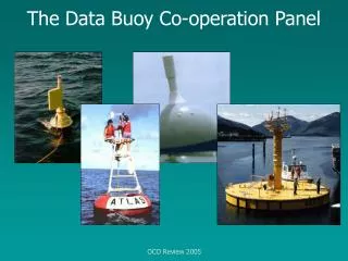
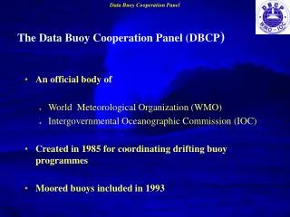
Topics • describe the Data Buoy Cooperation Panel (DBCP) • aims, • achievements and • Challenges • network status • developments of data buoy technology • JCOMM in-situ Observing Platform Support centre (JCOMMOPS) developments • Future work
Action Groups • Relationship of PIRATA to DBCP • Drifter deployment opportunities with Cruises. • Help to define requirements for other observing systems – drifter network, OceanSITES
Global Network status • Argo, DBCP • OceanSITES SOT • Google Earth
Acheivements • Global focus
Technology and Pilot projects • Testing new capabilities • Telecommunications • Iridium Pilot Project • Argos-3 • Buoy Technology • Intercomparisons(E-SURFMAR, GDP) • Waves – drifters and intercomparison • High resolution SST from Drifters • Better drogue detection
Real-time Data Flow - GTS • Data sharing • New GTS (WIS, BUFR standards) • QC feedback and monthly statistics • Data reporting tools (Meteofrance, live maps google earth, JCOMMOPS, OSMC etc)
Data and Metadata Management • Metadata – META-T Project • JCOMM • Standards and best practice • Shared expertise and documentation • Documentation of best practice • Archiving centres and data flow
JCOMMOPS • International Technical Coordination for the implementation of Global Ocean Observing Systems • JCOMMOPS provides coordination at the international level for oceanographic and marine observations from drifting buoys, moored buoys in the high seas, ships of opportunity and sub-surface profiling floats. JCOMMOPS operates under the auspices of the Joint WMO-IOC Technical Commission for Oceanography and Marine Meteorology (JCOMM). • GOOGLE EARTH, • Now doing OCEANSITES • DBCP • SOT • OceanSITES • Argo • Deployment opportunities
Developments and reporting tools • Status maps (PNG, PDF) updated monthly • Network success and density (ageing, reseeding) • Interactive maps • Web Map Viewer • Google Earth • Google Maps
Annual SOOP Line Sampling Report • Ship of Opportunity Program (SOOP) report produced annually to assess sampling with Expendable Bathy Thermographs (XBTs)
Sample Products • e.g. Stats for Argo CANADA: • - Deployments • Growth • Float models • Float Age distribution • Drifting/profiling depths • Survival rate • links to maps • ….
Future Goals • DBCP Task teams • Task Team on Moored Buoys • Metadata management and standards • Growth of JCOMMOPS to serve more communities • Further integration of the Global Ocean Observing System elements • OceanSITES (sharing platforms, minimum sensors required, sustainability) • Deployments and cruise planning • Documentation and use of best practice (hardware, data management, data quality etc) • Indicators of network success and usefullness of data