Download
1 / 14
140 likes | 307 Vues
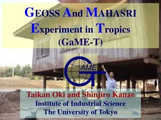
G EOSS A nd M AHASRI E xperiment in T ropics (GaME-T). Taikan Oki and Shinjiro Kanae Institute of Industrial Science The University of Tokyo. Building Up GaME-T. Objective:

E N D
GEOSS And MAHASRIExperiment in Tropics(GaME-T) Taikan Oki and Shinjiro Kanae Institute of Industrial Science The University of Tokyo
Building Up GaME-T • Objective: • Develop hydro-meteorological warning system associated with telemetry stations, and demonstrate the value of the warning system in Mae Waang, Chiang Mai, Thailand. • Ongoing Studies: • Installation of 15 new AWS stations with telemetry and continuation of a few flux measurement stations. • Case study of an extreme event caused by a tropical cyclone. • Hydrological modeling coupled with atmospheric weather forecast.
Hydrometeorological monitoring and modeling Radar-Raingauge Observation Space-Time Variationof Precipitation Satellite & In-situobs. of Soil Moist. Prediction ofPrecipitation Flux Measurementat Super Sites Assimilation Validation Forcing Data LSM1: SiBUC LSM2: MATSIRO Multi-ModelEnsemble Quasi-Real Time Prediction ofRiver Runoff and Soil Moistureby an Earth Observation System ResearchItem 1/2 Data &Information
Integrated Information Base on Water Cycles Quasi-Real Time Prediction of River Runoff and Soil Moisture Land Slide Risk Assessmentbased on Soil Moisture River Discharge &Water Table from Runoff Potential ofLand Slide Potential ofFlood User Interface forthe Integrated Information Systemon Water Cycles Archiving tremendous and various observational and simulated datasets IntegratedInformation Baseon Water Cycles ResearchItem Quasi-Real Time Delivery of Informationby an Earth Observation System Dedicated forIntegrated Water Resources Management 2/2 Data &Information
NO3 NO1 NO2 NO41 NO7 NO51 NO61 NO9 NO12 NO87 NO11 NO132 NO142 NO152 NO16 Site description Mae Wang basin in Chiang Mai (basin area : 600 km2)
Wind Speed & Direction 2.7m Air Temperature & Humidity 2.0m Short & long-wave radiation 1.0m Air pressure in Data logger box Rain Fall -5cm -10cm -20cm River Water Level : Soil Temperature : Soil Moisture -40cm Ground Water Level Instrumentation : Tel-super site NO.1 Making well at NO.4
Air Temperature 2.0m 1.0m Data logger box Rain Fall -5cm : Soil Temperature Instrumentation : Tel-rain site NO.8 NO.13
Air Temperature 2.0m Rain Fall 1.0m Data logger box Water Temperature River Water Level Instrumentation : Tel-rain site(with river level observation) NO.12 NO.11
Instrumentation : Data acquisition and Telemetry system Data logger • Data is logging every 5 seconds and recorded by averaging every 10 minutes. • Tel-super system can storage data for 6 month, Tel-rain system can storage data for 1.5 month. GSM modem • GSM is easily able to connect line directly by dial-up connection, although GSM (9.6 kbps) is low-speed access than GPRS (115 kbps). Data transfer every 1 hour from all observation sites GEOSS Data Server at RID Center 1 GEOSS Data Archive System at the Univerisuty of Tokyo
NO12→NO2:60 min (r = 0.51) NO11→NO2:10 min (r = 0.79) NO11→NO6:250 min (r = 0.40) NO2→NO6:240 min (r = 0.54) NO12→NO6:310 min (r = 0.35) Lag analysis on water table No lag correlation NO7→NO6, NO2
PUBLIC Disaster Potential,Information for Decision making, … Web Interface/Effective Warning etc. River discharge, soil moisture, ground water recharge, …. Physical Parameters toInformation for People Multi-Model SurfaceParameters CoupledLand surface Model& Hydrological Model Soil properties, vegetation index, human factors, … Multi- Forcing precipitation, temperature,radiation, wind, humidity, … HistoricalRecord Telemetering,Remote Sensing AtmosphericNumerical Model Hindcast Nowcast Forecast Real time “PUB” - the Future!
Plan for the AMY-2008 • NO research funding for field observation project in Thailand/Indo-China Peninsula from Japanese side, so far. • Would like to continue: • Flux measurement/AWS sites in Thailand • Study on hydrometeorological warning systems • Data collection and integration in the Peninsula • An idea for AMY-2008: • Combining TMD weather radar network with surface telemetry raingauge…revenge of IOP1998
THANKYOU! Friends,the hydrologists,can we fix it? Yes we can!(at least in the future)