Download
1 / 33
330 likes | 437 Vues
The Eagle Foothills Plan aims to integrate development within the Eagle Foothills area into the City of Eagle's Comprehensive Plan. Originally presented to the Ada County Commissioners in 2007 and later to the Eagle City Council in 2014, this initiative responds to citizen and landowner requests for proactive planning. The plan emphasizes groundwater protection, traffic management, and open space preservation while addressing the opportunities and constraints of the area. It reflects a collaborative effort, gathering input from over 250 volunteers and fostering a vision for compatible and sustainable development.

E N D
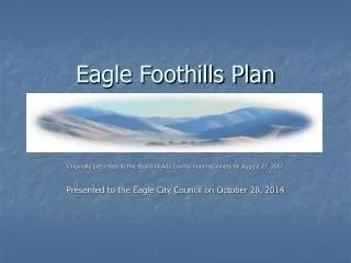
Eagle Foothills Plan Originally presented to the Board of Ada County Commissioners on August 27, 2007 Presented to the Eagle City Council on October 28, 2014
Separate Applications Both M3 and Suncor made separate applications to the City for inclusion into the City’s Comprehensive Plan in 2006 • These applications pre-date the City’s planning efforts & retain separate application status which are not folded into the draft City Plan. Though separate, ALL Comprehensive Land Use applications are being considered by the City during the same hearing process. • These applicants have also been involved in the traditional City hearing process and are committed to being part of the City of Eagle. These applications are part of the reason the City began planning for the foothills. • These applications are similar in several ways to the policies and priorities established in the draft City foothills plan (creation of centers, open space preserves/setbacks, & constraints identification)
Why is Eagle Planning for the Foothills? • Citizens & foothills landowners asked the City to begin a planning process. • The City has concerns about piece meal development pattern of separate Planned Community Applications within Ada County. • The development impacts from the foothills will funnel through the City. The City feels it is better to be proactive and plan for future development rather than ignore the pressures and react to individual applications. • The City wanted to help ensure that development was compatible with the City by establishing development guidelines within the foothills area.
2005 Public Polling 91% Self-identified as Eagle or Eagle Foothills 68% Used Eagle as the primary location for goods and services 50% Either worked in Eagle Business areas, at home, or were retired- half of the daily trip generated are staying within Eagle. 65% Wanted the City to coordinate/lead a comprehensive planning process for the foothills 71% Wanted Eagle development standards used within the foothills
What the City Heard “Start Soon!” “This area is considered Eagle” “We hope the City will take the lead” “Eagle should see the foothills as a part of the continuing quality development in Eagle” “Eagle Foothills should be separate from Boise” “Higher density would be acceptable with trail and open space preserved” “Development in the foothills will determine the future of Eagle”
Priorities for the Foothills Planning • Groundwater Protection- IDWR meeting • Traffic/Transportation-ACHD Process • Open Space Preservation
2006 Opportunities & Constraints Process In Summer of 2006, the City (at the urging of land owners & citizens) embarked on an exploratory process to identify the unique opportunities and constraints within the foothills prior to beginning a comprehensive planning process for the area. This process included a working group of land owners, neighborhood association representatives, and members of the P&Z Commissioner & City Council
2006 Foothills Opportunities and Constraints Study (% of Total Area) 85% is held in Private Ownership 22% has slopes greater than 25% 3.3% is in Floodway & Riparian Areas Nearly 20% has experienced significant disturbance Approximately 18% is considered prime habitat for big game Aside from the two State Highways, there is limited local access to the area
Planning Process • Today’s draft Foothills Plan is the result of a highly involved public process including over 250 volunteers and 2,000 hours of work. • Committees were: Habitat/ Open space Transportation Activity Centers Facilities/Infrastructure Land Owners Landscape/Design Review • Prior to hearing the draft plan was reviewed by the City officials, landowners & the committees
The Comprehensive Plan is a policy document. A Guideline for the future IF the area becomes part of the City. What a Comprehensive Plan does not do: • This plan does not provide zoning, entitlements, or require annexation • This plan does not require the renegotiation of an Area of City Impact • This plan does not grant any land owner permission to change the current use of their property • This plan does not provide detailed site specific plans that would be required as part of a development application on particular piece of property.
Pillars of the Draft City Plan • Provides predictable land uses and development patterns. • Focus development along the state highways system • Preserve a significant open space area within central foothills • Establish transportation connections to the state highway system • Limits impacts to the local system (Willow Creek Rd, Beacon Light)
Land Use The main messages the City received through the polling, visioning, and public participation process were: 1) Focus development to the highways & physically disturbed areas; 2) Ensure that there are rural/natural areas 3) Cluster uses into centers that would increase trip capture and create a “live, work, & play environment”
Open Space Rural Densities New Neighborhood Center ½ to 1 mile Rural Densities Urban Transition & Suburban Densities Centers & Clustering • Centers provide “magnets” for clustering units • Allows for decreasing radiating densities to preserves open space/natural areas • If properly implemented, centers could accommodate all the density within the plan on as little as 17% of the land.
Open Space The main messages the City received through the polling, visioning, and public participation process were: 1) Establish a mechanism for permanent open space preservation; 2) Design an open space network that builds on the limited (15% of the total area) existing public lands within the area; 3) Establish an open space network that is commensurate with the natural systems found in the foothills
Use the Open Space overlay on the land use map as a guide for the clustering and preservation of regional open space
Draft Plan Policies for Open Space • 40% of the area should be preserved for open space through the development process. • Constrained/natural areas should be the 1st priority for open space areas. • In less constrained areas, open space may also include golf courses, common areas, setbacks and buffers.
Transportation The main messages the City received through the polling, visioning, and public participation process were: 1) Direct trips to the state highway system 2) Provide for an east/west connection 3) Limit impacts on the existing local roadway system 4) Have an independent analysis of the anticipated impacts of the draft plan completed
Conceptual Roadway Network Removed by the BLM IC: Interchange PR: Potential RAB R: RAB
Independent Transportation Analysis*At 24,000 units Point Where BL Goes from 5 to 3 lanes Grade separated IC 6 lanes on SH55 3CRX
How did the City’s & County’s Draft Plans Compare Differences • Different geographies • The City plan is a build-out plan vs. a 20-year plan under the County or until an AOI application is requested • City plan identifies the location of activity centers • The City plan establishes a regional open space and trail networks and policies for permanent preservation and funding for these areas. • The City plan is in-lieu of separate Planned Community applications. • City plan does not preclude development on the existing infrastructure but identifies the needed future infrastructure to be funded by the development community.
How did the City’s & County’s Plans Compare Similarities • Both are constraint based plans: • Development densities are commensurate with the existing condition: • Floodways • Slopes in Excess of 25%Slope • Habitat (as identified by IF&G) • Unconstrained area • Transportation • Overall densities are comparable (.07 units/acre difference) • Both plans require the establishment of adequate infrastructure facilities prior to development
Where do we go from here? • Council Direction on Planning Policies • Reduce densities in the Comprehensive Plan • Stay the course • Recommendation to ACHD on Beacon Light Road