Contour Maps and Elevation Profiles (pages 10 & 13)
130 likes | 391 Vues
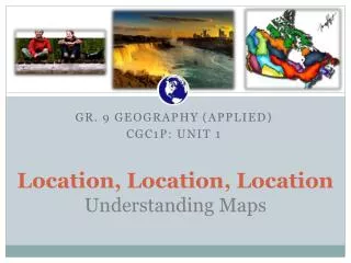
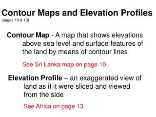
Contour Maps and Elevation Profiles (pages 10 & 13). Contour Map - A map that shows elevations above sea level and surface features of the land by means of contour lines See Sri Lanka map on page 10.

Contour Maps and Elevation Profiles (pages 10 & 13)
E N D
Presentation Transcript
Contour Maps and Elevation Profiles (pages 10 & 13) Contour Map - A map that shows elevations above sea level and surface features of the land by means of contour lines See Sri Lanka map on page 10 Elevation Profile – an exaggerated view of land as if it were sliced and viewed from the side See Africa on page 13
http://www.classzone.com/books/earth_science/terc/content/investigations/es0307/es0307page03.cfmhttp://www.classzone.com/books/earth_science/terc/content/investigations/es0307/es0307page03.cfm
Valleys and Higher Elevation A series of V-shapes indicates a valley and the V’s point to higher elevation. biosystems.okstate.edu/Home/fharry/4112/600.../ContourLines.ppt
U Shapes and Ridge A series of U shapes indicates a ridge. The U shapes will point to lower elevation. biosystems.okstate.edu/Home/fharry/4112/600.../ContourLines.ppt
Hills and Depressions A series of closed contours with increasing elevation indicates a hill. Hills may be identified with a “+” with the elevations biosystems.okstate.edu/Home/fharry/4112/600.../ContourLines.ppt
Hills and Depressions--cont • A series of closed contours with decreasing elevation indicates a depression. • Depressions may be identified with a “-”. biosystems.okstate.edu/Home/fharry/4112/600.../ContourLines.ppt
Contour and Relief Maps http://www.classzone.com/books/earth_science/terc/content/investigations/es0307/es0307page02.cfm 3 map views http://www.classzone.com/books/earth_science/terc/content/investigations/es0307/es0307page08.cfm Link to Topography site – contours and aerial map