Download

1 / 41
410 likes | 526 Vues
A Wisconsin Super Disaster: Oil Spill and Historic Flooding. 2011 Governor’s Conference on Homeland Security & Emergency Management. March 2-4, 2011 Madison, WI. Super Disasters.

E N D
A Wisconsin Super Disaster: Oil Spill and Historic Flooding 2011 Governor’s Conference on Homeland Security & Emergency Management March 2-4, 2011 Madison, WI
Super Disasters • It’s been documented that the California Central Valley experienced super-floods, that covered 300 miles, every 160 to 400 years going back to A.D. 212. • It’s been documented that a drought centered in Nebraska lasted 34 years – ever wonder why ancient civilizations and cities packed their bags and left?
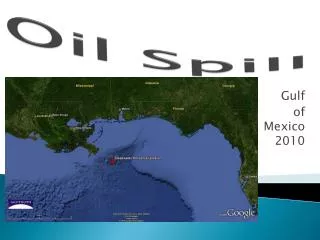
Oil Spill • Enbridge Oil Spill near Marshall, MI occurred in 2010 summer. • Due to litigation reasons, Rusty can’t speak specifically about that situation. • Instead, we will talk about a possible scenario in Wisconsin, utilizing Rusty’s experience in Marshall, MI.
Let’s Think Big! • Wisconsin has oil pipelines
Let’s Think Big! • Wisconsin has experienced historical flooding similar to or worse than the June, 2008 flood event! 8-Day Rainfall Totals Let’s extrapolate to 15 days Can easily “double” these amounts for a 15-Day total!
Jefferson County 15.64 ft on 06/19/2008 (previous record was 12.84 ft) Sauk and Columbia Counties in June 2008
Southeast Dodge County Lake Delton – during breach
Let’s Think Big! • Let’s combine an oil pipeline break and a super-flood! …for the year 2020! • What will it be like? How will Emergency Managers and the NWS interact?
Pre-2020 Weather Set-Up • Seven consecutive years of above normal rainfall and snowfall throughout the Wisconsin River watershed. • Past two years had major spring flooding at most locations on Wisconsin River. • Let’s assume dozens of earthen dams on tributaries within the watershed have failed in past two years.
2020 Weather Set-Up • At the start of June 2020, Wisconsin River experiencing only moderate flooding. • Stagnant weather pattern favors repeated rounds of thunderstorms with heavy rains moving northwest to southeast through most of Wisconsin River watershed. • Total rainfall for June 1-15 is 20 to 40 inches over watershed. Two-thirds of this occurred June 13-15.
June 1-15, 2020 Rainfall 40” 30” 20”
Result of Heavy Rains • By June 16, 2020, a large lake has formed in central Wisconsin, almost as big as “Glacial Lake Wisconsin.”
Result of Heavy Rains • Other large lakes formed within the Wisconsin River watershed with most roads in the watershed covered with water or closed, including Interstate 90/94. • Dozens of cities completely under water and isolated.
Other New Lakes June 16, 2020
Geology Information • A 6.0 earthquake, centered near Wisconsin Rapids occurs on Jun 17, 2020. • Earthquake occurs on an unknown fault-line extending from Wisconsin Rapids northwest to the Duluth area.
Mid-Continent Rift System Rifting occurred about 1 billion years ago Rifting is a separation or moving apart of tectonic plates Unknown fault line
Oil Pipeline • Pipeline break (X) occurs where the pipeline crosses the Wisconsin River south of Wisconsin Rapids near the triple-point of Wood, Juneau, and Adams Counties. X
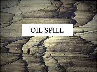
Oil Spill • Let’s assume 2 million gallons of oil are released at the break point where the pipeline crosses the Wisconsin River due to the earthquake. • Oil leaks into the Wisconsin River, which is a large inland lake due to on-going flooding.
Response to Super-Disaster • Priority #1 – Evacuate or rescue people stranded in flooded areas and move them to temporary shelters. • Priority #2 - stop oil spill before it reaches the Mississippi River, which is also above flood stage. Environmental Protection Agency (EPA) will oversee response efforts at federal, state, county, and local levels.
Response to Super-Disaster • 500,000 feet of boom are used to stop oil spill from reaching Mississippi River. • 50 containment basins/locations needed • 40 million gallons of oil/water collected • 400,000 cubic yards of soil shipped off-site • Several thousand oil spill workers?
Response to Super-Disaster • EOCs activated at State, County, & local levels. • All first-responders pushed to the limit and mutual aid agreements activated with additional FEMA & out-of-state assistance • EPA requests National Weather Service (NWS) decision-support services. Initial response & clean-up may take 6 months or more.
Response to Super-Disaster • NWS will draw on staffing and/or remote support from - 5 Wisconsin weather offices - Kansas City Regional Office - NWS Headquarters - Minneapolis River Fcst Center. - Other NWS offices in Midwest
Response to Super-Disaster • Initially, interactions may be a bit awkward between the EPA, Emergency Managers, and the NWS as each group becomes familiar with another group’s capabilities and needs.
Response to Super-Disaster • Locations for possible NWS staffing - State EOC - Incident Command Post (ICP) - Several County EOCs from oil spill location to Mississippi River. • NWS staffing most likely at State EOC and ICP, and maybe at critical County EOCs • Remote NWS support elsewhere?
Response to Super-Disaster • NWS support will consist of: - On-site, short-term briefings concentrating on weather impacts - Slide presentations of short & long-term forecasts - River forecasts & perhaps specialized long-range river probability forecasts or others on request
Response to Super-Disaster • NWS support will consist of: - E-sponder - Webinars (remote support) - Conference calls - E-mail - Usual general public information on NWS web sites
Response to Super-Disaster • NWS support - 800 MHz radio alerts - Heat Index 90 or higher (80 may be a trigger) - Lightning within 60 minutes - Sustained winds 25 mph+, or gusts 35 mph+ - Rainfall 1 inch or more in next 3 hours - Warnings for severe storms, flash floods, tornado - Other significant changes not anticipated before (Incident Command Safety line called?)
Response to Super-Disaster • Other impacts on recovery and cleanup operations can be mentioned on an “impact slide” in the briefing slide sets: - dense fog - freezing fog - frost - snow - river flooding
Response to Super-Disaster • NWS staffing at ICP or State EOC may initially may be 24/7, one 12 shift, or two 8-hour shifts with remote, local NWS office, backup support during off-duty hours. • Toward end of recovery/clean-up phase NWS staffing may be one 8 to 12 hour shift
Response to Super-Disaster • NWS will use an internal, on-line, resource- sharing, server account for involved offices • NWS can generate the following documents for ICP and/or EOC… - NWS Duty instructions - Log of actual daily duties accomplished - Log of alerts - Slide sets
Todd Shea’s slides • His slides (10 to 12?) will cover flood outlook for Mississippi River and its tributaries…most problems appear to be in the ARX and MPX CWAs. • If things change, additional slides for flooding problems in MKX and GRB CWAs may have to be added
2011 Summer Outlook • Long-range outlooks don’t show tendency toward above or below normal temperatures & precipitation. • Statistically-speaking…it appears much of Wisconsin will have equal chances of above normal, near normal, and below normal temps and precipitation.
Wisconsin Water Issues • Southern WI – dry fall 2010. Water table has lowered compared to 2008 and 2009. • Central and northern WI had a wet fall 2010 (big rains in September). • Much of Wisconsin had normal to above normal precipitation this past winter.
2011 Severe Weather Outlook • Less tornadoes than the 46 we had in 2010….let’s go with 30-35 for 2011. We average 21 per year. Caution…I have no predictive skill in this department. We’re overdue for an EF3 or EF4 or EF5 tornado. • Someone will have a flash flood event with 7-10” of rain measured in a 24-48 hr period.