Aquifer Sensitivity Assessment
Aquifer Sensitivity Assessment. Black Hills South Dakota A GIS Project by Annette Smith. Introduction . Location Uniqueness DRASTIC Model Modeling with ArcView Weighted Model with ModelBuilder Complications and Problems. Previous Work. Black Hills Hydrology Study

Aquifer Sensitivity Assessment
E N D
Presentation Transcript
Aquifer Sensitivity Assessment Black Hills South Dakota A GIS Project by Annette Smith
Introduction • Location • Uniqueness • DRASTIC Model • Modeling with ArcView • Weighted Model with ModelBuilder • Complications and Problems
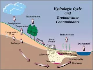
Previous Work • Black Hills Hydrology Study • funded by US Geological Survey • United States Environmental Protection Agency (USEPA)
United States: Black Hills Inset A A’’ Location
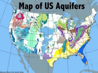
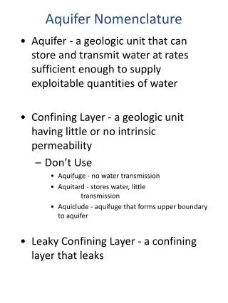
EPA Aquifer Sensitivity Model • Depth to Aquifer • Recharge • Aquifer Type • Soil • Topography • Intermediate Materials • Conductivity
The Equation (DI) DRASTIC Index = D r D w + R r R w + A r A w + S r S w + T r T w + I r I w + C r C w where r = rating and w = weight • Result: Sensitivity to Surface Contamination
Locating Data for the Model • Required Layers : D R A S T I C • Data Sources: • USGS • SD Hydrology Study • USDA • Soils
Building Themes • Import from .e00 to ArcView • Match Projection • Merge/ Join/ Intersect/ Overlay • Assigning ratings
Directly Downloaded Depth to Aquifer Soil Type From Geology Intermediate Material Topography From Literature Recharge Aquifer Media Hydraulic Conductivity Data Analysis
Model Building • Convert to Grid • Weighted Model • Model Builder
Assign Ratings • Values from 1 - 10 • Based on Ranges • Creates a relative result • Region Specific
Final Sensitivity Product Red (9) indicates area of extremely high sensitivity.
Overcoming Problems • Analysis of soil thickness
Determining Slope – DEM unuseful Extrapolate from soil thickness
Points of Consideration • Time for Data Retrieval • In depth knowledge of local geology • Space and Time required for Processing • Projection Difficulties • Regional and Relative