Ogallala Aquifer
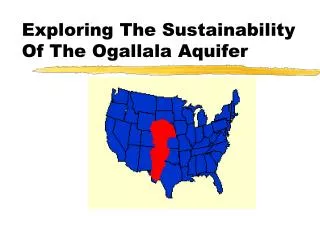
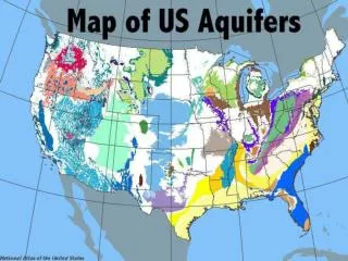
Ogallala Aquifer. High Plains Aquifer. The Ogallala Aquifer occupies the High Plains of the United States, extending northward from western Texas to South Dakota. The entire system underlies about 450,000 square kilometers of eight states. Water Use.


Ogallala Aquifer
E N D
Presentation Transcript
Ogallala Aquifer High Plains Aquifer
The Ogallala Aquifer occupies the High Plains of the United States, extending northward from western Texas to South Dakota. • The entire system underlies about 450,000 square kilometers of eight states.
Water Use • Approximately 27 percent of the irrigated land in the United States is in the High Plains • 30 percent of the ground water used for irrigation in the U.S. is pumped from the High Plains aquifer. • Irrigation withdrawals in 2000 were 17 billion gallons per day. • In 2000, 1.9 million people were supplied by ground water
Description • The Ogallala is composed primarily of unconsolidated, poorly sorted clay, silt, sand, and gravel with groundwater filling the spaces between grains below the water table. • It was created about 10 million years ago by deposition from streams that flowed eastward from the Rocky Mountains during the Pliocene epoch
Natural Replenishment of water • Replenishment comes from rainwater and snowmelt. • The High Plains has a semiarid climate, replenishment is very slow.
Importance • The Ogallala Aquifer is the single most important source of water in the High Plains region, providing nearly all the water for residential, industrial, and agricultural use. • Farming accounts for 94 percent of the groundwater use. • It supports nearly one-fifth of the wheat, corn, cotton, and cattle produced in the United States. • Crops provide grains and hay for confined feeding of cattle and hogs and for dairies.
Summary The Ogallala Aquifer is being both depleted and polluted. Irrigation withdraws much groundwater, yet little of it is replenished. Since large-scale irrigation began in the 1940s, water levels have declined more than 30 meters in parts of Kansas, New Mexico, Oklahoma, and Texas. In the 1980s and 1990s, the rate of groundwater mining, or overdraft, lessened, but still averaged approximately 82 centimeters per year.
A system that turns irrigation water on and off automatically based on leaf temperature is being developed by Agricultural Research Service soil scientists Texas.
Resources used Water Encyclopedia http://www.waterencyclopedia.com/Oc-Po/Ogallala-Aquifer.html Kerr Center www.kerrcenter.com/publications/ogallala_aquifer.pdf Science Daily http://www.sciencedaily.com/releases/2008/04/080420111817.htm USGS http://co.water.usgs.gov/nawqa/hpgw/HPGW_home.html