Download
1 / 51
510 likes | 798 Vues
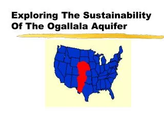
Exploring The Sustainability Of The Ogallala Aquifer. Acknowlegment. Erin O’Brien Kansas State University Biological & Agricultural Engineering Who in Summer 2001 studied the Ogallala in West Kansas under: National Science Foundation - Research Experience for Undergraduates

E N D
Acknowlegment Erin O’Brien • Kansas State University Biological & Agricultural Engineering • Who in Summer 2001 studied the Ogallala in West Kansas under: • National Science Foundation - • Research Experience for Undergraduates • McNair Scholar’s Program
Introduction • The Ogallala aquifer lies within the Great Plains region. • This groundwater source is a part of the High Plains aquifer system. • In Kansas the High Plains aquifer system and the Ogallala aquifer are typically the same.
High Plains (Ogallala) aquifer • Precipitation drops to less than 50 cm per year (20 inches) approximately west of a line that divides the U.S. in half High Plains
High Plains (Ogallala) aquifer • The paradox is that this semi-arid region is the source of much of our grain crops. • Kansas, the wheat state, is too dry to produce wheat unless water is added by irrigation. • Irrigation waters for the Great Plains states (South Dakota south to Texas) are taken from a single massive aquifer, the High Plains or Ogallala aquifer.
Micro or State level Scale • Western Kansas is a major economic source for Kansas: • 40% of the nation’s packaged beef comes from within 250 miles of Garden City, and • Kansas is 2nd in the nation in cattle slaughter and 3rd for red meat production.
Sustainability • “Meeting fundamental human needs while preserving the life-support systems of planet Earth is the essence of sustainable development.” —(Kates, et al. 2001) • Since irrigation from the Ogallala taps ‘fossil’ groundwater there is an issue of sustainability of the current system.
Ogallala • The High Plains aquifer has been a source for irrigation water since the early 1900’s. • Approximately 170,000 wells draw water from the aquifer
Ogallala • This has brought prosperity to an area described by Major Stephen Long in 1819 as "almost wholly unfit for cultivation and . . . uninhabited by people depending upon agriculture for their subsistence."
Ogallala • The aquifer is the largest area of irrigation-sustained cropland in the world
Dimensions • The aquifer's saturated zone may be up to 425 m thick (About same as Empire State Bld.) • Aquifer dimensions vary along its length. • It is always relatively shallow; the water table is typically less than 300 feet deep. • The aquifer contains more than 3.3 billion acre-feet of water (1 acre-foot = ~326,000 gallons), more water than Lake Huron.
Volume of groundwater in Ogallala aquifer restored by precipitation: ~10% • Unfortunately, the aquifer contains "fossil" water, • the product of a wetter paleoclimate associated with the end of the last ice age. • There is no sufficient contemporary source for water to recharge the whole aquifer • although substantial recharge does occur in some areas from streams (e.g. Platte River, Nebraska).
History • Groundwater from the aquifer was first widely used in the 1930's in Texas. Subsequently approximately 11% of the groundwater supply has been extracted.
History • 1. 1930-1950: water table depth remained constant as withdrawal was limited to a few wells • 2. 1950-1985: water table depth declined from 65 m to 115 m • increasing numbers of wells • acreage in Kansas climbed from less than half a million acres in 1959 to nearly 2 million acres in 1978. • 3. 1985 - present: decline in water table depth slowed due to decreasing discharge attributed to: • heavier than normal rains • increased energy costs for pumping • improved irrigation technology
Eventually with little to no recharge all the water will be gone
Recent Events • Decrease in volume of groundwater pumped from Ogallala aquifer, 1980-85: 19% • Largest Declines in the aquifer have occurred in southwest Kansas and the Texas Panhandle • Declines have been matched by population migrations from rural counties
Groundwater Overdraft • Over the life of the aquifer the water table dropped 70 meters in parts of the Panhandle • Western Kansas used 38% of the groundwater in the underlying aquifer.
Study Area • My study looked at the High Plains with a focus on SW Kansas. • The Ogallala aquifer: • Underlies 134,000 mi2, • Is the largest body of groundwater in the U.S. • The porous rock layers were formed ~10 million years ago by fluvial deposition.
Recall the High Plains aquifer is approximately equivalent to Lake Huron. • 30% of the water used for irrigation in the U.S. comes from the High Plains aquifer. • 10% percent of the drainable water in the High Plains aquifer underlies Kansas.
The High Plains aquifer faces many different concerns, including purity, quality, quantity, and saturated thickness. • The Ogallala region has many concerns: • ~19% is covered by sand dunes; • Water consumption is 10-40 times recharge • Local precipitation does not affect recharge
Ogallala facts: • Only 15-20% of the water is available for withdrawal and only 60-80% of this is technologically accessible. • Kansas scientists say it may take 35 years for recharge water to reach the aquifer.(when it comes at all) • The water in the Ogallala is fossil water and is only available through groundwater mining.
History • The droughts of the 1930s and 50s made people realize that the climate changes of the region were simply cyclical variations. • Irrigation rapidly expanded following the drought of the 1950s. • By 1972, ~40% of the available groundwater had been consumed.
Technology • In 1896 in Garden City, KS, a centrifugal pump was one of the first attempts at irrigation in Kansas. • Another pump was in use by 1911 in Scott City, KS. • In 1949, center-pivot systems were developed. • Drop tubes & subsurface drip irrigation (SDI) have become common recently.
Rules/Regulations • In 1972 KS passed the GMD Act to: • Regulate groundwater, • Grant drilling permits, and • Ensure old water rights are protected. • Constraints exist on policies that would decrease water availability. Adjustments must be technically, financially, legally, and socially feasible.
Sustainability Issues • Farmers irrigate for many reasons: • To meet a specific crop need; • To increase yearly income; • As a result of success by other irrigators; and • To maintain their water rights. • The number of irrigated acres is declining in all states. • Irrigation offers a climate substitute and enables increased yields.
Recurrent droughts are a hazard for the region. • There were two prolonged droughts in the last century: • In the 1930s and the 1950s. • What will happen when the water is gone? • Two New Jersey scholars have proposed a “buffalo commons” national park. Popper & Popper.
The area has already been affected by a decreased flow in the Arkansas River due to diversion and pumping. • It has only recently began to flow again, after a Supreme Court ruling limited withdrawals.
These pages show graphs indicating: • Predevelopment saturated thickness, • Current saturated thickness, • The amount of groundwater depletion, and • The number of years of usage remaining. --Schloss, et al. 2000.
The Ogallala Problem • Water level declines of 2-3 feet per year in some regions are drawing concern of the aquifer drying up - first one in the U.S. This is due to pumping more water than is replaced through recharge, and only 10% is restored by rainfall. Large issues exist over contamination and salt water intrusion problems as well.
The Ogallala Future • Drawdown from 1998 to 2050 is predicted to be more than 150 feet in some areas given the forecast amount of pumping. • By 2010, parts of the aquifer in Oklahoma and Kansas are simulated as going dry. Dutton, A.R., Reedy, R.C., and Mace, R.E. (2001). Saturated Thickness in the Ogallala Aquifer in the Panhandle Water Planning Area: Simulation of 2000 through 2050 Withdrawal Projections. http--www.twdb.state.tx.us-gam-ogll_n-OG-n_report.pdf.url
Summary • Can the Ogallala aquifer be sustained? • History shows that farmers are adaptable to a variable climate. • Technological advances have greatly improved water use efficiency.
The current irrigation-based economy can be sustained for several more decades. • We must plan for what will happen when irrigated agriculture and the associated agribusiness economy becomes a thing of the past.
Population in Decline Originator: p. buckley, 11/16/2010, source: National Atlas www.nationatlas.gov
Acknowledgements • Guru, Manjula V., and James E. Horne. "The Ogallala Aquifer.” Kerr Center for Sustainable Agriculture, Inc. <http://www.kerrcenter.com/RDPP/ogallala.htm>. July 2000. • Kates, Robert W., et al. “Sustainability Science.” Science. Vol. 292, 641-642: 27 April 2001. • Kromm, David E., and Stephen E. White, eds. Groundwater Exploitation in the High Plains. Lawrence, Kansas: University Press of Kansas, 1992. • Schloss, Jeffrey A., Robert W. Buddemeier, and Blake B. Wilson, eds. An Atlas of the Kansas High Plains Aquifer. Lawrence, Kansas: Kansas Geological Survey, 2000. • Dr. John Harrington, Jr., Dept. of Geography, Kansas State University • Dr. David E. Kromm, Dept. of Geography, Kansas State University
Surviving the Dust Bowl – 1930s http://video.pbs.org/video/1311363860/ http://www.youtube.com/watch?v=pVoXW4YrqTs